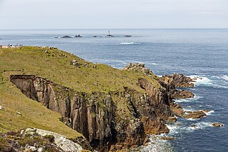
Land's End is a headland and tourist and holiday complex in western Cornwall, England, United Kingdom, on the Penwith peninsula about eight miles (13 km) west-south-west of Penzance at the western end of the A30 road. To the east of it is the English Channel, and to the west the Celtic Sea.
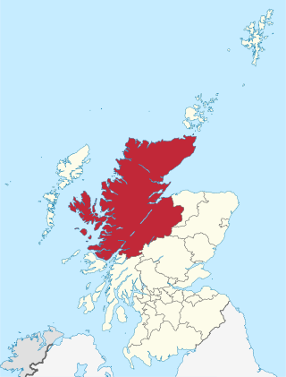
Highland is a council area in the Scottish Highlands and is the largest local government area in the United Kingdom. It was the 7th most populous council area in Scotland at the 2011 census. It shares borders with the council areas of Aberdeenshire, Argyll and Bute, Moray and Perth and Kinross. Their councils, and those of Angus and Stirling, also have areas of the Scottish Highlands within their administrative boundaries.
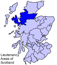
Ross and Cromarty, also referred to as Ross-shire and Cromartyshire, is a variously defined area in the Highlands and Islands of Scotland. There is a registration county and a lieutenancy area in current use, the latter of which is 8,019 square kilometres in extent. Historically there has also been a constituency of the Parliament of the United Kingdom, a local government county, a district of the Highland local government region and a management area of the Highland Council. The local government county is now divided between two local government areas: the Highland area and Na h-Eileanan Siar. Ross and Cromarty border Sutherland to the north and Inverness-shire to the south.
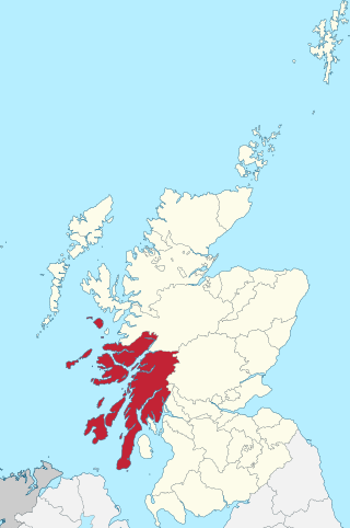
Argyll, sometimes called Argyllshire, is a historic county and registration county of western Scotland.

Lord of the Isles or King of the Isles (Scottish Gaelic: Triath nan Eilean or Rìgh Innse Gall; Latin: Dominus Insularum) is a title of Scottish nobility with historical roots that go back beyond the Kingdom of Scotland. It began with Somerled in the 12th century and thereafter the title was held by a series of his descendants, the Norse-Gaelic rulers of the Isle of Man and Argyll and the islands of Scotland in the Middle Ages. They wielded sea-power with fleets of galleys (birlinns). Although they were, at times, nominal vassals of the kings of Norway, Ireland, or Scotland, the island chiefs remained functionally independent for many centuries. Their territory included much of Argyll, the Isles of Arran, Bute, Islay, the Isle of Man, Hebrides, Knoydart, Ardnamurchan, and the Kintyre peninsula. At their height they were the greatest landowners and most powerful lords after the kings of England and Scotland.
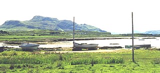
Kilchoan is a village on the Scottish peninsula of Ardnamurchan, beside the Sound of Mull in Lochaber, Highland. It is the most westerly village in mainland Britain, although several tiny hamlets lie further west on the peninsula. The western linear, coastal parts of the village are Ormsaigmore and Ormsaigbeg.

Ardnamurchan is a 50-square-mile (130-square-kilometre) peninsula in the ward management area of Lochaber, Highland, Scotland, noted for being very unspoiled and undisturbed. Its remoteness is accentuated by the main access route being a single track road for much of its length. The most westerly point of mainland Great Britain, Corrachadh Mòr, is in Ardnamurchan.

Ardnamurchan Point is a peninsula in Highland, Scotland where the Ardnamurchan Lighthouse is situated.

Dunnet Head is a headland in Highland, on the north coast of Scotland. Dunnet Head includes the most northerly point of both mainland Scotland and the island of Great Britain.

Keith Inch is the easternmost point of mainland Scotland, having formerly been an island. It is located in Peterhead in Aberdeenshire, forming the north point of Peterhead Bay. It is now joined to Greenhill, another former island.

The Mull of Galloway is the southernmost point of Scotland. It is situated in Wigtownshire, Dumfries and Galloway, at the end of the Rhins of Galloway peninsula.

Portuairk is a crofting township, at the western end of the Ardnamurchan peninsula, Lochaber, Highland, Scotland.
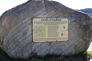
There is some debate as to the location of the geographical centre of Scotland. This is due to different methods of calculating the centre, and whether surrounding islands are included.
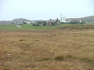
Sanna is a hamlet at the far western tip of the Scottish peninsula of Ardnamurchan, in Lochaber, Highland. It is one of the most westerly settlements on the mainland of Great Britain, and consists of a small collection of crofts and houses around a series of unspoilt sandy beaches. It is the setting for most of Alasdair Maclean's autobiographical book Night Falls on Ardnamurchan.
A headland, also known as a head, is a coastal landform, a point of land usually high and often with a sheer drop, that extends into a body of water. It is a type of promontory. A headland of considerable size often is called a cape. Headlands are characterised by high, breaking waves, rocky shores, intense erosion, and steep sea cliff.

Grigadale, in Ardnamurchan in the Highland Council Area, Scotland, is the most westerly settlement on mainland Britain.

Inverness-shire or the County of Inverness is a historic county, registration county and lieutenancy area of Scotland. Covering much of the Highlands and Outer Hebrides, it is Scotland's largest county, though one of the smallest in population, with 67,733 people or 1.34% of the Scottish population.

Salen is a coastal village on the Ardnamurchan peninsula, overlooking Salen Bay which is an inlet of the sea loch, Loch Sunart. Located in the Scottish council area of Highland, it is on the road to Ardnamurchan Point, the most westerly point of mainland Britain.

The Port an Eilean Mhòir boat burial is a Viking boat burial site in Ardnamurchan, Scotland, the most westerly point on the island of Great Britain. Dated to the 10th century, the burial consists of a Viking boat about 5 metres long by 1.5 metres (5 ft) wide in which a man was laid to rest with his shield, sword and spear as well as other grave goods.


