
The Battle of Cotagaita was fought on October 27, 1810 during the Campaign of Upper Peru in the Argentine War of Independence when the troops of the Army of the North were sent by the Primera Junta government in Buenos Aires to the Alto Perú to fight the Royalists. It was the first skirmish of the Army of the North in this theatre. The battle was fought near the town of Santiago de Cotagaita, nowadays in Potosí Department in Bolivia.
The Tumusla River is a river of Bolivia in the Potosí Department as well as in the Chuquisaca Department. It gets waters from the Los Frailes and Chichas mountain ranges. Upstream the river is named Yura and Toropalca. Cotagaita, a right affluent, is its most important tributary.
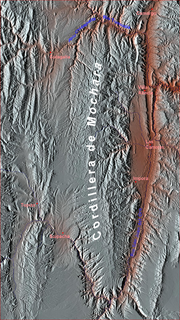
Cotagaita is a small town in Bolivia. In 2009 it had an estimated population of 1904.

Jatun Rumi is a mountain in the Andes of Bolivia which reaches a height of approximately 4,360 m (14,300 ft). It is located in the Potosí Department, Nor Chichas Province, Cotagaita Municipality.
Yana Unu is a mountain in the Andes of Bolivia which reaches a height of approximately 4,040 m (13,250 ft). It is located in the Potosí Department, Nor Chichas Province, Cotagaita Municipality. Yana Unu lies west of a valley named Jatun Q'asa. Its intermittent stream flows to the Caiti River.
Iskay Rumi is a 4,782-metre-high (15,689 ft) mountain in the Andes of Bolivia. It is located in the Potosí Department, Nor Chichas Province, Cotagaita Municipality. Iskay Rumi lies northwest of the mining town of Santa Bárbara.
Yaritayuq is a mountain in the Andes of Bolivia which reaches a height of approximately 4,100 m (13,500 ft). It is located in the Potosí Department, Nor Chichas Province, Cotagaita Municipality. Yaritayuq lies northeast of the village of Quechisla.
Jatun Wasi is a 4,361-metre-high (14,308 ft) mountain in the Andes of Bolivia. It is located in the Potosí Department, Nor Chichas Province, Cotagaita Municipality. Jatun Wasi lies at the Agua Castilla River, east of Yaritayuq.
Ch'utu Urqu is a mountain in the Andes of Bolivia which reaches a height of approximately 4,180 m (13,710 ft). It is located in the Potosí Department, Nor Chichas Province, Cotagaita Municipality. Ch'utu Urqu lies northwest of Iskay Rumi.
Yuraq P'ukru is a mountain in the Andes of Bolivia which reaches a height of approximately 3,920 m (12,860 ft). It is located in the Potosí Department, Nor Chichas Province, Cotagaita Municipality. Yuraq P'ukru lies at the Atocha River, northwest of the village of Quechisla.
Palta Urqu is a mountain in the Andes of Bolivia which reaches a height of approximately 3,760 m (12,340 ft). It is located in the Potosí Department, Nor Chichas Province, Cotagaita Municipality. Palta Urqu lies at the Atocha River, southwest of the village of Quechisla.
T'ika Wasi is a 4,105-metre-high (13,468 ft) mountain in the Andes of Bolivia. It is located in the Potosí Department, Nor Chichas Province, Cotagaita Municipality. T'ika Wasi lies north of the Jara Wayq'u, an affluent of the Caiti River.
Jatun Qaqa is a mountain in the Andes of Bolivia which reaches a height of approximately 3,820 m (12,530 ft). It is located in the Potosí Department, Nor Chichas Province, Cotagaita Municipality. Jatun Qaqa lies west of T'ika Wasi. The Jara Wayq'u flows along its southern slope. It is an affluent of the Caiti River.
Waka Wañusqa is a mountain in the Andes of Bolivia which reaches a height of approximately 4,460 m (14,630 ft). It is located in the Potosí Department, Nor Chichas Province, Cotagaita Municipality.
Yana Muqu, or Yana Mokho, is a 3,893 m (12,772 ft) mountain in the Andes of Bolivia. It is located in the Potosí Department, Nor Chichas Province, Cotagaita Municipality.
Quchayuq is a mountain in the Andes of Bolivia which reaches a height of approximately 3,680 m (12,070 ft). It is located in the Potosí Department, Nor Chichas Province, Cotagaita Municipality. Quchayuq lies northwest of Achakanayuq.
Rumi Kancha is a mountain in the Andes of Bolivia which reaches a height of approximately 3,880 m (12,730 ft). It is located in the Potosí Department, Nor Chichas Province, Cotagaita Municipality. Rumi Kancha lies south of Achakanayuq.
Yana Qaqa is a 3,742 m (12,277 ft) mountain in the Andes of Bolivia. It is located in the Potosí Department, Nor Chichas Province, Cotagaita Municipality. Yana Qaqa lies at the Caiti River.
Wanu Wanuyuq is a mountain in the Andes of Bolivia which reaches a height of approximately 4,140 m (13,580 ft). It is located in the Potosí Department, Nor Chichas Province, Cotagaita Municipality. Wanu Wanuyuq lies east of Achakanayuq.


