Tahua Municipality

Last updated
Tahua Municipality
Tawa
Municipality

Coquesa y Salar de Uyuni - Potosi - Bolivia.jpg

The village of Coquesa and Salar de Uyuni in Tahua Municipality
51402 Tahua Municipio.png
Location within Potosí Department
Bolivia adm location map.svg
Red pog.svg
Tahua Municipality
Location within Bolivia
Coordinates: 20°18′S67°24′W / 20.300°S 67.400°W / -20.300; -67.400 Coordinates: 20°18′S67°24′W / 20.300°S 67.400°W / -20.300; -67.400
CountryFlag of Bolivia.svg  Bolivia
Department Potosí Department
Province Daniel Campos Province
Seat Tahua
Area
  Total 1,263 sq mi (3,272 km2)
Elevation 12,100 ft (3,700 m)
Population (2001)
  Total 2,166
  Ethnicities Aymara
Time zone -4 (UTC-4)

Tahua Municipality is the second municipal section of the Daniel Campos Province in the Potosí Department in Bolivia. Its seat is Tahua.

Municipalities of Bolivia administrative division of Bolivia

Municipalities in Bolivia are administrative divisions of the entire national territory governed by local elections. Municipalities are the third level of administrative divisions, below departments and provinces. Some of the provinces consist of only one municipality. In these cases the municipalities are identical to the provinces they belong to.

Daniel Campos Province Province in Potosí Department, Bolivia

Daniel Campos is a province in the north-western parts of the Bolivian Potosí Department. It is named after the poet Daniel Campos who originated from this area. The capital of the province is Llica.

Potosí Department Place in Potosí, Bolivia

Potosí is a department in southwestern Bolivia. It comprises 118,218 km² with 823,517 inhabitants. The capital is the city of Potosí. It is mostly a barren, mountainous region with one large plateau to the west, where the largest salt flat in the world, Salar de Uyuni, is located.

Contents

Geography

Tahua Municipality lies in the Altiplano at the Uyuni salt flat.

Altiplano plateau

The Altiplano, Collao, Andean Plateau or Bolivian Plateau, in west-central South America, is the area where the Andes are the widest. It is the most extensive area of high plateau on Earth outside Tibet. The bulk of the Altiplano lies in Bolivia, but its northern parts lie in Peru, and its southern parts lie in Chile and Argentina.

Salar de Uyuni salt flat in Bolivia

Salar de Uyuni is the world's largest salt flat, at 10,582 square kilometers (4,086 sq mi). It is in the Daniel Campos Province in Potosí in southwest Bolivia, near the crest of the Andes and is at an elevation of 3,656 meters (11,995 ft) above sea level.

Some of the highest mountains of the municipality are listed below: [1]

Subdivision

The municipality consists of the following cantons:

The people

The people are predominantly indigenous citizens of Aymara descent. [2]

Indigenous peoples of the Americas Pre-Columbian inhabitants of North, Central, and South America and their descendants

The indigenous peoples of the Americas are the Pre-Columbian peoples of North, Central and South America and their descendants.

Aymara people ethnic group

The Aymara or Aimara people are an indigenous nation in the Andes and Altiplano regions of South America; about 1 million live in Bolivia, Peru and Chile. Their ancestors lived in the region for many centuries before becoming a subject people of the Inca in the late 15th or early 16th century, and later of the Spanish in the 16th century. With the Spanish American Wars of Independence (1810–25), the Aymaras became subjects of the new nations of Bolivia and Peru. After the War of the Pacific (1879–83), Chile acquired territory occupied by the Aymaras.

Ethnic group%
Quechua 6.0
Aymara 90.5
Guaraní, Chiquitos, Moxos 0.1
Not indigenous 3.3
Other indigenous groups0.0

See also

Related Research Articles

Antonio Quijarro Province Province in Potosí Department, Bolivia

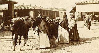
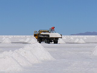
Antonio Quijarro is a province in the central parts of the Bolivian Potosí Department situated at the Salar de Uyuni. Its seat is Uyuni.

Eduardo Abaroa Province Province in Oruro, Bolivia

Eduardo Abaroa, also Eduardo Avaroa, or Challapata is a province in the southeastern parts of the Bolivian department of Oruro. Its seat is Challapata. The province was named after Colonel Eduardo Abaroa, Bolivia's hero of the War of the Pacific.

San Pedro de Totora Province Province in Oruro, Bolivia

San Pedro de Totora is a province in the northern parts of the Bolivian department of Oruro.

Tacna Province Province in Tacna, Peru

Tacna is the largest of four provinces in the Tacna Region in southern Peru located on the border with Chile and Bolivia. Its capital is Tacna.

Tarata Province Province in Tacna, Peru

Tarata is one of four provinces in the Tacna Region in southern Peru. Its capital is Tarata city.

Turco Municipality Municipality in Oruro Department, Bolivia

Turco Municipality is the second municipal section of the Sajama Province in the Oruro Department in Bolivia, and was founded on February 15, 1957. Its seat is Turco, situated 154 km west of Oruro at an altitude of 3,860 m. The municipality covers an area of 3,973 km², not taking into account the area of Laca Laca Canton.

Tarata District District in Tacna, Peru

Tarata District is one of eight districts of the province Tarata in Peru.

Sorata Municipality Municipality in La Paz Department, Bolivia

Sorata Municipality is the first municipal section of the Larecaja Province in the La Paz Department, Bolivia. Its capital is Sorata. The Illampu - Janq'u Uma massif is located within the municipality, site of the 17th highest lake in the world, Laguna Glaciar.

Batallas Municipality is the third municipal section of the Los Andes Province in the La Paz Department, Bolivia. Its capital is Batallas.

Palca Municipality Municipality in La Paz Department, Bolivia

Palca or Pallqa (Aymara) is the first municipal section of the Pedro Domingo Murillo Province in the La Paz Department, Bolivia. Its seat is Palca.

Ancoraimes Municipality Municipality in La Paz Department, Bolivia

Ancoraimes or Janq'u Laymi (Aymara) is the second municipal section of the Omasuyos Province in the La Paz Department, Bolivia. Its seat is Ancoraimes.

Waldo Ballivián Municipality Municipality in La Paz Department, Bolivia

Waldo Ballivián Municipality is the sixth municipal section of the Pacajes Province in the La Paz Department, Bolivia. Its seat is Tumarapi.

Sipe Sipe Municipality Municipality in Cochabamba Department, Bolivia

Sipe Sipe Municipality is the second municipal section of the Quillacollo Province in the Cochabamba Department, Bolivia. Its seat is Sipe Sipe. At the time of census 2001 the municipality had 31,337 inhabitants.

Catacora Municipality is the second municipal section of the José Manuel Pando Province in the La Paz Department, Bolivia. Its seat is Catacora.

Colquiri Municipality is the fourth municipal section of the Inquisivi Province in the La Paz Department, Bolivia. Its seat is Colquiri.

Malla Municipality is the fourth municipal section of the Loayza Province in the La Paz Department, Bolivia. Its seat is Malla.

Ayopaya Municipality is the first municipal section of the Ayopaya Province in the Cochabamba Department, Bolivia. Its seat is Ayopaya.

Yocalla Municipality Municipality in Potosí Department, Bolivia

Yocalla Municipality is the second municipal section of the Tomás Frías Province in the Potosí Department in Bolivia. Its seat is Yocalla.

Uyuni Municipality Municipality in Potosí Department, Bolivia

Uyuni Municipality is the first municipal section of the Antonio Quijarro Province in the Potosí Department in Bolivia. Its seat is Uyuni.

Wila Qullu may refer to:

References

  1. "Tahua". INE, Bolivia. Retrieved October 16, 2015.
  2. obd.descentralizacion.gov.bo/municipal/fichas/ (inactive)