Potosí Municipality

Last updated
Potosí Municipality
Municipality

Lagunas Kari Kari (Potosi - Bolivia).jpg

Khari Khari Lakes, Potosí Municipality
50101 Potosi Municipio.png
Location within Potosí Department
Bolivia adm location map.svg
Red pog.svg
Potosí Municipality
Location within Bolivia
Coordinates: 19°35′S65°43′W / 19.583°S 65.717°W / -19.583; -65.717 Coordinates: 19°35′S65°43′W / 19.583°S 65.717°W / -19.583; -65.717
CountryFlag of Bolivia.svg  Bolivia
Department Potosí Department
Province Tomás Frías Province
Seat Potosí
Population (2001)
  Total 145,057
  Ethnicities Quechua
Time zone -4 (UTC-4)

Potosí Municipality is the capital municipality of the Tomás Frías Province in the Potosí Department in Bolivia. Its seat is Potosí which is the capital of the department as well.

Municipalities of Bolivia administrative division of Bolivia

Municipalities in Bolivia are administrative divisions of the entire national territory governed by local elections. Municipalities are the third level of administrative divisions, below departments and provinces. Some of the provinces consist of only one municipality. In these cases the municipalities are identical to the provinces they belong to.

Tomás Frías Province Province in Potosí Department, Bolivia

Tomás Frías is a province in the northern parts of the Bolivian Potosí Department. Its capital is Potosí which is also the capital of the department. The province is named after the former president Tomás Frías Ametller.

Potosí Department Place in Potosí, Bolivia

Potosí is a department in southwestern Bolivia. It comprises 118,218 km² with 823,517 inhabitants. The capital is the city of Potosí. It is mostly a barren, mountainous region with one large plateau to the west, where the largest salt flat in the world, Salar de Uyuni, is located.

Contents

Geography

The Potosí mountain range traverses the municipality. Some of the highest mountains of the municipality are listed below: [1] [2] [3] [4] [5]

Potosí mountain range Mountain range in Bolivia

The Potosí mountain range in Bolivia is situated east and southeast of the city of Potosí. It is at least 25 km long stretching from north to south. Its highest mountain is Khunurana (Anaruyu) rising up to 5,071 m (16,637 ft). The features of the range are considered the product of volcanic activity known as the Khari Khari caldera. The caldera is about 40 km long and 25 km at its widest point.

Achakanani

Achakanani is a mountain in the Bolivian Andes which reaches a height of approximately 3,980 m (13,060 ft). It is located in the Potosí Department, Tomás Frías Province, Potosí Municipality. It lies near the village of Q'illu Mayu, northeast of Lik'ichiri. The Q'illu Mayu flows along its eastern slopes.

Chawpi Urqu (Potosí)

Chawpi Urqu is a mountain in the Bolivian Andes which reaches a height of approximately 4,460 m (14,630 ft). It is located in the Potosí Department, Tomás Frías Province, Potosí Municipality. It lies southeast of Jatun Q'asa.

Jatun Chutu

Jatun Ch'utu is a mountain in the Bolivian Andes which reaches a height of approximately 4,220 m (13,850 ft). It is located in the Potosí Department, Tomás Frías Province, Potosí Municipality. It lies southeast of the village of Juch'uy Wasi (Juchuy Huasi). The Jatun Mayu flows along its southern slopes.

Subdivision

The municipality consists of the following cantons:

Demographics

The people are predominantly indigenous citizens of Quechua descent. [6]

Indigenous peoples of the Americas Pre-Columbian inhabitants of North, Central and South America and their descendants

The indigenous peoples of the Americas are the Pre-Columbian peoples of North, Central and South America and their descendants.

Quechua people ethnic group

Quechua people or Quecha people, may refer to any or all speakers of the Quechua languages, which originated among the indigenous people of South America. Most Quechua speakers are native to Peru, although there are some significant populations living in Ecuador, Bolivia, Chile, Colombia and Argentina.

Ethnic group%
Quechua 68.1
Aymara 2.0
Guaraní, Chiquitos, Moxos 0.2
Not indigenous 29.5
Other indigenous groups0.2

See also

Related Research Articles

Arani Province Province in Cochabamba Department, Bolivia

Arani is a province in Cochabamba Department, Bolivia. Its capital is Arani, situated about 53 km from Cochabamba. Arani is known for its bread but also for the town's artisan wickerwork.

Quillacollo Province Province in Cochabamba Department, Bolivia

Quillacollo is a province in the Cochabamba Department, Bolivia. It is known for its festival in August where people from all over Bolivia come and pay homage to the Virgin of Urqupiña. Quillacollo is said to be one of the fastest growing cities in Bolivia.

José María Linares Province Province in Potosí Department, Bolivia

José María Linares is a province in the eastern parts of the Bolivian department of Potosí. Its capital is Puna.

Nor Chichas Province Province in Potosí Department, Bolivia

Nor Chichas is a province in the Eastern parts of the Bolivian Potosí Department. Its seat is Cotagaita.

Nor Cinti Province Province in Chuquisaca Department, Bolivia

Nor Cinti is a province in the Bolivian department of Chuquisaca. Its capital is Camargo.

Oropeza Province Province in Chuquisaca Department, Bolivia

Oropeza is a province in the Chuquisaca Department, Bolivia. Its seat is Sucre which is also the constitutional capital of Bolivia and the capital of the Chuquisaca Department.

Tomina Province Province in Chuquisaca Department, Bolivia

Tomina is a province in the Chuquisaca Department in Bolivia. Its seat is Padilla.

Chayanta Province Province in Potosí Department, Bolivia

Chayanta is a province in the northern parts of the Bolivian Potosí Department. Its capital is Colquechaca.

Quillacollo Municipality Municipality in Cochabamba Department, Bolivia

Quillacollo Municipality is the first municipal section of the Quillacollo Province in the Cochabamba Department, Bolivia. Its capital is Quillacollo. At the time of census 2001 the municipality had 104,206 inhabitants.

Yocalla Municipality Municipality in Potosí Department, Bolivia

Yocalla Municipality is the second municipal section of the Tomás Frías Province in the Potosí Department in Bolivia. Its seat is Yocalla.

Porco Municipality Municipality in Potosí Department, Bolivia

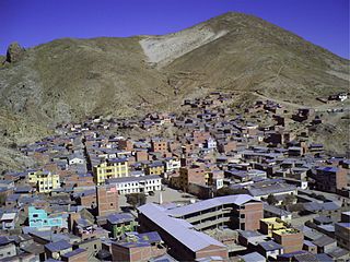
Porco Municipality is the third municipal section of the Antonio Quijarro Province in the Potosí Department in Bolivia. Its seat is Porco.

Ravelo Municipality Municipality in Potosí Department, Bolivia

Ravelo Municipality is the second municipal section of the Chayanta Province in the Potosí Department in Bolivia. Its seat is Ravelo.

Wayra Wasi

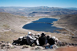
Wayra Wasi is a 4,416-metre-high (14,488 ft) mountain in the Bolivian Andes. It is situated in the Potosí Department, Tomás Frías Province, Potosí Municipality. Wayra Wasi lies west of Jatun Q'asa and the Ch'aki Mayu. The river originates southeast of the mountain. It flows to the north.

Jatun Qasa (Umallani)

Jatun Q'asa is a 4,590-metre-high (15,059 ft) mountain in the Bolivian Andes. It is situated in the Potosí Department, Tomás Frías Province, Potosí Municipality. Some of the nearest settlements are Umallani and Salla K'uchu. Jatun Q'asa lies east Wayra Wasi, between the Ch'aki Mayu in the west and the Challwiri River (Challviri) in the east. Both rivers flow to the north as right tributaries of the Pillku Mayu.

Jatun Qasa (Yocalla)

Jatun Q'asa is a 4,398-metre-high (14,429 ft) mountain in the Bolivian Andes. It is located in the Potosí Department, Tomás Frías Province, Yocalla Municipality. It lies east of the village of Puka Wasi (Puca Huasi).

Jatun Qaqa

Jatun Qaqa is a mountain in the Bolivian Andes which reaches a height of approximately 4,220 m (13,850 ft). It is located in the Potosí Department, Tomás Frías Province, Yocalla Municipality. It lies between Wayra Wasi in the east and Jatun Q'asa in the west.

Wayra Wasi (Potosí-Yocalla)

Wayra Wasi is a 4,208-metre-high (13,806 ft) mountain in the Bolivian Andes. It is located in the Potosí Department, Tomás Frías Province, at the border of the Potosí Municipality and the Yocalla Municipality, west of the village of Tarapaya.

References

  1. Evelio Echevarría, Cordillera de Potosí, Bolivia, The Alpine Journal, 1995
  2. Bolivian IGM map 1:50,000 Don Diego 6435-I
  3. Bolivian IGM map 1:50,000 6435-II-1 Potosí (Este)
  4. Bolivian IGM map 1:50,000 Puna 6434-I
  5. Bolivian IGM map 1:50,000 Porco 6434-IV
  6. obd.descentralizacion.gov.bo/municipal/fichas/ (inactive)