Coulee, North Dakota | |
|---|---|
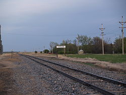 Railroad in Coulee | |
 Coulee  Coulee | |
| Coordinates: 48°32′43″N102°00′42″W / 48.54528°N 102.01167°W | |
| Country | United States |
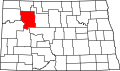
| State | North Dakota |
| County | Mountrail |
| Elevation | 2,064 ft (629 m) |
| Time zone | UTC-6 (Central (CST)) |
| • Summer (DST) | UTC-5 (CDT) |
| Area code | 701 |
| GNIS feature ID | 1028477 [1] |
Coulee is an unincorporated community in Mountrail County, North Dakota, United States, on the border of Ward County. [1]
It is the location of Our Savior's Scandinavian Lutheran Church, which is listed on the U.S. National Register of Historic Places. [2]