County of Belmore

Last updated

Belmore
Queensland
Belmore-county-queensland.png
Location within Queensland
Lands administrative divisions around Belmore:
Tomoo Maranoa,
Elgin
Pring
Mungallala,
Nebine
Belmore Carnarvon
Narran (NSW) Finch (NSW) Benarba (NSW)
Map all coordinates using: OpenStreetMap

The County of Belmore is a county in Queensland, Australia, [1] located west of the Darling Downs in the Shire of Balonne. [2]

Like all counties in Queensland, it is a non-functional administrative unit, that is used mainly for the purpose of registering land titles. [3] It was officially named and bounded by the Governor in Council on 7 March 1901 under the Land Act 1897. [1]

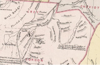
county in 1890 Cassilis and belmor county in 1890 Map of the Queensland counties. Queensland Government (1890).png
county in 1890

Like all counties in Queensland, it is a non-functional administrative unit, that is used mainly for the purpose of registering land titles. From 30 November 2015, the government no longer referenced counties and parishes in land information systems however the Museum of Lands, Mapping and Surveying retains a record for historical purposes. [4]

Parishes

Belmore is divided into parishes, listed as follows:

ParishLGACoordinatesTowns
Alton Balonne 28°06′S149°15′E / 28.100°S 149.250°E / -28.100; 149.250 (Alton Parish) Alton
BallagnaBalonne 28°13′S149°01′E / 28.217°S 149.017°E / -28.217; 149.017 (Ballagna Parish)
BoahBalonne 28°29′S148°21′E / 28.483°S 148.350°E / -28.483; 148.350 (Boah Parish)
BogiriaBalonne 28°55′S147°47′E / 28.917°S 147.783°E / -28.917; 147.783 (Bogiria Parish) Hebel
BollonBalonne 28°01′S147°26′E / 28.017°S 147.433°E / -28.017; 147.433 (Bollon Parish) Bollon
BoogahBalonne 28°21′S147°26′E / 28.350°S 147.433°E / -28.350; 147.433 (Boogah Parish)
BookalongBalonne 28°37′S148°23′E / 28.617°S 148.383°E / -28.617; 148.383 (Bookalong Parish)
BooligarBalonne 28°42′S148°16′E / 28.700°S 148.267°E / -28.700; 148.267 (Booligar Parish)
BoombahBalonne 28°12′S148°39′E / 28.200°S 148.650°E / -28.200; 148.650 (Boombah Parish)
BoomiBalonne 28°35′S147°28′E / 28.583°S 147.467°E / -28.583; 147.467 (Boomi Parish)
BorgeraBalonne 27°55′S147°47′E / 27.917°S 147.783°E / -27.917; 147.783 (Borgera Parish)
BrendaBalonne 28°51′S147°26′E / 28.850°S 147.433°E / -28.850; 147.433 (Brenda Parish)
BriarieBalonne 28°49′S147°43′E / 28.817°S 147.717°E / -28.817; 147.717 (Briarie Parish)
BullamonBalonne 28°40′S148°53′E / 28.667°S 148.883°E / -28.667; 148.883 (Bullamon Parish) Thallon
BullindgieBalonne 28°16′S147°56′E / 28.267°S 147.933°E / -28.267; 147.933 (Bullindgie Parish)
BumbleBalonne 28°49′S148°27′E / 28.817°S 148.450°E / -28.817; 148.450 (Bumble Parish)
BurgorahBalonne 27°59′S148°44′E / 27.983°S 148.733°E / -27.983; 148.733 (Burgorah Parish)
ByraBalonne 28°55′S147°15′E / 28.917°S 147.250°E / -28.917; 147.250 (Byra Parish)
CardiffBalonne 27°54′S147°33′E / 27.900°S 147.550°E / -27.900; 147.550 (Cardiff Parish)
CawildiBalonne 28°28′S148°13′E / 28.467°S 148.217°E / -28.467; 148.217 (Cawildi Parish)
ChippewayBalonne 28°04′S147°58′E / 28.067°S 147.967°E / -28.067; 147.967 (Chippeway Parish)
CodernahBalonne 28°45′S147°53′E / 28.750°S 147.883°E / -28.750; 147.883 (Codernah Parish)
CollybenBalonne 28°52′S148°59′E / 28.867°S 148.983°E / -28.867; 148.983 (Collyben Parish)
CowigellaBalonne 28°38′S147°46′E / 28.633°S 147.767°E / -28.633; 147.767 (Cowigella Parish)
CubbieBalonne 28°39′S148°01′E / 28.650°S 148.017°E / -28.650; 148.017 (Cubbie Parish)
CulgoaBalonne 28°45′S147°20′E / 28.750°S 147.333°E / -28.750; 147.333 (Culgoa Parish)
CunnianaBalonne 28°35′S148°40′E / 28.583°S 148.667°E / -28.583; 148.667 (Cunniana Parish)
CuoygahBalonne 28°50′S148°10′E / 28.833°S 148.167°E / -28.833; 148.167 (Cuoygah Parish)
CurrawildiBalonne 28°41′S148°08′E / 28.683°S 148.133°E / -28.683; 148.133 (Currawildi Parish) Dirranbandi
CurrawillinghiBalonne 28°56′S147°37′E / 28.933°S 147.617°E / -28.933; 147.617 (Currawillinghi Parish)
DareelBalonne 28°49′S148°50′E / 28.817°S 148.833°E / -28.817; 148.833 (Dareel Parish) Dareel
DewurraBalonne 28°14′S147°35′E / 28.233°S 147.583°E / -28.233; 147.583 (Dewurra Parish)
DoondiBalonne 28°23′S148°25′E / 28.383°S 148.417°E / -28.383; 148.417 (Doondi Parish)
DunwinnieBalonne 28°40′S148°38′E / 28.667°S 148.633°E / -28.667; 148.633 (Dunwinnie Parish)
EugunBalonne 28°07′S148°19′E / 28.117°S 148.317°E / -28.117; 148.317 (Eugun Parish)
EurabaBalonne 28°48′S148°00′E / 28.800°S 148.000°E / -28.800; 148.000 (Euraba Parish)
Fairymount Goondiwindi 28°07′S149°22′E / 28.117°S 149.367°E / -28.117; 149.367 (Fairymount Parish)
Geralda Goondiwindi 28°18′S149°16′E / 28.300°S 149.267°E / -28.300; 149.267 (Geralda Parish)
GerarBalonne 28°32′S148°52′E / 28.533°S 148.867°E / -28.533; 148.867 (Gerar Parish)
GnooloomaBalonne 28°56′S148°38′E / 28.933°S 148.633°E / -28.933; 148.633 (Gnoolooma Parish)
GoonaroBalonne 28°56′S147°59′E / 28.933°S 147.983°E / -28.933; 147.983 (Goonaro Parish)
GoulamainBalonne 27°53′S149°03′E / 27.883°S 149.050°E / -27.883; 149.050 (Goulamain Parish)
GulnarbarBalonne 28°07′S148°29′E / 28.117°S 148.483°E / -28.117; 148.483 (Gulnarbar Parish)
Gurardera Goondiwindi 28°26′S149°15′E / 28.433°S 149.250°E / -28.433; 149.250 (Gurardera Parish)
Guy GuyBalonne 28°14′S148°23′E / 28.233°S 148.383°E / -28.233; 148.383 (Guy Guy Parish)
HollymountBalonne 28°05′S149°07′E / 28.083°S 149.117°E / -28.083; 149.117 (Hollymount Parish)
KareeBalonne 28°20′S148°33′E / 28.333°S 148.550°E / -28.333; 148.550 (Karee Parish)
KatootaBalonne 27°51′S148°45′E / 27.850°S 148.750°E / -27.850; 148.750 (Katoota Parish)
KeebrahBalonne 28°32′S148°07′E / 28.533°S 148.117°E / -28.533; 148.117 (Keebrah Parish)
KirkBalonne 28°10′S148°08′E / 28.167°S 148.133°E / -28.167; 148.133 (Kirk Parish)
KooroonBalonne 27°52′S149°25′E / 27.867°S 149.417°E / -27.867; 149.417 (Kooroon Parish)
KulkiBalonne 28°34′S147°37′E / 28.567°S 147.617°E / -28.567; 147.617 (Kulki Parish)
KullinjahBalonne 27°57′S148°14′E / 27.950°S 148.233°E / -27.950; 148.233 (Kullinjah Parish)
MarillaBalonne 28°57′S148°13′E / 28.950°S 148.217°E / -28.950; 148.217 (Marilla Parish)
MaroungleBalonne 27°58′S148°23′E / 27.967°S 148.383°E / -27.967; 148.383 (Maroungle Parish)
MelangaBalonne 28°25′S148°43′E / 28.417°S 148.717°E / -28.417; 148.717 (Melanga Parish)
MinimiBalonne 28°07′S148°51′E / 28.117°S 148.850°E / -28.117; 148.850 (Minimi Parish)
MonaBalonne 28°09′S147°24′E / 28.150°S 147.400°E / -28.150; 147.400 (Mona Parish)
MoombahBalonne 27°53′S149°14′E / 27.883°S 149.233°E / -27.883; 149.233 (Moombah Parish)
Mugan Goondiwindi 28°45′S149°05′E / 28.750°S 149.083°E / -28.750; 149.083 (Mugan Parish)
MungindiBalonne 28°56′S148°52′E / 28.933°S 148.867°E / -28.933; 148.867 (Mungindi Parish) Mungindi
Newinga Goondiwindi 28°36′S149°21′E / 28.600°S 149.350°E / -28.600; 149.350 (Newinga Parish)
NindigullyBalonne 28°22′S148°53′E / 28.367°S 148.883°E / -28.367; 148.883 (Nindigully Parish) Nindigully
NinghamBalonne 28°16′S148°50′E / 28.267°S 148.833°E / -28.267; 148.833 (Ningham Parish)
NoondooBalonne 28°48′S148°38′E / 28.800°S 148.633°E / -28.800; 148.633 (Noondoo Parish)
RunnymedeBalonne 28°22′S147°15′E / 28.367°S 147.250°E / -28.367; 147.250 (Runnymede Parish)
St GeorgeBalonne 28°05′S148°40′E / 28.083°S 148.667°E / -28.083; 148.667 (St George Parish) St George
ShirleyBalonne 28°29′S148°31′E / 28.483°S 148.517°E / -28.483; 148.517 (Shirley Parish)
ThombyBalonne 27°57′S148°53′E / 27.950°S 148.883°E / -27.950; 148.883 (Thomby Parish)
TilquinBalonne 28°05′S147°32′E / 28.083°S 147.533°E / -28.083; 147.533 (Tilquin Parish)
TootherangBalonne 28°30′S147°53′E / 28.500°S 147.883°E / -28.500; 147.883 (Tootherang Parish)
TowtowriBalonne 27°56′S147°57′E / 27.933°S 147.950°E / -27.933; 147.950 (Towtowri Parish)
UhrBalonne 28°06′S147°43′E / 28.100°S 147.717°E / -28.100; 147.717 (Uhr Parish)
WagailyBalonne 27°59′S148°34′E / 27.983°S 148.567°E / -27.983; 148.567 (Wagaily Parish)
Wandibingie Goondiwindi 28°34′S149°08′E / 28.567°S 149.133°E / -28.567; 149.133 (Wandibingie Parish)
Weengallon Goondiwindi 28°22′S149°02′E / 28.367°S 149.033°E / -28.367; 149.033 (Weengallon Parish) Weengallon
WeeyanBalonne 27°44′S148°50′E / 27.733°S 148.833°E / -27.733; 148.833 (Weeyan Parish)
WhitalbyBalonne 28°11′S147°50′E / 28.183°S 147.833°E / -28.183; 147.833 (Whitalby Parish)
WhyenbahBalonne 28°19′S148°14′E / 28.317°S 148.233°E / -28.317; 148.233 (Whyenbah Parish)
Willarie Goondiwindi 28°40′S149°14′E / 28.667°S 149.233°E / -28.667; 149.233 (Willarie Parish)
WombilBalonne 28°23′S148°03′E / 28.383°S 148.050°E / -28.383; 148.050 (Wombil Parish)
WonditBalonne 27°56′S148°04′E / 27.933°S 148.067°E / -27.933; 148.067 (Wondit Parish)
WoolerinaBalonne 28°43′S147°35′E / 28.717°S 147.583°E / -28.717; 147.583 (Woolerina Parish)
WungerBalonne 27°44′S149°03′E / 27.733°S 149.050°E / -27.733; 149.050 (Wunger Parish)
WyenbirraBalonne 28°34′S147°17′E / 28.567°S 147.283°E / -28.567; 147.283 (Wyenbirra Parish)
YammaBalonne 28°25′S147°38′E / 28.417°S 147.633°E / -28.417; 147.633 (Yamma Parish)
YangleBalonne 28°54′S148°24′E / 28.900°S 148.400°E / -28.900; 148.400 (Yangle Parish)

Related Research Articles

<span class="mw-page-title-main">Rosebery County, Queensland</span>

The County of Rosebery is a county in Queensland, Australia. It is centred in the South Gregory Lands District. Like all counties in Queensland, it is a non-functional administrative unit, that is used mainly for the purpose of registering land titles.

<span class="mw-page-title-main">Porchester County, Queensland</span>

Porchester County, Queensland is a cadastral division and a County of Queensland located on the Gulf of Carpentaria adjacent to the Northern Territory border. The county is divided into civil parishes.

<span class="mw-page-title-main">Wellington County, Queensland</span>

Wellington County, Queensland is a cadastral division of Queensland and a County of remote western Queensland.

Ross County, Queensland is a cadastral division of Queensland and a County of remote western Queensland.

Noorama Countyis a cadastral division of Queensland and a County of the Warrego Land District of southwestern Queensland.

Nive County is a cadastral division of Queensland and a County of the Warrego Land District of southwestern Queensland. The county is divided into civil parishes.

<span class="mw-page-title-main">Windula County, Queensland</span>

Windula County

<span class="mw-page-title-main">Gordon County, Queensland</span>

Gordon County is a cadastral division of Queensland, Australia and a County of the South Gregory District of remote western Queensland. The county is divided into civil parishes.

<span class="mw-page-title-main">Bulgroo County, Queensland</span>

Bulgroo County is a cadastral division of Queensland and a County of the South Gregory District of remote western Queensland. The county is divided into civil parishes.

<span class="mw-page-title-main">Cooper County, Queensland</span>

Cooper County is a cadastral division of Queensland and a County of the South Gregory District of remote western Queensland. The county is divided into civil parishes.

Curralle County is a cadastral division of Queensland and a County of the South Gregory District of remote western Queensland.

Burarie County is a cadastral division of Queensland and a County of the South Gregory District of remote western Queensland. The county is divided into civil parishes.

<span class="mw-page-title-main">Kendall County, Queensland</span>

Kendall County is a County of Queensland located at 13.683°S 141.967°E on the Cape York Peninsula in remote far north of Queensland, Australia.

<span class="mw-page-title-main">County of Kungie, Queensland</span> County in Queensland, Australia

County of Kungie is one of the 318 counties of Queensland, Australia. The county is divided into civil parishes. It is within the Darling Downs region west Brisbane.

<span class="mw-page-title-main">Ayrshire County, Queensland</span>

Ayrshire County, Queensland is one of the 318 counties of Queensland, Australia. The county came into existence in the 19th century, and on 8 March 1901, the Governor of Queensland issued a proclamation legally dividing Queensland into counties under the Land Act 1897. Like all counties in Queensland, it is a non-functional administrative unit, that is used mainly for the purpose of registering land titles. From 30 November 2015, the government no longer referenced counties and parishes in land information systems however the Museum of Lands, Mapping and Surveying retains a record for historical purposes.
<span class="mw-page-title-main">Iffley County, Queensland</span>

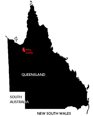
Iffley County, Queensland is one of the 318 counties of Queensland, Australia. The county is divided into civil parishes.

<span class="mw-page-title-main">Rodney County, Queensland</span>

Rodney County is one of the 318 counties of Queensland, Australia. The county is divided into civil parishes.
<span class="mw-page-title-main">Douglas County, Queensland</span>

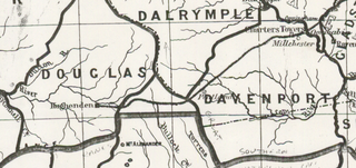
Douglas County, Queensland is one of the 318 counties of Queensland, Australia. The county is divided into civil parishes. The county came into existence in the 19th century, and on 8 March 1901, the Governor of Queensland issued a proclamation legally dividing Queensland into counties under the Land Act 1897. Like all counties in Queensland, it is a non-functional administrative unit, that is used mainly for the purpose of registering land titles. From 30 November 2015, the government no longer referenced counties and parishes in land information systems however the Museum of Lands, Mapping and Surveying retains a record for historical purposes.

Glanworth is a rural locality and county of Queensland in Australia. Glanword is located on the Westphalia Creek about 760km west-northwest from Brisbane, and at an elevation of approximately 366m above sea level.

Yappar County, Queensland is a cadastral division of Burke District of northern Queensland and a County of Queensland, Australia.

References

  1. 1 2 "Belmore (entry 2237)". Queensland Place Names. Queensland Government . Retrieved 1 September 2015.
  2. Queensland showing counties / compiled and published at the Survey Department, Brisbane, Brisbane : Survey Dept., 1900.
  3. Maranoa District, County of Belmore Maps - R1 Series at Queensland Archives.
  4. "Locality boundaries - Queensland". Department of Natural Resources, Mines and Energy. 27 August 2017. Archived from the original on 31 March 2018. Retrieved 2 October 2018.

28°02′S148°35′E / 28.033°S 148.583°E / -28.033; 148.583