Crick Road

Last updated

Crick Road
Crick Road, Oxford.JPG
View east along Crick Road from the junction with Bradmore Road
Length200 m (660 ft)
Postal codeOX2 6QJ
Coordinates 51°45′53″N1°15′25″W / 51.76475°N 1.25705°W / 51.76475; -1.25705
west end Bradmore Road
east end Fyfield Road
Construction
Completion1876
The blue plaque for the physiologist J. S. Haldane, who lived at 11 Crick Road during 1891-9. Haldane blue plaque, Oxford.JPG
The blue plaque for the physiologist J. S. Haldane, who lived at 11 Crick Road during 1891–9.
The geneticist J. B. S. Haldane FRS, the son of J. S. Haldane, who lived at 11 Crick Road. J. B. S. Haldane.jpg
The geneticist J. B. S. Haldane FRS, the son of J. S. Haldane, who lived at 11 Crick Road.

Crick Road is a road in North Oxford, England, an area characterised by large Victorian Gothic villas. [3]

Contents

Location

At the western end is the Bradmore Road and at the eastern end is Fyfield Road. To the north is Norham Road and to the south are Norham Gardens and the University Parks.

History and residents

Houses in the road were first leased between 1876 and 1880. [3] Architects include Willson Beasley, Frederick Codd, Galpin & Shirley, and Frederick R. Pike. The houses are mostly in pairs, with Jacobean as well as more traditional North Oxford Gothic detailing. [4]

In 1879, the school that was to become known as the Dragon School (previous known as the Oxford Preparatory School) moved from rooms at Balliol Hall in St Giles' to 17 Crick Road, which became known as "School House". [5] The headmaster was initially A. E. Clarke and from 1886 Charles Cotterill Lynam (known as the "Skipper"). [6] The school expanded and moved in 1895 to its current location at Bardwell Road, further north in North Oxford.

In 1879, the historian and later Master of Balliol College, Oxford, Arthur Lionel Smith married Mary Smith. [7] They first lived at 7 Crick Road until 1893. They had had nine children together, six of whom were born at the house in Crick Road. In the 20th century 7 Crick Road was the home of the Principal of St. Edmund Hall, John Kelly, who let part of the building to undergraduates, and then bequeathed it to St. Edmund Hall in 1997.

The Haldane family [8] lived at 11 Crick Road and the house is marked with a blue plaque. [2] [1] The family included the physiologist and father John Scott Haldane (1860–1936) and his wife Louisa, [9] together with their children, the geneticist and evolutionary biologist J. B. S. Haldane (Fellow of New College, Oxford), and the novelist Naomi Mitchison. The family later moved to 'Cherwell' at the end of Linton Road to the north, now the location of Wolfson College on the banks of the River Cherwell.

The botanist and Mayor of Oxford, George Claridge Druce (1850–1932), moved to 9 Crick Road in 1909. [10] He named the house "Yardley Lodge", after the village of Yardley Gobion where he lived in his youth. He died at his home and was buried in Holywell Cemetery, Oxford.

Related Research Articles

<span class="mw-page-title-main">Dragon School</span> School in Oxford, Oxfordshire, United Kingdom

The Dragon School is one school on two sites in Oxford, England. The Dragon Pre-Prep and Prep School are both co-educational schools. The Dragon Prep School was founded in 1877 as the Oxford Preparatory School. It takes day pupils and boarders.

<span class="mw-page-title-main">Marston, Oxford</span> Human settlement in England

Marston is a village in the civil parish of Old Marston about 2 miles (3 km) northeast of the centre of Oxford, England. It was absorbed within the city boundaries in 1991. It is commonly called Old Marston to distinguish it from the suburb of New Marston that developed between St. Clement's and the village in the 19th and 20th centuries. The A40 Northern Bypass, part of the Oxford Ring Road forms a long north-west boundary of the village and parish and a limb, namely a distributary, of the Cherwell forms the western boundary.

<span class="mw-page-title-main">North Oxford</span> Human settlement in England

North Oxford is a suburban part of the city of Oxford in England. It was owned for many centuries largely by St John's College, Oxford and many of the area's Victorian houses were initially sold on leasehold by the College.

<span class="mw-page-title-main">Park Town, Oxford</span> Human settlement in England

Park Town is a small residential area in central North Oxford, a suburb of Oxford, England. It was one of the earliest planned suburban developments in the area and most of the houses are Grade II listed.

<span class="mw-page-title-main">St Clement's, Oxford</span> District in Oxford, England

St Clement's is a district in Oxford, England, on the east bank of the River Cherwell. "St Clement's" is usually taken to describe a small triangular area from The Plain bounded by the Cherwell in the West, Cowley Road in the East. to the foot of Headington Hill in the South. It also refers to the ecclesiastical parish of St Clement's which includes some neighbouring areas and is used in the names of local City and County electoral districts.

<span class="mw-page-title-main">Bardwell Road</span> Road in North Oxford, England

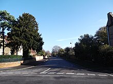
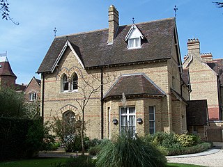
Bardwell Road is a residential road in Oxford, England. It is located in North Oxford off the Banbury Road, within the area of Oxford once owned by St John's College, Oxford. The road is known for its schools, especially the Dragon School.

<span class="mw-page-title-main">Linton Road</span> Road in North Oxford, England

Linton Road is a road in North Oxford, England.

<span class="mw-page-title-main">Norham Gardens</span> Road in North Oxford, England

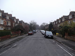
Norham Gardens is a residential road in central North Oxford, England. It adjoins the north end of Parks Road near the junction with Banbury Road, directly opposite St Anne's College. From here it skirts the north side of the Oxford University Parks, ending up at Lady Margaret Hall, a college of Oxford University that was formerly for women only, backing onto the River Cherwell. Public access to the Parks is available from the two ends of the road. To the north of the road are Bradmore Road near the western end and Fyfield Road near the eastern end.

Walton Manor is a residential suburb in Oxford, England. It is north of Jericho and the Radcliffe Observatory Quarter and forms part of North Oxford. The street layout and many of the area's buildings date from the mid-19th century. It was developed on land belonging to St John's College, Oxford.

<span class="mw-page-title-main">Norham Manor</span> Human settlement in England

The Norham Manor estate is a residential suburb in Oxford, England. It is part of central North Oxford. To the north is Park Town with its crescents, to the east is the River Cherwell, to the south are the University Parks and to the west is Walton Manor, on the other side of Banbury Road.

George Claridge Druce, MA, LLD, JP, FRS, FLS was an English botanist and a Mayor of Oxford.

<span class="mw-page-title-main">Pullens Lane</span> Road in Headington, east Oxford, England

Pullens Lane is in Headington, east Oxford, England. It is located at the top of Headington Hill, leading north off Headington Road to Jack Straw's Lane and Harberton Mead. The cul-de-sac Pullens Field leads off west from Pullens Lane.

<span class="mw-page-title-main">Chadlington Road</span> Road in North Oxford, England

Chadlington Road is a road in North Oxford, England.

<span class="mw-page-title-main">Chalfont Road</span> Road in North Oxford, England

Chalfont Road is a road in Walton Manor, North Oxford, England.

<span class="mw-page-title-main">Norham Road</span> Road in North Oxford, England

Norham Road is a road which lies east of the Banbury Road in central North Oxford, a suburb in the city of Oxford, England.

<span class="mw-page-title-main">Rawlinson Road</span>

Rawlinson Road is a residential road in North Oxford, England.

<span class="mw-page-title-main">Bradmore Road</span> Road in North Oxford, England

Bradmore Road is a residential road in North Oxford, England.

<span class="mw-page-title-main">Fyfield Road</span> Road in North Oxford, England

Fyfield Road is a residential road in North Oxford, England, on the Norham Manor estate.

<span class="mw-page-title-main">Frederick Codd</span>

Frederick Codd was a British Gothic Revival architect and speculative builder who designed and built many Victorian houses in North Oxford, England.

<span class="mw-page-title-main">Brewer Street, Oxford</span> Street in central Oxford, London

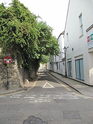
Brewer Street is a historic narrow street in central Oxford, England, south of Carfax. The street runs east–west, connecting with St Aldate's to the east and St Ebbe's Street to the west.

References

  1. 1 2 Warr, Elizabeth Jean (2011). The Oxford Plaque Guide. pp. 54–56. ISBN   978-0-7524-5687-4.{{cite book}}: |website= ignored (help)
  2. 1 2 "J. S. Haldane (1860–1936)". Oxfordshire Blue Plaques Scheme, UK. 14 March 2011. Retrieved 6 May 2011.
  3. 1 2 Hinchcliffe, Tanis (1992). North Oxford. New Haven & London: Yale University Press. pp. 55, 85, 109, 223. ISBN   0-14-071045-0.
  4. Sherwood, Jennifer; Pevsner, Nikolaus (1974). The Buildings of England: Oxfordshire. Penguin Books. p. 318. ISBN   0-14-071045-0.
  5. Jaques, C. H. (1977). "I: Beginnings". A Dragon Century: 1877–1977. Blackwell's. pp. 1–7.
  6. Jaques, C. H. (1977). "II: The Crick Road Era". A Dragon Century: 1877–1977. Blackwell's. pp. 7–21.
  7. Symonds, Ann Spokes (4 September 1997). "Families: The A.L. Smiths". The Changing Faces of North Oxford: Book One. Robert Boyd Publications. pp. 117–118. ISBN   1-899536-25-6.
  8. Symonds, Ann Spokes (4 September 1997). "Families: The Haldanes". The Changing Faces of North Oxford: Book One. Robert Boyd Publications. pp. 99–101. ISBN   1-899536-25-6.
  9. Graham, Malcolm (1992). "North Oxford". Images of Victorian Oxford. Alan Sutton Publishing. pp. 87–90. ISBN   0-86299-967-7.
  10. Jenkins, Stephanie (6 March 2011). "George Claridge Druce: Mayor of Oxford 1900/1". www.headington.org.uk. UK: Headington, Oxford. Archived from the original on 23 September 2013. Retrieved 6 May 2011.