
South Northamptonshire was from 1974 to 2021 a district in Northamptonshire, England. Its council was based in the town of Towcester, first established as a settlement in Roman Britain. The population of the Local Authority District Council in 2011 was 85,189.

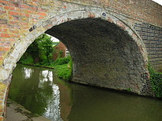
Barby is a village and civil parish about 5 miles (8 km) north of Daventry in Northamptonshire, England. The 2011 Census recorded the parish population as 2,336. Barby is located right off the M45 motorway a short spur from the M1 motorway to the A45 Trunk Road.

Boughton is a village and civil parish in West Northamptonshire, England, about 4 miles (6.4 km) from Northampton town centre along the A508 road between Northampton and Market Harborough. The parish area straddles both side of the road but the main part of the village is east. It is on the northern fringe of the Northampton urban area and, together with the neighbouring village of Moulton is in the preferred area for the expansion of the town.

Woodford Halse is a village about 6.5 miles (10.5 km) south of Daventry in Northamptonshire. It is in the civil parish of Woodford cum Membris, which includes also village of Hinton and hamlet of West Farndon. Hinton and Woodford Halse are separated by the infant River Cherwell and the former course of the Great Central Main Line railway.

Potterspury is a village and civil parish in West Northamptonshire. The nearest main town is Milton Keynes, the centre of which is about 7 miles south-east. At the time of the 2011 census, the parish's population was 1,453 people.
The Honour of Grafton is a collection of manors in the south east of Northamptonshire, England. The Honour is historic, dating back at least as far as 1542 when a bill for its management was before parliament.

Yardley Hastings is a village and civil parish in the English county of Northamptonshire. It is located south-east of the county town of Northampton and is skirted on its south side by the main A428 road to Bedford.
Wootton is a former village about 3 miles (4.8 km) south of Northampton town centre that is now part of Northampton.
Bugbrooke is a village and civil parish in Northamptonshire, England, on a ridge overlooking the valley of the River Nene.
The site of Moor End Castle is situated opposite Moor End Farm, along Moor End Road in the civil parish of Yardley Gobion, within the historic county of Northamptonshire.

West Northamptonshire is a unitary authority area covering part of the ceremonial county of Northamptonshire, England, created in 2021. By far the largest settlement in West Northamptonshire is the county town of Northampton, other significant towns include Daventry, Brackley and Towcester, the remainder of the area is rural.
George Claridge Druce, MA, LLD, JP, FRS, FLS was an English botanist and a Mayor of Oxford.
The Elizabeth Woodville School, Northamptonshire, was formed by the merger of Roade Sports College and Kingsbrook Specialist Business and Enterprise College in 2011. It is a secondary school with academy status, run by the Tove Learning Trust, and is located at two sites in the villages of Deanshanger, and Roade, both in South Northamptonshire. The merged school was named after Elizabeth Woodville, who was born in Grafton Regis, halfway between the two sites, and was Queen consort of King Edward IV.
Edmund Francis Law, usually referred to as 'E. F. Law', FRIBA was a British architect during the 19th century, notable for a large number of projects, particularly restorations, in the counties of Northamptonshire, Leicestershire and Rutland.
Wollaston School is a co-educational secondary school and sixth form located in Wollaston in the English county of Northamptonshire.

The Grafton Way is a 13-mile (21 km) footpath in Northamptonshire, England. It runs south east from Greens Norton to Cosgrove, where it meets the Knightley Way. It is named after the Dukes of Grafton, major land-owners in the area in the 18th and 19th centuries.

