
Stafford County is a county located in the U.S. state of Kansas. Its county seat is St. John. As of the 2020 census, the county population was 4,072. The county is named in honor of Lewis Stafford, a captain of Company E, First Kansas Infantry, who died at the Battle of Young's Point during the American Civil War.

Reno County is a county located in the U.S. state of Kansas. Its county seat and largest city is Hutchinson. As of the 2020 census, the population was 61,898. The county is named for Jesse Reno, a general during the American Civil War.

Pratt County is a county located in the U.S. state of Kansas. Its county seat and largest city is Pratt. As of the 2020 census, the county population was 9,157. The county was named for Caleb Pratt, a U.S. soldier who died in the Battle of Wilson's Creek during the American Civil War and had previously been involved in Bleeding Kansas.

Kingman County is a county located in the U.S. state of Kansas. Its county seat and largest city is Kingman. As of the 2020 census, the county population was 7,470. The county was named for Samuel Kingman, a chief justice of the Kansas Supreme Court during the 1860s and 1870s.

Cheyenne County is a county located in the northwest corner of the U.S. state of Kansas. Its county seat and most populous city is St. Francis. As of the 2020 census, the county population was 2,616. The county was named after the Cheyenne tribe.
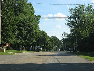
Tecumseh is an unincorporated community in Shawnee County, Kansas, United States, and situated along the Kansas River. As of the 2020 census, the population of the community and nearby areas was 696. The community and township are both named for the Shawnee chief.

Bois d'ArcBOH-dark is an unincorporated community in Butler County, Kansas, United States. It is located about six miles southeast of Augusta in Bloomington Township.

Xenia is an unincorporated area in Franklin Township, Bourbon County, Kansas, United States.

Petrolia is an unincorporated community in Allen County, Kansas, United States. It is situated along the Neosho River.
Bayard is an unincorporated community in Allen County, Kansas, United States.

Diamond Creek Township is a township in Chase County, Kansas, United States. As of the 2000 census, its population was 237.

Hopewell is an unincorporated community in Pratt County, Kansas, United States. It is located in the Rattlesnake Creek valley roughly 18 miles northwest of Pratt at NW 140th Ave and NW 110th St.

Patterson is an unincorporated community in Harvey County, Kansas, United States. It is located 5 miles south of Burrton at SW 84th St and S Patterson Rd.
Hooser is an unincorporated community in Dexter Township, Cowley County, Kansas, United States. It is located at 37°08′18″N96°37′48″W.

Willowdale is an unincorporated community in Kingman County, Kansas, United States. It is located 5 miles north of Zenda at the intersection of SW 100 Ave and SW 90 St.
Cairo is an unincorporated community in Pratt County, Kansas, United States. It is located between the cities of Pratt and Cunningham, roughly 11 miles east of Pratt.
Natrona is an unincorporated community in Pratt County, Kansas, United States. It is located six miles northeast of Pratt along NE 40th Ave on the north side of Highway 61.

Angelus is an unincorporated community in Sheridan County, Kansas, United States. It is located in Solomon Township, approximately 20 miles southwest of Hoxie. Also, it is located northwest of Grinnell and Interstate 70.
Studley is an unincorporated community in Sheridan County, Kansas, United States, approximately 16 miles east of Hoxie along U.S. Route 24. It is on the eastern edge of the county in Valley Township, bordering Graham County. It was named after the Studley Royal Park, in England.
Lund is a ghost town in Summit Township of Decatur County, Kansas, United States. It was located 12 miles south and 4 miles west of Oberlin.


