
Transport in Guinea is composed by a variety of systems that people in the country use to get around as well as to and from domestic and international destinations. The railway from Conakry to Kankan ceased operating in the mid-1980s. Most vehicles in Guinea are 20+ years old, and cabs are any four-door vehicle which the owner has designated as being for hire. Domestic air services are intermittent. Conakry International Airport is the largest airport in the country, with flights to other cities in Africa as well as to Europe.

Guinea-Bissau, officially the Republic of Guinea-Bissau, is a country in West Africa that covers 36,125 square kilometres (13,948 sq mi) with an estimated population of 2,026,778. It borders Senegal to its north and Guinea to its southeast.

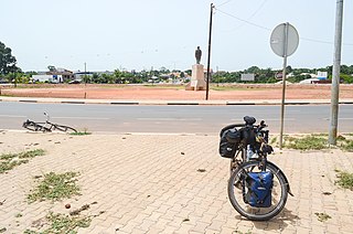
Transport infrastructure in Guinea-Bissau is basic, with most roads outside the capital Bissau being unpaved.

Bissau is the capital and largest city of Guinea-Bissau. As of 2015, it had a population of 492,004. Bissau is located on the Geba River estuary, off the Atlantic Ocean, and is Guinea-Bissau's largest city, major port, its administrative and military center.

Aristides Maria Pereira was a Cape Verdean politician. He was the first President of Cape Verde, serving from 1975 to 1991.

Osvaldo Vieira International Airport, also known as Bissau-Bissalanca Airport, is an international airport that serves the city of Bissau, the capital of Guinea-Bissau, as well as the Metropolitan Region of Bissau. It is the only international airport in the country.
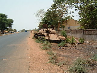
The Guinea-Bissau Civil War was fought from 7 June 1998 to 10 May 1999 and was triggered by an attempted coup d'état against the government of President João Bernardo Vieira led by Brigadier-General Ansumane Mané. Government forces, backed by neighbouring states, clashed with the coup leaders who had quickly gained almost total control over the country's armed forces.

EuroAtlantic Airways, legally EuroAtlantic Airways – Transportes Aéreos S.A., is a Portuguese Charter ACMI airline specialized in leasing and air charter headquartered in Carnaxide and based at Lisbon Airport.
Safim is a city and sector in the Biombo Region of Guinea-Bissau. It has a population of 17,356 inhabitants as of the 2009 national census.
The following outline is provided as an overview of and topical guide to Guinea-Bissau:
Cufar is a town in the Tombali Region of southern Guinea-Bissau.
Bubaque Airport is an airport serving the island town of Bubaque, in Guinea-Bissau. It is the Bijagos Archipelago's only airfield.
Bafatá Airport is an airport serving Bafatá in Guinea-Bissau. The dirt runway doubles as an avenue named Av. Brasil and may have vehicular traffic.
Quebo Airport is an airstrip serving the adjacent towns of Quebo and Aldeia in the Tombali Region of Guinea-Bissau. Quebo's national airport code is GG64.
Nova Lamego Airport is an airport serving the city of Gabú, the capital of the Gabú Region of Guinea-Bissau.

A coup d'état was attempted in Guinea-Bissau on 1 February 2022. A few hours later, president Umaro Sissoco Embaló declared the coup over, he said that "many" members of the security forces had been killed in a "failed attack against democracy".
