The A8 motorway is a 64.0-kilometre (39.8 mi) toll motorway in Croatia. It connects the A7 motorway near Rijeka with the road network in the Istrian peninsula via the Učka Tunnel. The road terminates at the Kanfanar interchange with the A9 motorway, which with the A8 motorway forms the Istrian Y road system. The motorway's national significance is reflected in its positive economic impact on the cities and towns it connects, as well as its importance to tourism in Croatia. The importance of the motorway for tourism is particularly high during the summer tourist season, when its traffic volume increases by about 65%.

The A9 motorway is a north–south motorway in Croatia, with a length of 78.3 kilometres. Beginning in Pula, the largest city on the Istrian peninsula, it runs north to the Croatian motorway and expressway network at the Kanfanar interchange. Here it meets the A8 motorway, forming the Istrian Y road system. The A9 continues north from here to the Kaštel and Plovanija border crossings into Slovenia. The motorway represents a significant north–south transportation corridor in Croatia and is a part of the European route E751. The motorway's national significance is reflected in the positive economic impact on the cities and towns it connects, as well as its importance to tourism in Croatia. Importance of the motorway for tourism is particularly high during summer tourist seasons, when traffic volume increases by more than 80%.

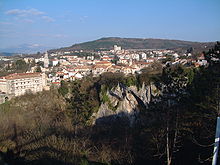
The European route E751, or E751, as defined by the Declaration on the Construction of Main International Traffic Arteries of 1975, and subsequent documents which amended the treaty, is an east–west Class-B branching European road route. Originating in Rijeka, Croatia, where it diverges from European route E61 before passing through the Kanfanar interchange, the route connects Pula, Rovinj, Poreč and Umag in Croatia with Koper in Slovenia. The route provides a high-performance road link in Istria and Slovenian Littoral. Unlike most routes, the E751 centers on the Kanfanar interchange and has three arms, each extending to Rijeka, Pula and Koper. The total length of the route, including all the route arms, is 160 km (99 mi).

D200 is a state road connecting Plovanija border crossing and Buje, as well as A9 motorway Umag interchange via Ž5002 county road. The road is 7.6 km long.
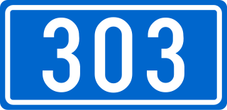
D303 is a state road connecting A9 and A8 motorways to Rovinj. The road is 13.5 km long.

D302 is a state road connecting A9 with Poreč and Baderna. The road is 11.8 km long.
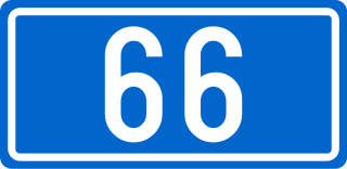
D66 is a state road in Croatia, connecting A9 motorway with D8 state road in Matulji. D66 road serves as a connection to a number of towns and resorts along the eastern coast of Istria peninsula, including Opatija, Lovran and Ičići, as well as to Brestova ferry port, from which Jadrolinija ferries fly to island of Cres (D100). The northern terminus of the road also provides a link towards Rijeka via D8 state road and to Matulji interchange on A8 motorway. The road is 90.1 km long.
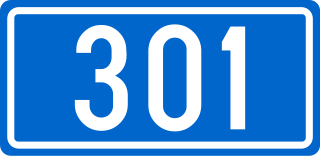
D301 is a state road connecting A9 with Novigrad and D21 state road. The road is 17.0 km long.
D300 is a state road connecting A9 with Umag and D21 state road in Buje. The road is 12.2 km long.

D101 is a state road connecting D100 state road to Merag ferry port, from where Jadrolinija ferries fly to Valbiska, Krk and D104 state road. The road is 10.9 km long.

D21 was an 80.1-kilometre-long (49.8 mi), north–south state road in Istria County, Croatia. A short section of D21 was a part of the European route E751. The northern terminus of the route was located at the Croatia–Slovenia border at the Dragonja River. There it connected to Koper, Slovenia, and Trieste, Italy, via the Slovene route G11 further north. The route was generally parallel to A9 motorway, with which it formed several junctions, either directly or via short connectors, at Buje, Bale and Vodnjan – towns served directly by D21. The southern terminus of the route was found in the city of Pula, at the southern tip of the Istrian Peninsula.
D64 is a state road connecting the city of Pazin with D66 state road in Vozilići.
D204 is a state road connecting Pribanjci and nearby border crossing to Slovenia to D3 state road in Bosanci, and the road also serves as a connecting road to the A1 motorway as it terminates in Bosiljevo 1 interchange. The northern terminus of the road is located at Aržano border crossing, providing access to Livno in Bosnia and Herzegovina. The road is 6.3 km (3.9 mi) long.
D512 is a state road connecting Makarska and Ravča on D62 state road, near A1 motorway Ravča interchange.

D44 is a state road connecting A9 motorway Nova Vas interchange to A8 expressway Lupoglav interchange via Buzet. The road is 50.5 km (31.4 mi) long.

D500 is a state road connecting A8 motorway to Kršan and D64 state road. The road is 23.7 km (14.7 mi) long.
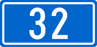
D32 is a state road in Gorski Kotar region of Croatia connecting Prezid and nearby border crossing to Slovenia to D3 state road in Delnice, and the road also serves as a connecting road to the A6 motorway as it terminates near Delnice interchange. The road is 49.7 km (30.9 mi) long.
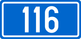
D116 is the main state road on island of Hvar in Croatia connecting towns of Hvar, Milna, Stari Grad and Jelsa to Sućuraj and ferry ports, from where Jadrolinija ferries fly to the mainland, docking in Split and the D410 state road and Drvenik and the D412 state road. The road is 77.9 km (48.4 mi) long.

D112 is a state road on the island of Šolta in Croatia connecting ferry port of Rogač, from where Jadrolinija ferries fly to the mainland, docking in Split and the D410 state road to the D111 state road, the main road on the island. The road is 1.9 km (1.2 mi) long.
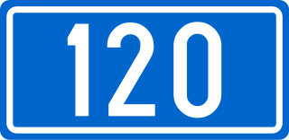
D120 is the main state road on island of Mljet in Croatia connecting Mljet National Park and resorts on the island to Sobra and the ferry port in the town, from where Jadrolinija ferries sail to the mainland, docking in Prapratno and the D416 state road. The road is 42.9 km (26.7 mi) long.