Tinjan Antignana | |
|---|---|
Municipality | |
 | |
 Flag | |
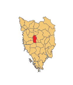 Location of Tinjan in Istria | |
 | |
 Tinjan | |
| Coordinates: 45°13′02″N13°50′20″E / 45.21722°N 13.83889°E | |
| Country | |
| County | |
| Area | |
• Municipality | 20.4 sq mi (52.8 km2) |
| • Urban | 4.2 sq mi (10.8 km2) |
| Population (2021) [2] | |
• Municipality | 1,729 |
| • Density | 85/sq mi (33/km2) |
| • Urban | 433 |
| • Urban density | 100/sq mi (40/km2) |
| Time zone | UTC+1 (CET) |
| • Summer (DST) | UTC+2 (CEST) |
| Postal code [3] | 52000 Pazin |
| Area code | 52 |
| Website | tinjan |
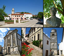
Tinjan (Italian : Antignana) is a village and municipality in Istria, west Croatia.
Contents
Tinjan is located is 50 km north of Pula and 10 km southwest of Pazin, in the Draga valley. The Coat of Arms of Tinjan is azure on a base vert a tower argent behind walls of the same. This is based on the historical pattern.
