
Nottingham is a city and unitary authority area in Nottinghamshire, East Midlands, England. It is located 110 miles (180 km) north-west of London, 33 miles (53 km) south-east of Sheffield and 45 miles (72 km) north-east of Birmingham. Nottingham has links to the legend of Robin Hood and to the lace-making, bicycle and tobacco industries. The city is also the county town of Nottinghamshire and the settlement was granted its city charter in 1897, as part of Queen Victoria's Diamond Jubilee celebrations. Nottingham is a tourist destination; in 2018, the city received the second-highest number of overnight visitors in the Midlands and the highest number in the East Midlands.

Beeston is a town in the Borough of Broxtowe, Nottinghamshire, England, 3.4 miles (5.5 km) south-west of Nottingham city centre. To its north-east is the University of Nottingham's main campus, University Park. The pharmaceutical and retail chemist group Boots has its headquarters 0.6 miles (1 km) east of the centre of Beeston, on the border with Broxtowe and the City of Nottingham. To the south lie the River Trent and the village of Attenborough, with extensive wetlands.

Eastwood is a former coal mining town in the Broxtowe district of Nottinghamshire, England, 8 miles (13 km) northwest of Nottingham and 10 miles (16 km) northeast of Derby on the border between Nottinghamshire and Derbyshire. Mentioned in Domesday Book, it expanded rapidly during the Industrial Revolution. The Midland Railway was formed here and it is the birthplace of D. H. Lawrence. The distinctive dialect of East Midlands English is extensively spoken, in which the name of the town is pronounced.

Arnold is a market town and unparished area in the Borough of Gedling in the county of Nottinghamshire in the East Midlands of England. It is situated to the north-east of Nottingham's city boundary. Arnold has the largest town centre in the Borough of Gedling and the most important town centre in the northeastern part of the conurbation of Greater Nottingham. Gedling Borough Council is headquartered in Arnold. Since 1968 Arnold has had a market, and the town used to have numerous factories associated with the hosiery industry. Nottinghamshire Police have been headquartered in Arnold since 1979. At the time of the 2011 United Kingdom census, Arnold had a population of 37,768.
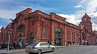
Nottingham station, briefly known as Nottingham City and for rather longer as Nottingham Midland, is a railway station and tram stop in the city of Nottingham. It is the principal railway station of Nottingham. It is also a nodal point on the city's tram system, with a tram stop that was originally called Station Street but is now known as Nottingham Station.
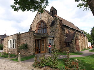
Chilwell is a village and residential suburb of Nottingham, in the borough of Broxtowe of Nottinghamshire, west of Nottingham city. Until 1974 it was part of Beeston and Stapleford Urban District, having been in Stapleford Rural District until 1935.
Wollaton is a suburb and former parish in the western part of Nottingham, England. Wollaton has two Wards in the City of Nottingham with a total population as at the 2011 census of 24,693. It is home to Wollaton Hall with its museum, deer park, lake, walks and golf course.
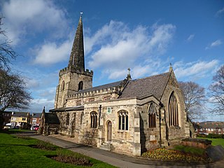
Stapleford is a town and civil parish in the Borough of Broxtowe in Nottinghamshire, England, 5.6 miles (9.0 km) west of Nottingham. The population at the 2011 census was 15,241.

Attenborough is a village in the Borough of Broxtowe in Nottinghamshire, England. It forms part of the Greater Nottingham area, and is 4+1⁄2 miles (7.2 km) to the southwest of the city of Nottingham, between Long Eaton and Beeston. It adjoins the suburbs of Toton to the west and Chilwell to the north. The population of the ward, as at the 2011 Census, was 2,328.
Bramcote is a suburban village in the Broxtowe district of Nottinghamshire, England, between Stapleford and Beeston. It is in Broxtowe parliamentary constituency. The main Nottingham–Derby road today is the A52, Brian Clough Way. Nearby are Beeston, Wollaton, Chilwell and Stapleford. One of the main roads between Nottingham and Derby used to pass through the village centre, entering a cutting that formed a blind bend. A country house to the north of the village became publicly owned and was demolished in 1968. Its grounds became a public area of park and hillside, now known as Bramcote Hills Park.

Beeston railway station is a Grade II listed railway station on the Midland Main Line which serves the town of Beeston in Nottinghamshire, England. It lies 3.2 miles (5.1 km) south-west of Nottingham railway station, and 750 metres (0.5 mi) south-east of Beeston transport interchange for local buses and Nottingham Express Transit trams. The station is managed by East Midlands Railway.
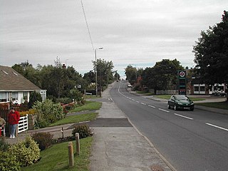
Bilsthorpe is a village and civil parish in the Newark and Sherwood district of Nottinghamshire, England. According to the 2001 census it had a population of 3,076, increasing to 3,375 at the 2011 Census. It is located near the junction of the A614 and A617, around 5 miles south of Ollerton, 9 miles east of Mansfield and 6 miles north-west of Southwell.

Chilwell School is a secondary school located in Chilwell, near Nottingham, England. The school is located adjacent to the Chilwell Olympia sports complex and has an attached sixth-form college. In January 2005, the school was designated a specialist school in Arts and Maths and Computing.

Frederick Ball LRIBA was an architect based in Nottingham. He was Sheriff of Nottingham from 1906–07, and Mayor of Nottingham from 1913–1914.
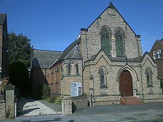
Charles Nelson Holloway was an architect based in Nottingham.

Arnold Plackett LRIBA was an 20th century architect based in Long Eaton.

Joseph Warburton LRIBA MRAIC was an 20th century architect based in Beeston, Nottinghamshire and Regina, Saskatchewan.

George Francis Grimwood LRIBA was an 20th century engineer and architect based in Nottingham.

James Huckerby was a 19th-century builder and architect based in Beeston, Nottingham.

Alexander Wilson LRIBA was an architect based in Nottingham. Some of his most significant work include the 900 houses built on the Beeston Rylands estate in the late 1930s.


