
Bareilly division is an administrative geographical unit of Uttar Pradesh state of India. Bareilly is the administrative headquarters of the division. Part of the Rohilkhand region, Bareilly division has four major cities in west Uttar Pradesh - Bareilly, Badaun, Pilibhit and Shahjahanpur.
Budaun is a medieval city and headquarters of Budaun district, Uttar Pradesh, India. It is located about a mile east of the Sot river, and 27 km north of the river Ganges, in the Rohilkhand region of Uttar Pradesh. According to the 2011 census, it has a total population of 159,221, which is projected at 161,555 at present. Budaun rose to historical importance as the capital of the Delhi Sultanate for four years from 1210 CE to 1214 CE during the reign of Sultan Iltutmish. It was the most important post of Northern Frontier during Mughal reign. Budaun is a big market, historically famous and religiously important city. Budaun is 230 km south-east of New Delhi and 245 km north-west of Lucknow, both taking about 6 hours by road.

Badaun district is one of the districts of Uttar Pradesh state of India, with its headquarters in the town of Badaun. The district is part of the Bareilly division, and covers an area of 4,234 km2 (1,635 sq mi). According to legend, Budaun was named after the Ahir prince Budh.
Bisauli is a town and a municipal board in Badaun district in the state of Uttar Pradesh, India. It is settled on Badaun - Moradabad Highway. Bisauli is known for its temples and mosques abounding the town. Bisauli is a constituency of District Budaun. Member of Legislative Assembly from Bisuli is Ashutosh Maurya of Samajwadi Party
Dataganj is a town and a nagar palika in Badaun district in the state of Uttar Pradesh, India.
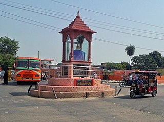
Sahaswan is a city and a municipal board in Budaun district in the Indian state of western Uttar Pradesh. It is also an administrative Block, 0177 is the block code.

Ujhani is an industry-based city and a municipal board in Badaun district in the Indian state of Uttar Pradesh.
Usawan is a town and a Nagar panchayat in Badaun District in the Indian state of Uttar Pradesh.
Gunnaur Assembly constituency is one of the 403 constituencies of the Uttar Pradesh Legislative Assembly, India. It is a part of the Budaun district and one of the five assembly constituencies in the Badaun Lok Sabha constituency. First election in this assembly constituency was held in 1952 after the "DPACO (1951)" was passed in 1951. After the "Delimitation of Parliamentary and Assembly Constituencies Order" was passed in 2008, the constituency was assigned identification number 111.
Badaun Assembly constituency is one of the 403 constituencies of the Uttar Pradesh Legislative Assembly, India. It is a part of the Badaun district and one of the five assembly constituencies in the Badaun Lok Sabha constituency. First election in this assembly constituency was held in 1957 after the "DPACO (1956)" was passed in 1956. After the "Delimitation of Parliamentary and Assembly Constituencies Order" was passed in 2008, the constituency was assigned identification number 115.
Shekhupur Assembly constituency is one of the 403 constituencies of the Uttar Pradesh Legislative Assembly, India. It is a part of the Badaun district and one of the five assembly constituencies in the Aonla Lok Sabha constituency. First election in this assembly constituency was held in 2012 after the "Delimitation of Parliamentary and Assembly Constituencies Order, 2008" was passed and the constituency was formed in 2008. The constituency is assigned identification number 116.
Shyam Nagar is an area of Budaun city in Uttar Pradesh, India.
Sanay is a village in Budaun district, Uttar Pradesh. Its village code is 128237. It is located on the right side of river Sot. Sanai is a medium size village located in Budaun of Budaun district, Uttar Pradesh with total 118 families residing. The Sanai village has population of 683 of which 366 are males while 317 are females as per Population Census 2011.
Yusuf Nagar a village in Salarpur block, Budaun district of Uttar Pradesh, India. Yusuf Nagar village is also a gram panchayat. It is located 20 km away from Budaun, which is a district, as well as sub-district, headquarter of Yusuf Nagar village.
Gurai is a village in Ujhani Tehsil and Budaun district, Uttar Pradesh, India. The major cast of the village residents is Kurmi. The village is administrated by Gram Panchayat. Budaun railway station is 6 KM away from the village. Its village code is 128461.
Bhagautipur is a village in Salarpur block, Budaun district, Uttar Pradesh, India. Its village code is 128327. Budaun railway station is 5 KM away from the village. The village is administrated by Gram Panchayat. The major caste of residing people in the village is Kurmi.
Asrasi is a village in Qadar Chowk Block, Budaun district, Uttar Pradesh, India. Its village code is 128566. The village is administrated by Gram Panchayat. According to 2011 Census of India, the total population of the village is 2,502 out of 1,320 are males and 1,182 are females.
Titauli is a village in Salarpur block, Budaun district, Uttar Pradesh, India. The village is administrated by Gram panchayat. Its village code is 128265. According to 2011 Census of India, the total population of the village is 1,749, out of 955 are males and 794 are females.
Salarpur is a Block & village panchayat in Budaun district, Uttar Pradesh, India. Its block code is 0180. 67 panchayat of Budaun district comes under Salarpur block. According to 2011 Census of India, the total houses in Salarpur is 27,767 and total population is 1,68,197 out of 90,637 are males and 77,560 are females.

Asafpur is a block & village panchayat (Kasba) in Budaun district, Uttar Pradesh, India. Its block number is 0173. There are 84 villages under Asafpur block. According to 2011 Census of India, total number of houses in Asafpur is 28,395 and total population is 1,73,601 out of 92,682 are males and are 80,919 females.

