Related Research Articles

North Omaha is a community area in Omaha, Nebraska, in the United States. It is bordered by Cuming and Dodge Streets on the south, Interstate 680 on the north, North 72nd Street on the west and the Missouri River and Carter Lake, Iowa on the east, as defined by the University of Nebraska at Omaha and the Omaha Chamber of Commerce.
Florence is a present-day neighborhood in Omaha, Nebraska, United States on the city's north end and was one of the oldest cities in Nebraska before being annexed by Omaha. Given the high concentration of National Register of Historic Places in the neighborhood, it is acknowledged that "The historic Florence neighborhood was a city before Nebraska was officially a state," and is regarded as "the historic front door to Omaha as well as the state."
North Omaha, Nebraska has a recorded history spanning over 200 years, pre-dating the rest of Omaha, encompassing wildcat banks, ethnic enclaves, race riots and social change. North Omaha has roots back to 1812 and the founding of Fort Lisa. It includes the Mormon settlement of Cutler's Park and Winter Quarters in 1846, a lynching before the turn of the twentieth century, the thriving 24th Street community of the 1920s, the bustling development of its African-American community through the 1950s, a series of riots in the 1960s, and redevelopment in the late 20th and early 21st century.
Significant events in the history of North Omaha, Nebraska include the Pawnee, Otoe and Sioux nations; the African American community; Irish, Czech, and other European immigrants, and; several other populations. Several important settlements and towns were built in the area, as well as important social events that shaped the future of Omaha and the history of the nation. The timeline of North Omaha history extends to present, including recent controversy over schools.
The neighborhoods of Omaha are a diverse collection of community areas and specific enclaves. They are spread throughout the Omaha metro area, and are all on the Nebraska side of the Missouri River.

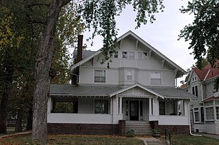
The Gold Coast Historic District is located in Midtown Omaha, Nebraska. Listed on the National Register of Historic Places in 1997, this historic district covers approximately a 30 block area roughly bounded by 36th, 40th, Jones, and Cuming Streets. The neighborhood housed many of Omaha's cultural and financial leaders between 1900 and 1920, taking over from Omaha's original Gold Coast in prominence.

The Bemis Park Landmark Heritage District is located in North Omaha, Nebraska. Situated from Cuming Street to Hawthorne Avenue, Glenwood Avenue to 33rd Street, Bemis Park was annexed into Omaha in 1887, and developed from 1889 to 1922. The district was designated an Omaha Landmark in 1983.
The Near North Side of Omaha, Nebraska is the neighborhood immediately north of downtown. It forms the nucleus of the city's historic African-American community, and its name is often synonymous with the entire North Omaha area. Originally established immediately after Omaha was founded in 1854, the Near North Side was once confined to the area around Dodge Street and North 7th Street. Eventually, it gravitated west and north, and today it is bordered by Cuming Street on the south, 30th on the west, 16th on the east, and Locust Street to the north. Countless momentous events in Omaha's African American community happened in the Near North Side, including the 1865 establishment of the first Black church in Omaha, St. John's AME; the 1892 election of the first African American state legislator, Dr. Matthew Ricketts; the 1897 hiring of the first Black teacher in Omaha, Ms. Lucy Gamble, the 1910 Jack Johnson riots, the Omaha race riot of 1919 that almost demolished the neighborhood and many other events.
The Kountze Place neighborhood of Omaha, Nebraska is a historically significant community on the city's north end. Today the neighborhood is home to several buildings and homes listed on the National Register of Historic Places. It is located between North 16th Avenue on the east to North 30th Street on the west; Locust Street on the south to Pratt Street on the north. Kountze Place was annexed into Omaha in 1887. The neighborhood was built as a suburban middle and upper middle class enclave for doctors, lawyers, successful businessmen and other professional workers.
The Miller Park neighborhood in North Omaha, Nebraska, is a historically significant community housing a historic district and several notable historic places. It is located between Sorenson Parkway on the south and Redick Avenue on the north, Florence Boulevard on the east and 30th Street on the west. The Minne Lusa neighborhood borders on the north, and the Saratoga neighborhood is on the south. Fort Omaha borders the neighborhood on the west. Miller Park is the namesake park in the neighborhood, as well as the Miller Park Elementary School. In 2017, the Miller Park/Minne Lusa area was ranked as having the 2nd highest rate of homicides and other violent crimes out of 81 Omaha neighborhoods.
Scriptown was the name of the first subdivision in the history of Omaha, which at the time was located in Nebraska Territory. It was called "Scriptown" because scrip was used as payment, similar to how a company would pay employees when regular money was unavailable. Its original survey placed the location from the Missouri River to North 30th Street, Cuming to Fort Street.
Little Italy is a neighborhood in Omaha, Nebraska which served as the historic home to Omahans of Italian ancestry. It was the source of many laborers for the Union Pacific railroad, much of Omaha's bootlegging during Prohibition and the Santa Lucia Procession, which started in 1924 and continues annually.

Little Bohemia, or Bohemian Town, is a historic neighborhood in Omaha, Nebraska. Starting in the 1880s, Czech immigrants settled in this highly concentrated area, also called "Praha" (Prague) or "Bohemian Town", bounded by South 10th Street on the east, South 16th Street on the west, Pierce Street on the north, and Martha Street on the south, with a commercial area went along South 13th and South 14th Streets, centered on William Street. It was located south of downtown, and directly west of Little Italy. A portion of the neighborhood along South 13th Street was listed on the National Register of Historic Places in 2020.
Gifford Park is a historic neighborhood in midtown Omaha, Nebraska. It is roughly bounded by the North Freeway on the east, North 38th Street on the west, Dodge Street on the south and Cuming Street on the north. Its namesake park was added to the City parks network in 1916. The neighborhood is bounded by several historic neighborhoods, including Bemis Park, Gold Coast, and the Near North Side.

Hanscom Park is a historic neighborhood in Midtown Omaha, Nebraska. Its namesake public park is one of the oldest parks in Omaha, donated to the City in 1872. U.S. President Gerald R. Ford was born in a house in the Hanscom Park neighborhood. Its boundaries are Woolworth Street on the north, South 42nd on the west, Interstate 480 on the east and I-80 on the south.
The Logan Fontenelle Housing Project was a historic public housing site located from 20th to 24th Streets, and from Paul to Seward Streets in the historic Near North Side neighborhood of Omaha, Nebraska, United States. It was built in 1938 by the Public Works Administration for housing working-class families. With the loss of thousands of industrial jobs in the 1950s and 1960s, the project became filled with families on welfare. As problems increased in the 1970s and 1980s, Logan Fontenelle was referred to as "Little Vietnam" because of drug dealing and gang violence. After Logan Fontenelle residents won a 1991 civil rights lawsuit brought against the Omaha Housing Authority and the U.S. Department of Housing and Urban Development, HUD tore down the projects in 1995 to replace them with new, lower density housing.
Sheelytown was a historic ethnic neighborhood in South Omaha, Nebraska, USA with populations of Irish, Polish and other first generation immigrants. Located north of the Union Stockyards, it was bounded by Edward Creighton Boulevard on the north, Vinton Street on the south, South 24th Street to the east, and 35th Street to the west. Sheelytown was named for the Sheely Brothers Packing Houses that were located in the area. Sheelytown was annexed by Omaha in 1887. The Omaha Quartermaster Depot was built just east of the community across the Union Pacific tracks.
The Burlington Road neighborhood of Omaha, Nebraska is bordered by South 42nd Street on the west, L Street on the south, Interstate 80 on the north and Dahlman Avenue on the east. Once incorporated in the City of South Omaha, the area has also been known as Golden Hill in the past.
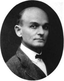
James Charles Dahlman, also known as Jim Dahlman, Cowboy Jim and Mayor Jim, was elected to eight terms as mayor of Omaha, Nebraska, serving the city for 20 years over a 23-year-period. A German-American and an agnostic, Dahlman grew up in a ranching area and started working as a Texas cowboy. He was elected as a county sheriff and small town mayor in western Nebraska before moving to Omaha.
Czechs in Omaha, Nebraska have made significant contributions to the political, social and cultural development of the city since the first immigrants arrived in 1868.
References
- ↑ (nd) "Dahlman history", University of Nebraska. Retrieved 7/17/07.
- ↑ (nd) Dahlman Neighborhood Association website. Retrieved 6/21/07.
- ↑ (nd) Al's Story Archived 2007-10-06 at the Wayback Machine . Riedmann Family History. Retrieved 6/21/07.