
Winter Quarters was an encampment formed by approximately 2,500 members of the Church of Jesus Christ of Latter-day Saints as they waited during the winter of 1846–47 for better conditions for their trek westward. It followed a preliminary tent settlement some 3½ miles west at Cutler's Park. Members of the LDS faith built more than 800 cabins at the Winter Quarters settlement. Located in present-day North Omaha overlooking the Missouri River, the settlement remained populated until 1848.

North Omaha is a community area in Omaha, Nebraska, in the United States. It is bordered by Cuming and Dodge Streets on the south, Interstate 680 on the north, North 72nd Street on the west and the Missouri River and Carter Lake, Iowa on the east, as defined by the University of Nebraska at Omaha and the Omaha Chamber of Commerce.
Florence is a present-day neighborhood in Omaha, Nebraska, United States on the city's north end and was one of the oldest cities in Nebraska before being annexed by Omaha. Given the high concentration of National Register of Historic Places in the neighborhood, it is acknowledged that "The historic Florence neighborhood was a city before Nebraska was officially a state," and is regarded as "the historic front door to Omaha as well as the state."
East Omaha is a geographically designated community located in Omaha, Nebraska. Located three miles (5 km) from downtown Omaha, East Omaha is the site of Eppley Airfield, Omaha's main airport, and Carter Lake. This area was Omaha's first annexation, joining the city in 1854. Originally separated from Omaha by the Missouri River, a large section of the area's land was dissected by a ruling from the U.S. Supreme Court in 1892. Today, 2,500 houses, a school, grocery stores and a church that made up the original town have been demolished and replaced by several government facilities, the Eppley Airfield, and more.
North Omaha, Nebraska has a recorded history spanning over 200 years, pre-dating the rest of Omaha, encompassing wildcat banks, ethnic enclaves, race riots and social change. North Omaha has roots back to 1812 and the founding of Fort Lisa. It includes the Mormon settlement of Cutler's Park and Winter Quarters in 1846, a lynching before the turn of the twentieth century, the thriving 24th Street community of the 1920s, the bustling development of its African-American community through the 1950s, a series of riots in the 1960s, and redevelopment in the late 20th and early 21st century.
Significant events in the history of North Omaha, Nebraska include the Pawnee, Otoe and Sioux nations; the African American community; Irish, Czech, and other European immigrants, and; several other populations. Several important settlements and towns were built in the area, as well as important social events that shaped the future of Omaha and the history of the nation. The timeline of North Omaha history extends to present, including recent controversy over schools.
Saratoga Springs, Nebraska Territory, or Saratoga, was a boom and bust town founded in 1856 that thrived for several years. During its short period of influence the town grew quickly, outpacing other local settlements in the area including Omaha and Florence, and briefly considered as a candidate for the Nebraska Territorial capitol. Saratoga was annexed into Omaha in 1887, and has been regarded a neighborhood in North Omaha since then.
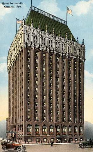
The history of Omaha, Nebraska, began before the settlement of the city, with speculators from neighboring Council Bluffs, Iowa staking land across the Missouri River illegally as early as the 1840s. When it was legal to claim land in Indian Country, William D. Brown was operating the Lone Tree Ferry to bring settlers from Council Bluffs to Omaha. A treaty with the Omaha Tribe allowed the creation of the Nebraska Territory, and Omaha City was founded on July 4, 1854. With early settlement came claim jumpers and squatters, and the formation of a vigilante law group called the Omaha Claim Club, which was one of many claim clubs across the Midwest. During this period many of the city's founding fathers received lots in Scriptown, which was made possible by the actions of the Omaha Claim Club. The club's violent actions were challenged successfully in a case ultimately decided by the U.S. Supreme Court, Baker v. Morton, which led to the end of the organization.
The neighborhoods of Omaha are a diverse collection of community areas and specific enclaves. They are spread throughout the Omaha metro area, and are all on the Nebraska side of the Missouri River.
Racial tension in Omaha, Nebraska occurred mostly because of the city's volatile mixture of high numbers of new immigrants from southern and eastern Europe and African-American migrants from the Deep South. While racial discrimination existed at several levels, the violent outbreaks were within working classes. Irish Americans, the largest and earliest immigrant group in the 19th century, established the first neighborhoods in South Omaha. All were attracted by new industrial jobs, and most were from rural areas. There was competition among ethnic Irish, newer European immigrants, and African-American migrants from the South, for industrial jobs and housing. They all had difficulty adjusting to industrial demands, which were unmitigated by organized labor in the early years. Some of the early labor organizing resulted in increasing tensions between groups, as later arrivals to the city were used as strikebreakers. In Omaha as in other major cities, racial tension has erupted at times of social and economic strife, often taking the form of mob violence as different groups tried to assert power. Much of the early violence came out of labor struggles in early 20th century industries: between working class ethnic whites and immigrants, and blacks of the Great Migration. Meatpacking companies had used the latter for strikebreakers in 1917 as workers were trying to organize. As veterans returned from World War I, both groups competed for jobs. By the late 1930s, however, interracial teams worked together to organize the meatpacking industry under the United Packinghouse Workers of America (UPWA). Unlike the AFL and some other industrial unions in the CIO, UPWA was progressive. It used its power to help end segregation in restaurants and stores in Omaha, and supported the civil rights movement in the 1960s. Women labor organizers such as Tillie Olsen and Rowena Moore were active in the meatpacking industry in the 1930s and 1940s, respectively.
The Miller Park neighborhood in North Omaha, Nebraska, is a historically significant community housing a historic district and several notable historic places. It is located between Sorenson Parkway on the south and Redick Avenue on the north, Florence Boulevard on the east and 30th Street on the west. The Minne Lusa neighborhood borders on the north, and the Saratoga neighborhood is on the south. Fort Omaha borders the neighborhood on the west. Miller Park is the namesake park in the neighborhood, as well as the Miller Park Elementary School. In 2017, the Miller Park/Minne Lusa area was ranked as having the 2nd highest rate of homicides and other violent crimes out of 81 Omaha neighborhoods.

The Minne Lusa Residential Historic District is located in North Omaha, Nebraska. It is included on the National Register of Historic Places. According to the National Park Service, it is an "example of a substantial, affordable single-family residential development within the city limits that was platted, developed and constructed by a single firm between 1915 and 1941." The neighborhood is filled with bungalows, Craftsman, and other styles that were popular in the era. There are 540 properties in the neighborhood that contribute to the historic district, the other 167 do not. Minne Lusa Boulevard is a contributing structure.
The Omaha Claim Club, also called the Omaha Township Claim Association and the Omaha Land Company, was organized in 1854 for the purpose of "encouraging the building of a city" and protecting members' claims in the area platted for Omaha City in the Nebraska Territory. At its peak the club included "one or two hundred men", including several important pioneers in Omaha history. The Club included notable figures important to the early development of Omaha. It was disbanded after a ruling against their violent methods by the U.S. Supreme Court in 1860 in Baker v. Morton.
Miller Park Elementary School is located at 5625 North 28th Avenue in the Miller Park neighborhood in Omaha, Nebraska, United States. The school is credited for creating the original Junior Forest Club concept.
The Irish in Omaha, Nebraska have constituted a major ethnic group throughout the history of the city, and continue to serve as important religious and political leaders. They compose a large percentage of the local population.

The Dead Rabbits riot was a two-day civil disturbance in New York City evolving from what was originally a small-scale street fight between members of the Dead Rabbits and the Bowery Boys into a citywide gang war, which occurred July 4–5, 1857. Taking advantage of the disorganized state of the city's police force—brought about by the conflict between the Municipal and Metropolitan police—the fighting spiraled into widespread looting and damage of property by gangsters and other criminals from all parts of the city. It is estimated that between 800 and 1,000 gang members took part in the riots, along with several hundred others who used the disturbance to loot the Bowery area. It was the largest disturbance since the Astor Place Riot in 1849 and the biggest scene of gang violence until the New York Draft Riots of 1863. Order was restored by the New York State Militia, supported by detachments of city police, under Major-General Charles W. Sandford.
North 30th Street is a two-way street that runs south–north in the North Omaha area of Omaha, Nebraska. With the street beginning at Dodge Street, historically significant sections include those from Dodge to Lake Street, from Fort Street to Laurel Avenue, and from Weber to Bondesson Streets.
The Swedes in Omaha, Nebraska are a long-standing ethnic group in the city with important economic, social, and political ties.
Significant events in the history of Omaha, Nebraska, include social, political, cultural, and economic activities.
Florence was a historic municipality in Nebraska. Founded in 1854, the Nebraska Territory Legislature first incorporated it as a town in 1855 and then incorporated it as a city in 1857. In 1917, it was annexed by the City of Omaha and ceased to exist as an independent municipality. Since then it has been a neighborhood located in North Omaha.
