Omaha is the most populous city in the U.S. state of Nebraska and the county seat of Douglas County. It is located in the Midwestern United States along the Missouri River, about 10 mi (15 km) north of the mouth of the Platte River. The nation's 40th-most populous city, Omaha had a population of 486,051 as of the 2020 census. It is the anchor of the eight-county Omaha–Council Bluffs metropolitan area, which extends into Iowa and is the 58th-largest metro area in the United States, with a population of 967,604. Furthermore, the greater Omaha–Council Bluffs–Fremont combined statistical area had 1,004,771 residents in 2020.

The Dundee–Happy Hollow Historic District is located west of Midtown Omaha, Nebraska. It covers the area between Harney Street on the south, Hamilton Street on the north, Happy Hollow Boulevard on the west, and 46th Street on the east. The "heart" of Dundee is located at 50th and Underwood Avenue in Omaha, Nebraska, United States. It was founded in 1880 and annexed into the city in 1915. Dundee is home to Warren Buffett and nationally syndicated editorial cartoonist Jeff Koterba and was the hometown of filmmaker Alexander Payne. Actor Henry Fonda additionally lived in the Dundee neighborhood.

North Omaha is a community area in Omaha, Nebraska, in the United States. It is bordered by Cuming and Dodge Streets on the south, Interstate 680 on the north, North 72nd Street on the west and the Missouri River and Carter Lake, Iowa on the east, as defined by the University of Nebraska at Omaha and the Omaha Chamber of Commerce.
The neighborhoods of Omaha are a diverse collection of community areas and specific enclaves. They are spread throughout the Omaha metro area, and are all on the Nebraska side of the Missouri River.

Midtown is a geographic area of Omaha, Nebraska that is a culturally, socially and economically important area of the city. It is home to major research centers, national corporations, several historic districts, and a number of historic residences.

Field Club is an affluent and historic neighborhood located in the Midtown region of Omaha, Nebraska. Roughly bounded by Pacific Street, 32nd Avenue, Center St., and 36th Street, the neighborhood was placed on the National Register of Historic Places as a historic district on November 15, 2000. Field Club is the location of dozens of historically significant homes in the Omaha area, including the Gerald R. Ford Birthsite and Gardens.

The Bemis Park Landmark Heritage District is located in North Omaha, Nebraska. Situated from Cuming Street to Hawthorne Avenue, Glenwood Avenue to 33rd Street, Bemis Park was annexed into Omaha in 1887, and developed from 1889 to 1922. The district was designated an Omaha Landmark in 1983.

The Harry Buford House is a historic house located at 1804 North 30th Street in North Omaha, Nebraska. Built in 1929 in a Period Revival style, it was designated a landmark by the City of Omaha in 1983.
Little Italy is a neighborhood in Omaha, Nebraska which served as the historic home to Omahans of Italian ancestry. It was the source of many laborers for the Union Pacific railroad, much of Omaha's bootlegging during Prohibition and the Santa Lucia Procession, which started in 1924 and continues annually.

Hanscom Park is a historic neighborhood in Midtown Omaha, Nebraska. Its namesake public park is one of the oldest parks in Omaha, donated to the City in 1872. U.S. President Gerald R. Ford was born in a house in the Hanscom Park neighborhood. Its boundaries are Woolworth Street on the north, South 42nd on the west, Interstate 480 on the east and I-80 on the south.
Walnut Hill is a historic neighborhood located in north Omaha, Nebraska. It is bounded by North 40th Street on the east, Cuming Street on the south, Northwest Radial Highway and Saddle Creek Road on the west and Hamilton Street on the north.

The economy of Omaha, Nebraska is linked to the city's status as a major commercial hub in the Midwestern United States since its founding in 1854. Dubbed the "Motor Mouth City" by The New York Times, Omaha is widely regarded as the telecommunications capital of the United States. The city's economy includes agriculture, food processing, insurance, transportation, healthcare and education. Warren Buffett of Berkshire Hathaway has lived in Omaha all of his life, as have the ConAgra Foods, Union Pacific Railroad and Mutual of Omaha Companies, and Kiewit Corporation, all Fortune 500 corporations.

Boulevards in Omaha are part of a park and boulevard system originally designed in 1889 by Horace Cleveland. There are more than one hundred miles (160 km) of boulevards throughout the city of Omaha, Nebraska today.

The Lincoln Highway in Omaha, Nebraska, runs east–west from near North 183rd Street and West Dodge Road in Omaha, Nebraska, towards North 192nd Street outside of Elkhorn. This section of the Lincoln Highway, one of only 20 miles (32 km) that were paved with brick in Nebraska, is one of the most well-preserved in the country. The roadway was listed on the National Register of Historic Places in 1984. The Lincoln Highway was the first road across the United States, traversing coast-to-coast from Times Square in New York City to Lincoln Park in San Francisco, California.

Transportation in Omaha, Nebraska, includes most major modes, such as pedestrian, bicycle, automobile, bus, train and airplane. While early transportation consisted of ferries, stagecoaches, steamboats, street railroads, and railroads, the city's transportation systems have evolved to include the Interstate Highway System, parklike boulevards and a variety of bicycle and pedestrian trails. The historic head of several important emigrant trails and the First transcontinental railroad, its center as a national transportation hub earned Omaha the nickname "Gate City of the West" as early as the 1860s.

The Saddle Creek Underpass is located in the Midtown area of Omaha, Nebraska. Designed to carry Saddle Creek Road under Dodge Street, the underpass was constructed in 1934 by the Works Progress Administration. It was included on the Bridges in Nebraska Multiple Property Submission on June 29, 1992.
Dodge Street is the main east–west street in Omaha, Nebraska. Numbered as U.S. Route 6 (US 6) for most of its length, the street starts in Downtown Omaha and connects to West Dodge Road just west of 78th Street. From there, it continues westward through the remainder of Douglas County.

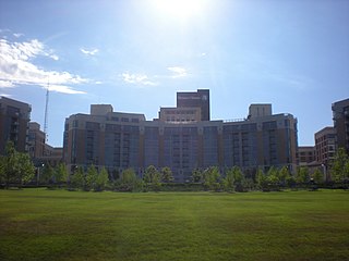
Midtown Crossing at Turner Park is a vibrant mixed-use development in midtown Omaha, featuring retail, office, residential spaces, and green areas. Renowned for its bustling local business scene and year-round community events, this 16-acre seven-building development hosts more than 30 retail and office tenants, 297 condominiums, 196 apartment units, and picturesque Turner Park.
Nebraska Medicine, is a private not-for-profit American healthcare company based in Omaha, Nebraska. The company was created as Nebraska Health System (NHS) in 1997, when Bishop Clarkson Hospital merged with the adjacent University Hospital in midtown Omaha. Renamed The Nebraska Medical Center in 2003, in 2014 the company merged with UNMC Physicians and Bellevue Medical Center to become Nebraska Medicine. The company has full ownership of two hospitals and 39 specialty and primary care clinics in and around Omaha, with partial ownership in two rural hospitals and a specialty hospital. Nebraska Medicine's main campus, Nebraska Medicine – Nebraska Medical Center, has 718 beds, while its Bellevue Medical Center campus has 91 beds.
Fairacres is a neighborhood and historic district in Omaha, Nebraska. It is south of Dundee and west of Midtown. It is roughly bounded by Underwood Avenue to the north, Dodge Street to the south, North 69th Street to the west, and North 62nd Street to the east. It is primarily residential, and was annexed into Omaha in 1941. It was listed the National Register of Historic Places in 2017.


