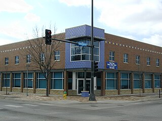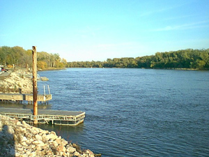
North Omaha is a community area in Omaha, Nebraska, in the United States. It is bordered by Cuming and Dodge Streets on the south, Interstate 680 on the north, North 72nd Street on the west and the Missouri River and Carter Lake, Iowa on the east, as defined by the University of Nebraska at Omaha and the Omaha Chamber of Commerce.
Cabanne's Trading Post was established in 1822 by the American Fur Company as Fort Robidoux near present-day Dodge Park in North Omaha, Nebraska, United States. It was named for the influential fur trapper Joseph Robidoux. Soon after it was opened, the post was called the French Company or Cabanné's Post, for the ancestry and name of its operator, Jean Pierre Cabanné, who was born and raised among the French community of St. Louis, Missouri.
Florence is a neighborhood in Omaha, Nebraska, United States on the city's north end and originally one of the oldest cities in Nebraska. It was incorporated by the Nebraska Territorial Legislature on March 10, 1857. The site of Winter Quarters for Mormon migrants traveling west, it has the oldest cemetery for people of European descent and oldest standing gristmill in Nebraska. Florence was the site of an illegal territorial legislature in 1858. Given the high concentration of National Register of Historic Places in the neighborhood, it is regarded as "the historic front door to Omaha as well as the state."
Significant events in the history of North Omaha, Nebraska include the Pawnee, Otoe and Sioux nations; the African American community; Irish, Czech, and other European immigrants, and; several other populations. Several important settlements and towns were built in the area, as well as important social events that shaped the future of Omaha and the history of the nation. The timeline of North Omaha history extends to present, including recent controversy over schools.
Saratoga Springs, Nebraska Territory, or Saratoga, was a boom and bust town founded in 1856 that thrived for several years. During its short period of influence the town grew quickly, outpacing other local settlements in the area including Omaha and Florence, and briefly considered as a candidate for the Nebraska Territorial capitol. Saratoga was annexed into Omaha in 1887, and has been regarded a neighborhood in North Omaha since then.

Fort Omaha, originally known as Sherman Barracks and then Omaha Barracks, is an Indian War-era United States Army supply installation. Located at 5730 North 30th Street, with the entrance at North 30th and Fort Streets in modern-day North Omaha, Nebraska, the facility is primarily occupied by Metropolitan Community College. A Navy Operational Support Center and Marine Corps Reserve unit, along with an Army Reserve unit occupy the periphery of the 82.5 acres (33.4 ha) fort. The government deeded all but four parcels of the land to Metropolitan Community College in 1974.

The Bemis Park Landmark Heritage District is located in North Omaha, Nebraska. Situated from Cuming Street to Hawthorne Avenue, Glenwood Avenue to 33rd Street, Bemis Park was annexed into Omaha in 1887, and developed from 1889-1922. The district was designated an Omaha Landmark in 1983.
The Kountze Place neighborhood of Omaha, Nebraska is a historically significant community on the city's north end. Today the neighborhood is home to several buildings and homes listed on the National Register of Historic Places. It is located between North 16th Avenue on the east to North 30th Street on the west; Locust Street on the south to Pratt Street on the north. Kountze Place was annexed into Omaha in 1887. The neighborhood was built as a suburban middle and upper middle class enclave for doctors, lawyers, successful businessmen and other professional workers.
The Miller Park neighborhood in North Omaha, Nebraska is a historically significant community housing a historic district and several notable historic places. It is located between Sorenson Parkway on the south and Redick Avenue on the north, Florence Boulevard on the east and 30th Street on the west. The Minne Lusa neighborhood borders on the north, and the Saratoga neighborhood is on the south. Fort Omaha borders the neighborhood on the west. Miller Park is the namesake park in the neighborhood, as well as the Miller Park Elementary School. In 2017, the Miller Park/Minne Lusa area was ranked as having the 2nd highest rate of homicides and other violent crimes out of 81 Omaha neighborhoods.
Scriptown was the name of the first subdivision in the history of Omaha, which at the time was located in Nebraska Territory. It was called "Scriptown" because scrip was used as payment, similar to how a company would pay employees when regular money was unavailable. Its original survey placed the location from the Missouri River to North 30th Street, Cuming to Fort Street.

The Notre Dame Academy and Convent is located at 3501 State Street in the Florence neighborhood on the north end of Omaha, Nebraska. It is significant for its ethnic association with the Czech population in Nebraska as the only school and convent of the Czechoslovakian School Sisters de Notre Dame in the United States. The building was listed on the National Register of Historic Places in 1998. The groups were home to a high school for girls from 1925 through 1974.

Little Bohemia, or Bohemian Town, is a historic neighborhood in Omaha, Nebraska. Starting in the 1880s, Czech immigrants settled in this highly concentrated area, also called "Praha" (Prague) or "Bohemian Town", bounded by South 10th Street on the east, South 16th Street on the west, Pierce Street on the north, and Martha Street on the south, with a commercial area went along South 13th and South 14th Streets, centered on William Street. It was located south of downtown, and directly west of Little Italy. A portion of the neighborhood along South 13th Street was listed on the National Register of Historic Places in 2020.
Walnut Hill is a historic neighborhood located in north Omaha, Nebraska. It is bounded by North 40th Street on the east, Cuming Street on the south, Northwest Radial Highway and Saddle Creek Road on the west and Hamilton Street on the north.

N.P. Dodge Memorial Park, or simply Dodge Park, is a recreational area located at 11001 John J. Pershing Drive in North Omaha, Nebraska, United States. Located on the Missouri River, the park provides fishing, water skiing, and boating, as well as hiking throughout its riparian forests. Baseball fields, soccer fields, horseshoe pits, and tennis courts are included for sporting events. There is a picnic area, pavilions, historical monuments, and a campground.
Sheelytown was a historic ethnic neighborhood in South Omaha, Nebraska, USA with populations of Irish, Polish and other first generation immigrants. Located north of the Union Stockyards, it was bounded by Edward Creighton Boulevard on the north, Vinton Street on the south, South 24th Street to the east, and 35th Street to the west. Sheelytown was named for the Sheely Brothers Packing Houses that were located in the area. Sheelytown was annexed by Omaha in 1887. The Omaha Quartermaster Depot was built just east of the community across the Union Pacific tracks.
Lincoln Boulevard in Omaha, Nebraska was built in the early 1890s as part of the city's boulevard system under control of the Board of Park Commissioners. It runs through the Bemis Park neighborhood west-east from Mercer Boulevard to its end at North 29 Street; it then reemerges immediately north of Dodge Street, where it intersects with Turner Boulevard.
Howard Kennedy Elementary School is located at 2906 North 30th Street in North Omaha, Nebraska, United States. Almost since its inception Kennedy was regarded as one of Omaha's "black schools," almost exclusively African American. Football great Gale Sayers attended the school.
The Florence Park is a city-owned public park in the Florence neighborhood of North Omaha, Nebraska. Located at North 30th and State Streets, it is the oldest park and the oldest original town square in Nebraska, having been created by the original pioneers of the area in the 1840s. In the southern end of the park there is an official Nebraska State Historical Marker that tells the story of Winter Quarters, the 1840s settlement in the area. For many years a large cottonwood tree in the park featured a plaque that proclaimed its usage by Brigham Young as a hitching post.
North 30th Street is a two-way street that runs south–north in the North Omaha area of Omaha, Nebraska. With the street beginning at Dodge Street, historically significant sections include those from Dodge to Lake Street, from Fort Street to Laurel Avenue, and from Weber to Bondesson Streets.
Gibson Bend of the Missouri River is a meander located in Pottawattamie County, Iowa and Douglas County, Nebraska, located at 41°11′15″N95°55′15″W. The Gibson neighborhood is a community area in Omaha, Nebraska abutting the Gibson Bend.


