Dahlonega, Iowa | |
---|---|
Coordinates: 41°03′31″N92°22′12″W / 41.05861°N 92.37000°W | |
Country | United States |
State | Iowa |
County | Wapello |
Elevation | 827 ft (252 m) |
Time zone | UTC-6 (Central (CST)) |
• Summer (DST) | UTC-5 (CDT) |
Area code | 641 |
GNIS feature ID | 455767 [1] |
Dahlonega is an unincorporated community in Wapello County, Iowa, United States. [1]
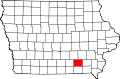
Dahlonega lies northeast of Ottumwa, near the junction of U.S. Route 63 and County Highway H-25.
Dahlonega was founded in Dahlonega Township. The site was originally named Shellbark because several homes were made of shellbark hickory wood, but was changed to Dahlonega, a Native American word meaning "gold" or "yellow". [2]
The post office at Dahlonega operated from 1844 to 1907. [3] A number of schools operated in the area. Dahlonega School No. 1 educated students from 1921 to 1959, and is now listed on the National Register of Historic Places. [4]
Dahlonega's bid to become the county seat of Wapello County was defeated by one vote in 1843. [5]
In 1850, Dahlonega had three stores, a tavern, a blacksmith shop, a church, a school, and a sawmill. A town hall, a pottery, and two meat-packing houses followed in 1856. [2]
Dahlonega's population was estimated at 300 in 1887, [6] and was 292 in 1902. [7] However, by 1917, the population had dropped to 131. [8]
Wapello County is a county located in the U.S. state of Iowa. As of the 2020 census, the population was 35,437. The county seat is Ottumwa. The county was formed on February 17, 1843, and named for Wapello, a Meskwaki chief.
Bladensburg is a small unincorporated community in Wapello County, Iowa, United States. It lies midway between Agency and Batavia at a distance of five miles (8 km) from each, and the largest nearby city is Ottumwa, seven miles (11 km) to the west-southwest.
Viola Center was an unincorporated community in Audubon County, Iowa, in the United States.
Zenorsville is an unincorporated community in Boone County, in the U.S. state of Iowa.
Viele is an unincorporated community in northern Lee County, Iowa, United States. It lies near the junction of 235th and 240th Streets, six miles west of the city of Fort Madison. Its elevation is 541 feet (196 m).
Yampa is a small unincorporated community in Wapello County, Iowa, United States.
Chequest was an unincorporated community in Davis County, Iowa, United States. Its elevation is 722 feet (287 m). It was on County Road V42 near Chequest Creek.
Vista was an unincorporated community in Buchanan County, Iowa, United States. It was located at the junction of local roads Freeman Avenue and 260th Street.
Newburg is an unincorporated community in Jasper County, in the U.S. state of Iowa.
Green Castle, also spelled Greencastle, is an unincorporated community in Jasper County, in the U.S. state of Iowa.
Clyde is an unincorporated community in Jasper County, in the U.S. state of Iowa. Clyde lies along the junction of North 102st Avenue W and Iowa Highway 330.
Galesburg is an unincorporated community in Jasper County, in the U.S. state of Iowa. Galesburg lies along the junction of Main Street/Sioux Avenue and Highway T14 S.
Fairmount is an unincorporated community in Jasper County, in the U.S. state of Iowa. Fairmount lies along the junction of Iowa Highway 163 and West 70th Street South. The community has also been known as Fairmont.
Ehler is an unincorporated community in Adams Township, Delaware County, Iowa, United States. The community lies three miles southwest of Ryan.
Bremer is an unincorporated community in Warren Township in Bremer County, Iowa, United States.
Wapsie is an unincorporated community in Franklin Township in Bremer County, Iowa, United States.
Knittel is an unincorporated community in Maxfield Township in Bremer County, Iowa, United States.
Horton is an unincorporated community in Polk Township in Bremer County, Iowa, United States.
Republic is an unincorporated community in southern Chickasaw County, in the U.S. state of Iowa.
Bard was an unincorporated community in Louisa County, in the U.S. state of Iowa.