Daisy Hill, Indiana

Last updated

Daisy Hill, Indiana
Map of Indiana highlighting Washington County.svg
Washington County's location in Indiana
Location map of Washington County, Indiana.svg
Red pog.svg
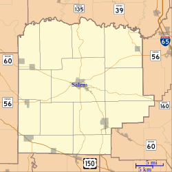
Daisy Hill
Location of Daisy Hill in Washington County
Coordinates: 38°30′24″N85°56′21″W / 38.50667°N 85.93917°W / 38.50667; -85.93917
Country United States
State Indiana
County Washington
Township Polk
Elevation
[1]
791 ft (241 m)
Time zone UTC-5 (Eastern (EST))
  Summer (DST) UTC-4 (EDT)
ZIP code
47165
Area codes 812, 930
GNIS feature ID452098 [1]

Daisy Hill is an unincorporated community in Polk Township, Washington County, in the U.S. state of Indiana. [1]

Contents

History

According to tradition, Daisy Hill was so named on account of there being a cemetery near the town site. [2]

Daisy Hill was mostly destroyed by a powerful tornado in the 1974 Super Outbreak. [3] This tornado was rated F5 [3] and completely leveled farms in the Daisy Hill area.

Geography

Daisy Hill is located at 38°30′24″N85°56′21″W / 38.50667°N 85.93917°W / 38.50667; -85.93917 .

References

  1. 1 2 3 U.S. Geological Survey Geographic Names Information System: Daisy Hill, Indiana
  2. Indiana Names, v.4. Terre Haute, IN: Indiana State University. 1973. p. 58.
  3. 1 2 "Violent Tornadoes in Indiana". National Weather Service . Retrieved December 26, 2015.