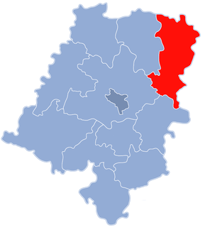
Rudniki is a village in Olesno County, Opole Voivodeship, in south-western Poland. It is the seat of the gmina called Gmina Rudniki. It lies approximately 23 kilometres (14 mi) north-east of Olesno and 63 km (39 mi) north-east of the regional capital Opole.

Chwiły is a village in the administrative district of Gmina Rudniki, within Olesno County, Opole Voivodeship, in south-western Poland. It lies approximately 4 kilometres (2 mi) west of Rudniki, 20 km (12 mi) north-east of Olesno, and 60 km (37 mi) north-east of the regional capital Opole.
Cieciułów is a village in the administrative district of Gmina Rudniki, within Olesno County, Opole Voivodeship, in south-western Poland. It lies approximately 5 kilometres (3 mi) south-east of Rudniki, 21 km (13 mi) north-east of Olesno, and 62 km (39 mi) north-east of the regional capital Opole.
Faustianka is a village in the administrative district of Gmina Rudniki, within Olesno County, Opole Voivodeship, in south-western Poland. It lies approximately 4 kilometres (2 mi) west of Rudniki, 21 km (13 mi) north-east of Olesno, and 61 km (38 mi) north-east of the regional capital Opole.
Hajdamaki is a village in the administrative district of Gmina Rudniki, within Olesno County, Opole Voivodeship, in south-western Poland. It lies approximately 5 kilometres (3 mi) south of Rudniki, 19 km (12 mi) north-east of Olesno, and 59 km (37 mi) north-east of the regional capital Opole.
Janinów is a village in the administrative district of Gmina Rudniki, within Olesno County, Opole Voivodeship, in south-western Poland. It lies approximately 3 kilometres (2 mi) north-east of Rudniki, 25 km (16 mi) north-east of Olesno, and 65 km (40 mi) north-east of the regional capital Opole.
Jaworek is a village in the administrative district of Gmina Rudniki, within Olesno County, Opole Voivodeship, in south-western Poland. It lies approximately 2 kilometres (1 mi) south-east of Rudniki, 23 km (14 mi) north-east of Olesno, and 63 km (39 mi) north-east of the regional capital Opole.
Jaworzno is a village in the administrative district of Gmina Rudniki, within Olesno County, Opole Voivodeship, in south-western Poland. It lies approximately 4 kilometres (2 mi) east of Rudniki, 24 km (15 mi) north-east of Olesno, and 65 km (40 mi) north-east of the regional capital Opole.
Julianpol is a village in the administrative district of Gmina Rudniki, within Olesno County, Opole Voivodeship, in south-western Poland. It lies approximately 6 kilometres (4 mi) south-east of Rudniki, 23 km (14 mi) north-east of Olesno, and 64 km (40 mi) north-east of the regional capital Opole.
Kuźnica is a village in the administrative district of Gmina Rudniki, within Olesno County, Opole Voivodeship, in south-western Poland. It lies approximately 5 kilometres (3 mi) north-west of Rudniki, 23 km (14 mi) north-east of Olesno, and 61 km (38 mi) north-east of the regional capital Opole.
Kuźnica Żytniowska is a village in the administrative district of Gmina Rudniki, within Olesno County, Opole Voivodeship, in south-western Poland. It lies approximately 6 kilometres (4 mi) south-west of Rudniki, 17 km (11 mi) north-east of Olesno, and 57 km (35 mi) north-east of the regional capital Opole.
Łazy is a village in the administrative district of Gmina Rudniki, within Olesno County, Opole Voivodeship, in south-western Poland. It lies approximately 3 kilometres (2 mi) north-west of Rudniki, 22 km (14 mi) north-east of Olesno, and 62 km (39 mi) north-east of the regional capital Opole.
Mirowszczyzna is a village in the administrative district of Gmina Rudniki, within Olesno County, Opole Voivodeship, in south-western Poland. It lies approximately 3 kilometres (2 mi) east of Rudniki, 24 km (15 mi) north-east of Olesno, and 65 km (40 mi) north-east of the regional capital Opole.
Młyny is a village in the administrative district of Gmina Rudniki, within Olesno County, Opole Voivodeship, in south-western Poland. It lies approximately 2 kilometres (1 mi) north of Rudniki, 24 km (15 mi) north-east of Olesno, and 64 km (40 mi) north-east of the regional capital Opole.
Odcinek is a village in the administrative district of Gmina Rudniki, within Olesno County, Opole Voivodeship, in south-western Poland. It lies approximately 4 kilometres (2 mi) north-west of Rudniki, 24 km (15 mi) north-east of Olesno, and 63 km (39 mi) north-east of the regional capital Opole.
Polesie is a village in the administrative district of Gmina Rudniki, within Olesno County, Opole Voivodeship, in south-western Poland. It lies approximately 6 kilometres (4 mi) east of Rudniki, 27 km (17 mi) north-east of Olesno, and 67 km (42 mi) north-east of the regional capital Opole.
Porąbki is a village in the administrative district of Gmina Rudniki, within Olesno County, Opole Voivodeship, in south-western Poland. It lies approximately 2 kilometres (1 mi) west of Rudniki, 22 km (14 mi) north-east of Olesno, and 62 km (39 mi) north-east of the regional capital Opole.
Słowików is a village in the administrative district of Gmina Rudniki, within Olesno County, Opole Voivodeship, in south-western Poland. It lies approximately 4 kilometres (2 mi) north-east of Rudniki, 26 km (16 mi) north-east of Olesno, and 66 km (41 mi) north-east of the regional capital Opole.
Żurawie is a village in the administrative district of Gmina Rudniki, within Olesno County, Opole Voivodeship, in south-western Poland. It lies approximately 3 kilometres (2 mi) south of Rudniki, 21 km (13 mi) north-east of Olesno, and 61 km (38 mi) north-east of the regional capital Opole.