
Sheringham is a seaside town and civil parish in the county of Norfolk, England. The motto of the town, granted in 1953 to the Sheringham Urban District Council, is Mare Ditat Pinusque Decorat, Latin for "The sea enriches and the pine adorns".

Holt is a market town, civil parish and electoral ward in the English county of Norfolk. The town is 22.8 miles (36.7 km) north of the city of Norwich, 9.5 miles (15.3 km) west of Cromer and 35 miles (56 km) east of King's Lynn. The town has a population of 3,550, rising and including the ward to 3,810 at the 2011 census. Holt is within the area covered by North Norfolk District Council. Holt has a heritage railway station; it is the south-western terminus of the preserved North Norfolk Railway, known as the Poppy Line.

Salthouse is a village and a civil parish in the English county of Norfolk. It is situated on the salt marshes of North Norfolk. It is 3.8 miles (6.1 km) north of Holt, 5.4 miles (8.7 km) west of Sheringham and 26.3 miles (42.3 km) north of Norwich. The village is on the A149 coast road between King's Lynn and Great Yarmouth. The nearest railway station is at Sheringham for the Bittern Line which runs between Sheringham, Cromer and Norwich. The nearest airport is Norwich International Airport. The landscape around Salthouse lies within the Norfolk Coast AONB and the North Norfolk Heritage Coast. The civil parish has an area of 6.22 km2 (2.40 sq mi) and in 2001 had a population of 196 in 88 households, the population increasing to 201 at the 2011 Census. For the purposes of local government, the parish falls within the district of North Norfolk.

Ingworth is a village and a civil parish in the English county of Norfolk. It is 1.7 miles (2.7 km) north of Aylsham, 14.3 miles (23.0 km) north of Norwich, 7.3 miles (11.7 km) east of North Walsham and 9 miles (14 km) south-southwest of Cromer. The nearest railway station is at North Walsham, which is located on the Bittern Line between Sheringham and Norwich. The nearest airport is Norwich International Airport. The village is bypassed by the A140 road, 0.9 miles (1.4 km) to the west. The village and parish of Ingworth had, in the 2001 census, a population of 94. For the purposes of local government, the village falls within the district of North Norfolk. The population taken at the 2011 census remained less than 100 and was included in the civil parish of Erpingham.

Gunthorpe is a village and a civil parish in the English county of Norfolk. The village is 8.6 miles east north east of the town of Fakenham, 14.9 miles west south west of Cromer and 122 miles north north east of London. The nearest railway station is at Sheringham for the Bittern Line which runs between Sheringham, Cromer and Norwich. The nearest airport is Norwich International Airport.
Stody is a village and a civil parish in the English county of Norfolk. The village is 13.2 miles (21.2 km) west south west of Cromer, 21.8 miles (35.1 km) north north west of Norwich and 125 miles (201 km) north north east of London. The village lies 4.1 miles (6.6 km) south west of the town of Holt. The nearest railway station is at Sheringham for the Bittern Line which runs between Sheringham, Cromer and Norwich. The nearest airport is Norwich International Airport.
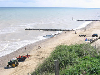
Mundesley /ˈmʌn.dzli/ is a coastal village and a civil parish in the English county of Norfolk. The village is 20.3 miles (32.7 km) north-north east of Norwich, 7.3 miles (11.7 km) south east of Cromer and 136 miles (219 km) north east of London. The village lies 5.6 miles (9.0 km) north-north east of the town of North Walsham. The nearest railway station is at North Walsham, for the Bittern Line which runs between Sheringham and Norwich. The nearest airport is Norwich Airport. The village sits astride the B1159 coast road that links Cromer and Caister-on-Sea, and is at the eastern end of the B1145 a route which runs between King's Lynn and Mundesley. Mundesley is within the Norfolk Coast AONB. It has a resident population of around 2,695, measured at 2,758 in the 2011 Census. The River Mun or Mundesley Beck flows into the sea here. On 5 September 2022 Mundesley beach won the North Norfolk District Council Battle of the Beaches to be recognised as the top beach in North Norfolk in a close run off against West Runton beach.

Saxlingham is a village and former civil parish, now in the parish of Field Dalling, in the North Norfolk district, in the county of Norfolk, England. It lies 13 miles (21 km) west of Cromer, 26 miles (42 km) north-west of Norwich, 3.6 miles (5.8 km) west of the town of Holt and 126 miles (203 km) north-east of London. In 1931 the parish had a population of 122.

Little Snoring is a village and a civil parish in Norfolk, England.

Knapton is a village and a civil parish in the English county of Norfolk. The village is 8.9 miles (14.3 km) southeast of Cromer, 19.4 miles (31.2 km) northeast of Norwich and 134 miles (216 km) northeast of London. The Village is located alongside the B1145 a route which runs between King's Lynn and Mundesley. The nearest railway station is at North Walsham for the Bittern Line which runs between Sheringham, Cromer and Norwich. The nearest airport is Norwich International Airport.
Guestwick is a village and a civil parish in the English county of Norfolk. The village is 19.6 miles (31.5 km) south-west of Cromer, 18.7 miles (30.1 km) north-west of Norwich and 131 miles (211 km) north-east of London. The village lies 10.2 miles (16.4 km) west of the nearby town of Aylsham. The village lies far from any High roads. The nearest railway station is at Sheringham for the Bittern Line which runs between Sheringham, Cromer and Norwich. The nearest airport is Norwich International Airport.

West Beckham is a village and a civil parish in the English county of Norfolk The village is 6.1 miles (9.8 km) west south west of Cromer, 25.3 miles (40.7 km) north north west of Norwich and 131 miles (211 km) north north east of London. The village lies 4.1 miles (6.6 km) east of the town of Holt. The village is 2.4 miles (3.9 km) inland from the North Norfolk Coast to the north. The village is 0.8 miles to the south of the A148 King's Lynn to Cromer road. The nearest railway station is at Sheringham for the Bittern Line which runs between Sheringham, Cromer and Norwich. The nearest airport is Norwich International Airport.
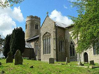
Upper Sheringham is a village and a civil parish in the English county of Norfolk. The village is 26.8 miles (43.1 km) north-north-west of Norwich, 6 miles (9.7 km) west of Cromer and 132 miles (212 km) north-north-east of London. The village is 1.2 miles (1.9 km) from the town of Sheringham.

Ryburgh is a civil parish in the English county of Norfolk. The parish is 21.2 miles (34.1 km) south-west of Cromer, 23.1 miles (37.2 km) north-west of Norwich and 117 miles (188 km) north-east of London. The parish lies 4 miles (6.4 km) south-east of the nearby town of Fakenham. The nearest railway station is at Sheringham for the Bittern Line which runs between Sheringham, Cromer and Norwich. The nearest airport is Norwich International Airport. The parish includes the villages of Great Ryburgh and Little Ryburgh.

Stibbard is a village and civil parish in the English county of Norfolk. The village is 19.3 miles (31.1 km) south-west of Cromer, 21.2 miles (34.1 km) north-west of Norwich and 120 mi (190 km) north-east of London. The village lies 4.9 miles (7.9 km) south-east of the nearby town of Fakenham. The nearest railway station is at Sheringham for the Bittern Line which runs between Sheringham, Cromer and Norwich. The nearest airport is Norwich International Airport.

Pettywell is a hamlet within the a civil parish of Reepham in the English county of Norfolk. The hamlet is 8.3 miles (13.4 km) west south west of Aylsham and 14.7 miles (23.7 km) north west of Norwich and 128 miles (206 km) north east of London. The hamlet is on the north side of the B1145 which links King's Lynn and Mundesley. The nearest railway station is at North Walsham for the Bittern Line which runs between Sheringham, Cromer and Norwich.The nearest airport is at Norwich International Airport. For the purposes of local government, the parish of Reepham falls within the district of Broadland.

The Cliftonville Hotel is an AA 3 star Hotel, and Grade II listed building, located in the English seaside town of Cromer in the county of Norfolk, United Kingdom.

The Sea Marge Hotel is an AA 4-star hotel in the English seaside village of Overstrand in the county of Norfolk. The hotel also has 2 AA Rosettes for Food.

The Bell Hotel is an AA 3-star hotel in the English town of Thetford within the county of Norfolk. The hotel has been a Grade II* listed building since 3 April 1951.

Edward Boardman (1833–1910) was a Norwich born architect. He succeeded John Brown as the most successful Norwich architect in the second half of the 19th century. His work included both civic and ecclesiastical buildings, in addition to private commissions. Together, with his rival, George Skipper, he produced many notable buildings with several standing to this day (2013).

