
Domremy, Saskatchewan is a special service area in the Rural Municipality of St. Louis No. 431, in the Canadian province of Saskatchewan. It held village status prior to December 31, 2006. The population was 124 people in 2006. Domremy is located on Highway 320 near Highway 2 and Highway 225 in central Saskatchewan. Domremy had a post office established as early as May 1, 1896 in the District of Saskatchewan, NWT.

Meacham is a village in the Canadian province of Saskatchewan within the Rural Municipality of Colonsay No. 342 and Census Division No. 11. It is located 69 kilometres east of the City of Saskatoon on Highway 2.
Parkbeg is a hamlet in Wheatlands Rural Municipality No. 163, Saskatchewan, Canada. The hamlet is located at the junction of Highway 1 and Highway 627 approximately 58 km directly west of the City of Moose Jaw on the Trans Canada Highway.

Penzance is a special service area in the Rural Municipality of Sarnia No. 221, in the Canadian province of Saskatchewan. It held village status prior to January 31, 2008. The community is located 88 km north of the City of Moose Jaw on Highway 2. Penzance was named after the original Penzance, in Cornwall, England.
Highgate, Saskatchewan is an unincorporated area in the rural municipality of Battle River No. 438, Saskatchewan, in the Canadian province of Saskatchewan. Highgate is located on Saskatchewan Highway 16, the Yellowhead in north western Saskatchewan. Highgate siding, a railroad siding and post office first opened in 1919 at the legal land description of Sec.17, Twp.45, R.17, W3. The population is smaller than a hamlet, and is counted within the RM. Highgate is located just north west of North Battleford, Saskatchewan.
St. Boswells is a hamlet in Glen Bain Rural Municipality No. 105, Saskatchewan, Canada. The hamlet is about 8 km east of Highway 19, and about 25 km northwest of the town of Gravelbourg. Very little remains of the former village except a well known as the best water around, and sidewalks which mark the once prosperous business section of St. Boswells.
Ardill is a hamlet in RM of Lake Johnston No. 102, Saskatchewan, Canada. Listed as a designated place by Statistics Canada, the hamlet had a listed population of 0 in the Canada 2006 Census.
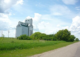
Delmas is a hamlet in Battle River Rural Municipality No. 438, Saskatchewan, Canada. Listed as a designated place by Statistics Canada, the hamlet had a population of 128 in the Canada 2016 Census. The hamlet is located approximately 32.6 kilometres (20.3 mi) west of North Battleford on Highway 16.

Speers is a village in the Canadian province of Saskatchewan within the Rural Municipality of Douglas No. 436 and Census Division No. 16. The village is located approximately 50 minutes southeast of the City of North Battleford on Highway 40.
Wiseton is a village in the Canadian province of Saskatchewan within the Rural Municipality of Milden No. 286 and Census Division No. 12. The village is located at the junction of Highway 44 and Highway 664 approximately 40 km southwest of Outlook.

Nelson Beach is an unincorporated community within the Rural Municipality of Hoodoo No. 401, Saskatchewan, Canada. The hamlet is located 2 km east of the town of Wakaw, approximately 95 km (59 mi) northeast of the city of Saskatoon, and about an equal distance south of Prince Albert, on the southwest shore of Wakaw Lake.
Rheinfeld is a hamlet in Coulee Rural Municipality No. 136, Saskatchewan, Canada. The hamlet is located on Highway 628 9 km north of Highway 363, about 15 km south of Swift Current.
South Gnadenthal is a hamlet in Coulee Rural Municipality No. 136, Saskatchewan, Canada. The hamlet is located on Highway 721, about 35 km southeast of Swift Current.
Schoenwiese is a hamlet in Swift Current Rural Municipality No. 137, Saskatchewan, Canada. The hamlet is located on Highway 628 about 2 km north of Highway 379, about 15 km south of Swift Current.
Marysburg is a hamlet in Saskatchewan located along Highway 756. The hamlet is an un-incorporated place within the Rural Municipality of Humboldt. It is located about 16 kilometres (9.9 mi) north of Humboldt.
Cardross, originally named Grace, is an unincorporated hamlet in Terrell Rural Municipality No. 101, Saskatchewan, Canada. The hamlet is located approximately 45 km north-east of Assiniboia on Township road 102 & Range road 274.

Feudal is a hamlet in Perdue No. 346, Saskatchewan, Canada. The hamlet is located at the junction of Highway 655 and Township road 340 approximately 15 km north of the Village of Harris.

Lemsford is an unincorporated hamlet in Clinworth Rural Municipality No. 230, Saskatchewan, Canada. It previously held the status of village until January 1, 1951. The hamlet is located 42 km east of the Town of Leader at the intersection of Highway 32 and Highway 649, the hamlet is also serviced by the Great Western Railway.
Chipperfield is a hamlet in Monet Rural Municipality No. 257, Saskatchewan, Canada. The hamlet is located at the junction of Highway 752 and Range road 170 approximately 50 km south-west of the Town of Rosetown, only 170 km south-west of the City of Saskatoon.
Maxwellton is a hamlet in Excel Rural Municipality No. 71, Saskatchewan, Canada.

