Sydney is the capital city of the state of New South Wales and the most populous city in Australia. Located on Australia's east coast, the metropolis surrounds Sydney Harbour and extends about 80 km (50 mi) from the Pacific Ocean in the east to the Blue Mountains in the west, and about 80 km (50 mi) from Ku-ring-gai Chase National Park and the Hawkesbury River in the north and north-west, to the Royal National Park and Macarthur in the south and south-west. Greater Sydney consists of 658 suburbs, spread across 33 local government areas. Residents of the city are colloquially known as "Sydneysiders". The estimated population in June 2023 was 5,450,496, which is about 66% of the state's population. The city's nicknames include the Emerald City and the Harbour City.

Bondi Junction is an eastern suburb of Sydney, in the state of New South Wales, Australia. It is 6 kilometres east of the Sydney central business district and is part of the local government area of Waverley.

Balmain is a suburb in the Inner West of Sydney, New South Wales, Australia. Balmain is located two kilometres west of the Sydney central business district, in the local government area of the Inner West Council.

Kirribilli is a suburb of Sydney, New South Wales, Australia. One of the city's most established and affluent neighbourhoods, it is located three kilometres north of the Sydney central business district, in the local government area administered by North Sydney Council. Kirribilli is a harbourside suburb, sitting on the Lower North Shore of Sydney Harbour. Kirribilli House is one of the two official residences of the Prime Minister of Australia.

The Eastern Suburbs is the eastern metropolitan region of Sydney, New South Wales, Australia.

Oxford Street is a major thoroughfare in Sydney, New South Wales, Australia, running from the south-east border of the Sydney central business district to Bondi Junction in the Eastern Suburbs. Close to the CBD in particular, the street is lined with numerous shops, bars and nightclubs. After the 1980s, Oxford Street garnered a reputation as Sydney's primary nightclub strip and subsequently saw a large increase in the number of crimes committed in the area. However, the 2014 lockout laws saw many nightclubs close and the crime rate drop as Sydney's nightlife hubs moved to Darling Harbour and Newtown. The lockout laws ended in 2020 with a focus on small bars and restaurants. Many nightclubs reopened in 2021 especially around Taylor Square.

Macquarie Street is a street in the central business district of Sydney in New South Wales, Australia. Macquarie Street extends from Hyde Park at its southern end to the Sydney Opera House at its northern end. Apart from connecting these two major landmarks, the key government institutions of the state of New South Wales are all located on this street.

The Sydney central business district (CBD) is the historical and main commercial centre of Sydney. The CBD is Sydney's city centre, or Sydney City, and the two terms are used interchangeably. Colloquially, the CBD or city centre is often referred to simply as "Town" or "the City".

Balmoral is an urban locality in the suburb of Mosman in Sydney, New South Wales, Australia. It is in the local government area of the Municipality of Mosman and is part of the Lower North Shore.

Point Piper is a small, harbourside eastern suburb of Sydney, in the state of New South Wales, Australia, 6 kilometres (4 mi) east of the Sydney CBD, in the local government area known as the Municipality of Woollahra.

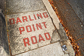
Darling Point is a harbourside eastern suburb of Sydney, Australia. It is 4 kilometres east of the Sydney central business district and is part of the local government area of Woollahra Council.
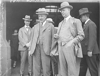
Sir Samuel Hordern was an Australian businessman, animal breeder and philanthropist. Born into the prominent Sydney trading family, Hordern directed the family company of Anthony Hordern & Sons from 1909 to 1926.

Cahill Expressway is an urban freeway in Sydney and was the first freeway constructed in Australia, with the first section, from the Bradfield Highway to Conservatorium Place being opened to traffic in March 1958. It links the southern end of the Sydney Harbour Bridge, via an elevated roadway, a tunnel and cuttings between the Royal Botanic Garden and The Domain, to Woolloomooloo in Sydney's inner-eastern suburbs.

}}

Wentworth Point is a suburb of Sydney, in the state of New South Wales, Australia. It is located 13 kilometres west of the Sydney central business district, on the eastern edge of the local government area of City of Parramatta. It is on the western shore of Homebush Bay on the southern side of the Parramatta River. Wentworth Point is usually regarded as part of the Greater Western Sydney region, including in administrative contexts, but it is also regarded as part of the Inner West region of Sydney in some contexts, especially commercial contexts.
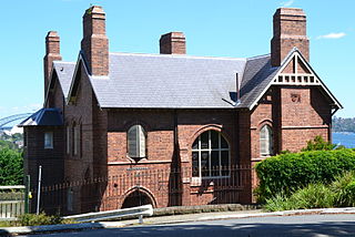
Cloncorrick is a heritage-listed house located in Darling Point, a suburb of Sydney, in New South Wales, Australia. It was built in 1884 for Sir George Bowen Simpson to a design by John Horbury Hunt in the Victorian Free Gothic style. Simpson named the house after Cloncorrick Castle in Ireland, where his grandfather once lived. The home was the residence of several notable Australians and is considered to be a house of local historic significance. It has been converted into two apartments.

The Paddington Town Hall is a heritage-listed former town hall building located at 249 Oxford Street in the inner eastern Sydney suburb of Paddington, in the City of Sydney local government area of New South Wales, Australia. Sir Henry Parkes laid its foundation stone in 1890 when Paddington was a separate municipality. It was designed by John Edward Kemp and built from 1890 to 1891, and remains a distinctive example of Victorian architecture in Sydney. The clock tower, completed in 1905, is 32 metres (105 ft) high and is a prominent landmark on the ridge of Oxford Street. It is also known as Town Hall and was added to the New South Wales State Heritage Register on 2 April 1999.

Herbert Edward Badham (1899–1961) was an Australian realist painter and art teacher.
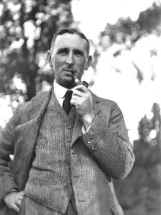
Thomas Pollard Sampson was an Australian architect active in New South Wales during the first forty years of the 20th century. His work encompassed the styles of the Federation Arts and Crafts and Bungalow through to the Inter-War Styles. In 1912 he designed an octagonal roofed stadium at Rushcutters Bay that seated up to 12,000 spectators. At the time, the Sydney Stadium was said to be "the largest roofed-in structure in the world." In the 1920s and 1930s, as a golfer and member of Concord Golf Club and Pennant Hills Golf Club, he designed the clubhouses at both courses. The buildings of both these well known Sydney clubs are still in use in 2023.
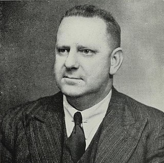
Lindsay Gordon Scott ARAIA was an Australian architect best associated for his design of the Erskineville Town Hall and numerous surf pavilions in New South Wales, including several on the Northern Beaches of Sydney.
