Daviess County Airport | |||||||||||||||
---|---|---|---|---|---|---|---|---|---|---|---|---|---|---|---|
Summary | |||||||||||||||
Airport type | Public | ||||||||||||||
Owner | Daviess County BOAC | ||||||||||||||
Serves | Washington, Indiana | ||||||||||||||
Elevation AMSL | 473 ft / 144 m | ||||||||||||||
Coordinates | 38°42′02″N087°07′47″W / 38.70056°N 87.12972°W | ||||||||||||||
Map | |||||||||||||||
Runways | |||||||||||||||
| |||||||||||||||
Statistics | |||||||||||||||
| |||||||||||||||
Source: Federal Aviation Administration [1] |
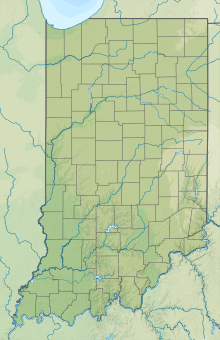
Daviess County Airport( ICAO : KDCY, FAA LID : DCY) is a county-owned public-use airport located three nautical miles (6 km) northeast of the central business district of Washington, a city in Daviess County, Indiana, United States. [1]
Although most U.S. airports use the same three-letter location identifier for the FAA and IATA, this airport is assigned DCY by the FAA but has no designation from the IATA. [2]
Daviess County Airport covers an area of 130 acres (53 ha) at an elevation of 473 feet (144 m) above mean sea level. It has two runways; one asphalt paved runway designated 18/36 which measures 4,615 by 75 feet (1,407 x 23 m) and one turf runway designated 9/27 which measures 2,650 by 150 feet (808 x 46 m). [1]
For the 12-month period ending December 31, 2019, the airport had 2,803 aircraft operations, an average of 8 per day: 99% general aviation and less than 1% air taxi. In January 2022, there were 30 aircraft based at this airport: 26 single-engine, 3 multi-engine and 1 jet. [1]
Airlake Airport is a public use airport in Dakota County, Minnesota, United States. Owned by the Metropolitan Airports Commission, It is approximately 20 miles (32 km) south of both downtown Minneapolis and downtown St. Paul The airport is located near the Twin Cities suburbs of Lakeville and Farmington.
Iliamna Airport is a state-owned public-use airport located three nautical miles (5.5 km) west of the central business district of Iliamna, in the Lake and Peninsula Borough of the U.S. state of Alaska.
Elkhart Municipal Airport is a city-owned public-use airport located three nautical miles (6 km) northwest of the central business district of Elkhart, a city in Elkhart County, Indiana, United States.
Shawnee Field is a public use airport in Greene County, Indiana, United States. It is owned by Shawnee Field Inc. and is located three nautical miles (5.56 km) west of the central business district of Bloomfield, Indiana.
Eagle Creek Airpark is a public use airport located seven nautical miles (13 km) west of the central business district of Indianapolis, a city in Marion County, Indiana, United States. It is owned by the Indianapolis Airport Authority and serves as a reliever airport for Indianapolis International Airport.
Sullivan County Airport is a county-owned public-use airport located three nautical miles northwest of the central business district of Sullivan, a city in Sullivan County, Indiana, United States. It is included in the FAA's National Plan of Integrated Airport Systems for 2011–2015, which categorized it as a general aviation facility.
Warsaw Municipal Airport is a public use airport located two miles (3 km) north of the central business district of Warsaw, a city in Kosciusko County, Indiana, United States. It is owned by the Warsaw Board of Aviation Commissioners.
Inverness Airport is a public use airport located two nautical miles (4 km) southeast of the central business district of Inverness, a city in Citrus County, Florida, United States. The airport is owned by Citrus County and contains an aviation unit of the Citrus County Sheriff's Office. It is also located next to the Citrus County Speedway.
French Lick Municipal Airport is a city-owned public-use airport located three nautical miles southwest of the central business district of French Lick, a town in Orange County, Indiana, United States. Also known as French Lick Airport, it serves the French Lick and West Baden, Indiana area.
Jasper County Airport is located one mile northwest of Rensselaer, in Jasper County, Indiana, United States.
Henderson City-County Airport is a public use airport located four nautical miles (7 km) west of the central business district of Henderson, a city in Henderson County, Kentucky, United States. The airport is owned by the City & County of Henderson.
Fayette County Airport is a county-owned, public-use airport located two nautical miles southwest of the central business district of Somerville, in Fayette County, Tennessee, United States. According to the FAA's National Plan of Integrated Airport Systems for 2009–2013, it was classified as a general aviation airport.
Huntington Municipal Airport is a city-owned, public-use airport located three nautical miles southeast of the central business district of Huntington, a city in Huntington County, Indiana, United States. According to the FAA's National Plan of Integrated Airport Systems for 2009–2013, it was classified as a general aviation airport.
Tri-State Steuben County Airport is a public use airport in Steuben County, Indiana, United States. Owned by the Steuben County Board of Aviation Commissioners, it is located three nautical miles (6 km) west of the central business district of Angola, Indiana. The airport is included in the National Plan of Integrated Airport Systems for 2011–15, which categorized it as a general aviation facility.
Huntingburg Airport is a public use airport located three nautical miles (6 km) south of the central business district of Huntingburg, a city in Dubois County, Indiana, United States. It is owned by the Dubois County Airport Authority. This airport is included in the National Plan of Integrated Airport Systems for 2011–2015, which categorized it as a general aviation facility.
Portland Municipal Airport is a city-owned, public-use airport located one nautical mile (2 km) northwest of the central business district of Portland, a city in Jay County, Indiana, United States. It is included in the National Plan of Integrated Airport Systems for 2011–2015, which categorized it as a general aviation facility.
Plymouth Municipal Airport is a public use airport located two nautical miles (4 km) north of the central business district of Plymouth, a city in Marshall County, Indiana, United States. It is owned by the Plymouth Board of Aviation of Commissioners. This airport is included in the National Plan of Integrated Airport Systems for 2011–2015, which categorized it as a general aviation facility.
New Castle-Henry County Municipal Airport is a public use airport located four nautical miles southeast of the central business district of New Castle, a city in Henry County, Indiana, United States. It is included in the National Plan of Integrated Airport Systems for 2011–2015, which categorized it as a general aviation facility.
White County Airport is a public use airport in White County, Indiana, United States. It is owned by the White County Board of Aviation Commissioners and located three nautical miles (6 km) south of the central business district of Monticello, Indiana. This airport is included in the National Plan of Integrated Airport Systems for 2011–2015, which categorized it as a general aviation facility.
Kentland Municipal Airport is a public use airport located one nautical mile (2 km) southeast of the central business district of Kentland, in Newton County, Indiana, United States. It is owned by the Kentland Board of Aviation Commissioners. This airport was included in the National Plan of Integrated Airport Systems for 2011–2015, which categorized it as a general aviation facility.