
The Falls Creek Alpine Resort is an alpine ski resort in the Hume region in northeastern Victoria, Australia. It is located in the Alpine National Park in the Victorian Alps, approximately 350 kilometres by road from Melbourne, with the nearest town being Mount Beauty, which is approximately 30 km (20 mi) away. The resort lies between an elevation of 1,210 and 1,830 m above sea level, with the highest lifted point at 1,780 m (5,840 ft). Skiing is possible on the nearby peak of Mount McKay at 1,842 m (6,043 ft), accessed by snowcat from the resort.

Mansfield is a small town in the foothills of the Victorian Alps in the Australian state of Victoria. It is approximately 180 kilometres (110 mi) north-east of Melbourne by road. The population around Mansfield was 4,787 as at the 2016 census. The town itself has 3410 persons.

Healesville is a town in Victoria, Australia, 52 km north-east from Melbourne's central business district. Its local government area is the Shire of Yarra Ranges. At the 2016 Census, Healesville had a population of 7,461. The median age was 44 years.

Terang is a town in the Western District of Victoria, Australia. The town is in the Shire of Corangamite and on the Princes Highway 212 kilometres (132 mi) south west of the state's capital, Melbourne. At the 2006 census, Terang had a population of 1,824. At the 2001 census, Terang had a population of 1,859. The population of Terang has since risen according to the 2011 Census; the population is now 2,348, of which 1,155 are male and 1,193 are female, with the median age being 44.

Ararat is a city in south-west Victoria, Australia, about 198 kilometres (120 mi) west of Melbourne, on the Western Highway on the eastern slopes of the Ararat Hills and Cemetery Creek valley between Victoria's Western District and the Wimmera. Its urban population according to 2016 census is 8,297 and services the region of 11,752 residents across the Rural City's boundaries. It is also the home of the 2018/19 GMGA Golf Championship Final.

Kiewa River, a perennial river that is part of the Murray catchment within the Murray-Darling basin, is located in the Alpine bioregion, in the Australian state of Victoria.

Mount Bogong,, located in the Alpine National Park and part of the Victorian Alps of the Great Dividing Range, is the highest mountain in Victoria, Australia, at 1,986 metres (6,516 ft) above sea level.
Coleraine is a town in Victoria, Australia on the Glenelg Highway, 334 kilometres (208 mi) west of the state capital, Melbourne and 34 kilometres (21 mi) north-west of Hamilton in the Shire of Southern Grampians local government area. It was named after the town in County Londonderry, Northern Ireland. At the 2006 census, the urban area of Coleraine had a population of 991.

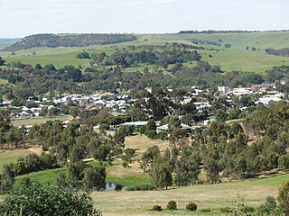
Mount Beauty is a small town in north-eastern Victoria, Australia. The town lies alongside the Kiewa River, at the junction of the Kiewa Valley Highway and Bogong High Plains Road in the Alpine Shire local government area.

Alexandra is a significant regional centre in north-east Victoria, Australia, 130 kilometres north-east of the State Capital, Melbourne. It is located at the junction of the Goulburn Valley Highway (B340) and Maroondah Highway (B360), in the Shire of Murrindindi local government area. At the 2016 census, the town had a population of 2,695 and the broader area a population of 6420.

Swifts Creek is a town in the Tambo Valley of East Gippsland, Victoria, Australia. The town is on the Great Alpine Road between Omeo and Ensay, 379 kilometres (235 mi) east of the state capital Melbourne and 300 metres (980 ft) above sea level. The area was originally settled by Europeans in the gold rushes of the mid-1800s. At the 2011 census, Swifts Creek and the surrounding area had a population of 419, with a median age of 47.
Camperdown is a historically significant rural town in southwestern Victoria, Australia, 190 kilometres (120 mi) west of the state capital, Melbourne. At the 2016 census, Camperdown had a population of 3,369.

Donald is a town in Victoria, Australia, located on the Richardson River, at the junction of Sunraysia Highway and Borung Highway, in the Shire of Buloke. At the 2016 census, it had a population of 1,498.
Dunkeld is a town in Victoria, Australia, at the southern end of the Grampians National Park, in the Shire of Southern Grampians. It is approx 283 km west of Melbourne on the Glenelg Highway. The town's population is holding steady but ageing. At the 2016 census, Dunkeld had a population of 678.

Manangatang is a remote town in north-west Victoria, Australia. At the 2016 census, Manangatang had a population of 309. It is sometimes noted for its unusual name, from an Aboriginal term - "manang" meaning land and "kaaiti" meaning water.

Wycheproof is a small town in the centre of the Shire of Buloke, in north western Victoria, Australia. As of the 2016 census, it had a population of 635.
Nyah is a town in northern Victoria, Australia. The town is located on the Murray Valley Highway, in the Rural City of Swan Hill local government area, 365 kilometres (227 mi) north west of the state capital, Melbourne. At the 2011 census, Nyah had a population of 483.
The Dederang Mount Beauty Football Netball Club, nicknamed the Bombers, is an Australian rules football and netball club based in Dederang, Victoria. Dederang teams currently play in the Tallangatta & District Football League.
The Kiewa Valley Highway is a minor highway of 80 kilometres (50 mi) which traverses the Kiewa Valley near the alpine regions of Victoria, Australia. In the 1950s the road was sealed and realigned to Mount Beauty to permit the transport of materials for the construction of the Kiewa Hydroelectric Scheme. From Mount Beauty the road continues as the Bogong High Plains Road, a winding and twisty route via the alpine resort of Falls Creek, which terminates at its junction with the Omeo Highway at Shannonvale south of Glen Valley.

The Shire of Yackandandah was a local government area about 290 kilometres (180 mi) northeast of Melbourne, the state capital of Victoria, Australia. The shire covered an area of 1,148.75 square kilometres (443.5 sq mi), and existed from 1862 until 1994.

