Deli River

Last updated

Deli River
Soengai Petani
COLLECTIE TROPENMUSEUM IJzeren spoorbrug van de Deli Spoorweg Maatschappij met twintig overspanningen over de Deli rivier in de spoorlijn van Medan naar Belawan. TMnr 60001574.jpg
Deli Railway Company bridge over the Deli River near Belawan
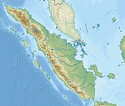
Indonesia Sumatra relief location map.jpg
Red pog.svg
Location of river mouth
Indonesia relief location map.jpg
Red pog.svg
Deli River (Indonesia)
Native nameSungai Deli (Indonesian)
Location
CountryIndonesia
Province North Sumatera
Physical characteristics
Source Mount Sibayak
  locationSibolangit
  elevation2,000 m (6,600 ft)
Mouth Strait of Malacca
  location
Medan Kota Belawan
  coordinates
3°46′1″N98°42′9.8″E / 3.76694°N 98.702722°E / 3.76694; 98.702722
Length73 km (45 mi) [1]
Basin size346 km2 (134 sq mi)
Width 
  average5.58 m (18.3 ft)
Basin features
River system Deli basin
Population1,346,520 (2015) [2]
Deli River (1905) KITLV - 26884 - Kleingrothe, C.J. - Medan - Sungai Deli in Labuan, East Coast of Sumatra - circa 1905.tif
Deli River (1905)

Deli River (Indonesian: Sungai Deli) is a river located in Sumatra, Indonesia, and courses through Medan before discharging to the Strait of Malacca near the port city of Belawan. [3] It is one of the eight rivers in Medan. The Deli Sultanate was founded on the delta of the river around 1640, [1] and later around the 19th century, this river acted as an artery of trade for the sultanate to other areas.
Contents

Hydrology

The forest area in the headwaters of the Deli is 3,655 hectares, or 7.59 percent of 48 162 hectares of Deli watershed. With an area of 48 162 hectares, length of 73 kilometers (km), and a width of 5.58 m, Deli watershed should have at least 140 hectares, or 30 percent of the watershed.

Today, the river is heavily polluted. 70 percent of waste in the Deli River are solid or liquid waste, due to waste generated in the densely populated city of Medan (reaching 1,725 tons a day [4] ).

Geography

The river flows in the northeastern area of Sumatra with predominantly tropical rainforest climate (designated as Af in the Köppen-Geiger climate classification). [5] The annual average temperature in the area is 24 °C. The warmest month is January, when the average temperature is around 26 °C, and the coldest is December, at 22 °C. [6] The average annual rainfall is 2862 mm. The wettest month is October, with an average of 446 mm rainfall, and the driest is June, with 129 mm rainfall. [7]

See also

Notes

1. ^ Population calculated from the sum of populations in the 14 subdistricts of Medan municipality which were used for population calculation in the citation. [1]

Related Research Articles

<span class="mw-page-title-main">Musi River (Indonesia)</span> River in Sumatra, Indonesia

The Musi River is a river in Southern Sumatra, Indonesia. It flows from south-west to north-east, from the Barisan Mountains range that form the backbone of Sumatra, in Kepahiang Regency, Bengkulu Province, to the Bangka Strait that forms an extension of the South China Sea. It is about 750 kilometers long, and drains most of South Sumatra province. After flowing through Palembang, the provincial capital, it joins with several other rivers, including the Banyuasin River, to form a delta near the town of Sungsang. The river, dredged to a depth of about 6.5 meters, is navigable by large ships as far as Palembang, which is the site of major port facilities used primarily for the export of petroleum, rubber and palm oil.

<span class="mw-page-title-main">Asahan River</span> River in North Sumatra, Indonesia

The Asahan River is one of the principal rivers in North Sumatra, Indonesia, that begins in Porsea, Toba Regency near the southeast corner of Lake Toba.

The Bohorok River is a river of the Langkat Regency in North Sumatra Province, Indonesia, about 1400 km northwest of the capital Jakarta. It is a tributary of Wampu River.

<span class="mw-page-title-main">Siak River</span> River in Indonesia

The Siak is a river of Riau province, in the east of Sumatra, Indonesia, about 1000 km northwest of the capital Jakarta. Approximately 370 kilometres in length, the Siak is a blackwater river which owes its brown color to dissolved organic matter (DOM) leached from surrounding, heavily disturbed peat soils; it is heavily polluted, notably by the petroleum industry. It flows through the town of Pekanbaru before emptying into the Strait of Malacca.

The Baliung River is a river flowing in southern Java, within the Banten province, Indonesia. The upstream starts in the southern mountains of Java; it flows southward into the Indian Ocean, about 130 kilometres (81 mi) southwest of Jakarta.

Simpang-kiri River is a river in Riau province, central-eastern Sumatra, Indonesia, about 800 km northwest of the capital Jakarta.

Simpang-kanan River is a river in northern Sumatra, Indonesia, about 1400 km northwest of the capital Jakarta.

Renun River is a river in northern Sumatra, Indonesia, about 1400 km northwest of the capital Jakarta.

Tamiang River is a river in the province of Aceh, northern Sumatra, Indonesia, 

Kualu River is a river in northern Sumatra, Indonesia, about 1600 km northwest of the capital Jakarta.

Tungkal River is a river in Jambi province, Sumatra island, Indonesia, about 700 km northwest of the capital Jakarta.

The Banyuasin River is a river in southern Sumatra, Indonesia, about 500 km northwest of the capital Jakarta.

The Bila River is a river in northern Sumatra, Indonesia, about 1200 km northwest of the capital Jakarta. It is a tributary of the Barumun River.

Mandau River is a river in Riau province of central Sumatra island, Indonesia, about 1000 km northwest of the capital Jakarta. It is a tributary of the Siak River.

Rokan-kiri River is a river in Riau province, central part of Sumatra island, Indonesia, about 1100 km northwest of the capital Jakarta. It is a tributary of the Rokan River.

Rokan-kanan River is a river in Riau province, central part of Sumatra island, Indonesia, about 1100 km northwest of the capital Jakarta. It is a tributary of the Rokan River.

Kumu River is a river in Riau province, central-eastern Sumatra, Indonesia, about 1100 km northwest of the capital Jakarta. It is a tributary of the Rokan River.

<span class="mw-page-title-main">Rokan River</span> River in Riau, Indonesia

Rokan River is a river in Riau province, central-eastern Sumatra, Indonesia, about 1100 km northwest of the capital Jakarta.

The Kampar Kiri River is a river in central Sumatra, Indonesia, about 900 km northwest of the capital Jakarta. It is a tributary of the Kampar River.

The Simpang-kanan River is a river in southern Sumatra, Indonesia, about 600 km northwest of the capital Jakarta. It is a tributary of the Rawas River.

References

  1. 1 2 3 Sembiring, Silvia Tabah Hati BR. "Pengelolaan Daerah Aliran Sungai (DAS) Deli" (PDF) (in Indonesian). Medan: University of North Sumatra. Retrieved 8 August 2017.
  2. "Jumlah Penduduk Menurut Kecamatan dan Jenis Kelamin, 2011–2015". Badan Pusat Statistik Kota Medan (in Indonesian). Statistics Indonesia . Retrieved 8 August 2017.[ permanent dead link ]
  3. Sungai Deli – Geonames.org.
  4. "Timbunan Sampah di Medan 1725 Ton per Hari" (in Indonesian). Lintas Medan. Retrieved 8 August 2017.
  5. Peel, M C; Finlayson, B L; McMahon, T A (2007). "Updated world map of the Köppen-Geiger climate classification". Hydrology and Earth System Sciences. 11: 1633–1644. doi: 10.5194/hess-11-1633-2007 . Retrieved 30 January 2016.
  6. "NASA Earth Observations Data Set Index". NASA. 30 January 2016. Archived from the original on 10 May 2020. Retrieved 12 December 2018.
  7. "NASA Earth Observations: Rainfall (1 month – TRMM)". NASA/Tropical Rainfall Monitoring Mission. 30 January 2016. Archived from the original on 19 April 2019. Retrieved 12 December 2018.