
Tooele County is a county in the U.S. state of Utah. As of the 2010 United States Census, the population was 58,218. Its county seat and largest city is Tooele. The county was created in 1850 and organized the following year.

Tooele is a city in Tooele County in the U.S. state of Utah. The population was 35,742 at the 2020 census. It is the county seat of Tooele County. Located approximately 30 minutes southwest of Salt Lake City, Tooele is known for Tooele Army Depot, for its views of the nearby Oquirrh Mountains and the Great Salt Lake.
The Shoshone or Shoshoni are a Native American tribe with four large cultural/linguistic divisions:

The Goshutes are a tribe of Western Shoshone Native Americans. There are two federally recognized Goshute tribes today:
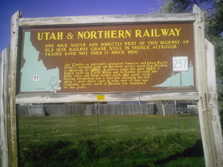
The Utah & Northern Railway is a defunct railroad that was operated in the Utah Territory and later in the Idaho Territory and Montana Territory in the western United States during the 1870s and 1880s. It was the first railroad in Idaho and in Montana.
Transportation in Salt Lake City consists of a wide network of roads, an extensive bus system, a light rail system, and a commuter rail line. Although Salt Lake City, Utah is a traditionally car-oriented city, the rapidly growing public transit system has a high number of riders for a city of its size, and public transit is widely supported by its residents and businesses.

The Confederated Tribes of the Goshute Reservation is located in Juab County, Utah, Tooele County, Utah, and White Pine County, Nevada, United States. It is one of two federally recognized tribes of Goshute people, the other being the Skull Valley Band of Goshute Indians of Utah.

The Mountain View Corridor is a freeway under construction in northern Utah that will run along the western periphery of Salt Lake County and south into northwest Utah County. Except for the last several miles on its southern end the Mountain View Corridor is numerically designated as State Route 85 (SR-85) in the Utah state highway system. The entire Mountain View Corridor will be maintained by the Utah Department of Transportation (UDOT).
The Skull Valley Indian Reservation is located in Tooele County, Utah, United States, approximately 45 miles (72 km) southwest of Salt Lake City. It is inhabited by the Skull Valley Band of Goshute Indians of Utah, a federally recognized tribe. The population includes approximately 31 people in 7 households and is characterized by a high incidence of poverty.

The Deseret Peak Wilderness is located in the Stansbury Mountains of Tooele County, Utah, United States near the towns of Tooele and Grantsville, not far from the Great Salt Lake. It is part of the Wasatch-Cache National Forest. This semi-arid wilderness is part of the Great Basin ecosystem. Elevations range from about 6,000 feet to the top of Deseret Peak's limestone escarpment at 11,031 feet (3,362 m). In this high country, with barren Skull Valley to the west, you'll find some springs and intermittent creeks, despite the general dryness of the area.
Interstate 80 (I-80) is a part of the Interstate Highway System that runs from San Francisco, California, to Teaneck, New Jersey. The portion of the highway in the U.S. state of Utah is 196.35-mile-long (315.99 km), through the northern part of the state. From west to east, I-80 crosses the state line from Nevada in Tooele County and traverses the Bonneville Salt Flats—which are a part of the larger Great Salt Lake Desert. It continues alongside the Wendover Cut-off—the corridor of the former Victory Highway—U.S. Route 40 (US-40) and the Western Pacific Railroad Feather River Route. After passing the Oquirrh Mountains, I-80 enters the Salt Lake Valley and Salt Lake County. A short portion of the freeway is concurrent with I-15 through Downtown Salt Lake City. At the Spaghetti Bowl, I-80 turns east again into the mouth of Parley's Canyon and Summit County, travels through the mountain range and intersects the eastern end of I-84 near Echo Reservoir before turning northeast towards the Wyoming border near Evanston. I-80 was built along the corridor of the Lincoln Highway and the Mormon Trail through the Wasatch Range. The easternmost section also follows the historical routes of the First Transcontinental Railroad and US-30S.

The Wendover Cut-off, also called the Wendover Road or Wendover Route, is a two-lane highway in the western part of Tooele County in the U.S. state of Utah. Stretching 40.3 miles (64.9 km) from Wendover to Knolls across the Bonneville Salt Flats, a part of the Great Salt Lake Desert, the cut-off was once part of the primary link between the Nevada state line and Salt Lake City. In 2012, between 240 and 250 vehicles used the cut-off near its western terminus in Wendover on an average day.
State Route 196 is a north-south state highway located entirely in Tooele County, Utah that begins at SR-199 and ends at I-80. It passes through Skull Valley, and was added to the state highway system in 1998 to prevent the Skull Valley Band of Goshute Indians from using their reservation to store nuclear waste.

Gosiute is a dialect of the endangered Shoshoni language historically spoken by the Goshute people of the American Great Basin in modern Nevada and Utah. Modern Gosiute speaking communities include the Confederated Tribes of the Goshute Reservation and the Skull Valley Band of Goshute Indians.

The Stansbury Mountains are a 28-mile (45 km) long mountain range located in eastern Tooele County, Utah. It is named for U.S. Army Major Howard Stansbury, a topographical engineer, who led an expedition that surveyed the region.
State Route 199 (SR-199) is a state highway in the U.S. state of Utah. Spanning 21.96 miles (35.34 km), it connects SR-196 and the Dugway Proving Ground with SR-36 between Rush Valley and the Deseret Chemical Depot.
Low is a ghost town in northern Tooele County, Utah, United States.
Tekoi Rocket Test Range, or Tekoi, is a former solid fuel rocket motor test and calibration site operated by Hercules Aerospace near the Utah Test and Training Range in Utah's West Desert, approximately 80 miles (130 km) west of Salt Lake City, Utah. It is located on the Goshute's Skull Valley Indian Reservation.
Private Fuel Storage LLC (PFS) was a nuclear power industry consortium organized to manage spent spent nuclear fuel based in La Crosse, Wisconsin. The plan was to store it above-ground in dry casks on the Goshute's Skull Valley Indian Reservation, Tooele County, Utah. It was withdrawn in 2012.


