
Rawalpindi District is a district located in the northernmost part of the Punjab province of Pakistan. Parts of the district form part of the Islamabad Rawalpindi metropolitan area. Rawalpindi city is the district capital.
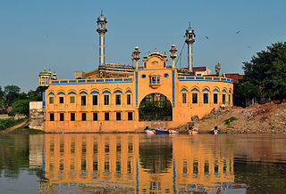
Jhelum is a city on the West Bank of the Jhelum River, which is located in the district of Jhelum in the North of Punjab, Pakistan. It is the 44th largest city of Pakistan by population. Jhelum is known for providing many soldiers to the British Army before independence, and later to the Pakistan armed forces, due to which it is also known as City of Soldiers or Land of Martyrs and Warriors.

Sohawa is an administrative sub-division (Tehsil) of the Jhelum District, situated in the Punjab province of Pakistan, located in the northwestern part of the district. One sign of Sohawa is the toll plaza by the name of 'Tarakki' on the Grand Trunk Road. The main bazaar of Sohawa attracts people from nearby villages.
The Gakhar is a historical Punjabi Muslim tribe with origins in the northern Punjab, Pakistan. The Gakhars now predominantly follow Islam after conversion from Hinduism during the Islamic rule in Punjab.

Gujranwala District, is a district that is a part of the Majha region in Punjab, Pakistan. Gujranwala District is bordered by the districts of Wazirabad, Sialkot, Hafizabad and Sheikhupura. Gujranwala district has 5 National Assembly and 12 Punjab Assembly constituencies. Gujranwala is known as the city of wrestlers and famous for its food.
Narali is one of the oldest and largest towns of Gujar Khan Tehsil, Punjab province of Pakistan. Narali used to be the hub of trade before partition. It had large Hindu and Sikh populations that dominated the trade circle. It still has a number of remains and ruins of Hindu culture and temples. It is culturally richer than the adjoining villages. Narali enjoys a very important position because it has union council office, patwarkhana, health centre and a post office.

Hindkowans, also known as the Hindki, is a contemporary designation for speakers of Indo-Aryan languages who live among the neighbouring Pashtuns, particularly the speakers of various Hindko dialects of Western Punjabi (Lahnda). The origins of the term refer merely to the speakers of Indo-Aryan languages rather than to any particular ethnic group. The term is not only applied to several forms of "Northern Lahnda" but also to the Saraiki dialects of the districts of Dera Ghazi Khan, Mianwali, and Dera Ismail Khan, which border the southern Pashto-speaking areas.

Kotli Sattian is a Tehsil (subdivision) of Murree District in the Punjab province of Pakistan. Its name is derived from the mountain town of Kotli and the Satti tribe. This subdivision is geographically a part of the Murree and Kahuta hills. It was declared a subdivision in 1990 by breaking up 40 villages out of both subdivisions.
Kahuta Tehsil is one of the seven tehsils (subdivisions) of Rawalpindi District in the Punjab province of Pakistan. The neighbouring tehsil of Kallar Sayedan used to be part of Kahuta, but was later created as separate tehsil. The name Kahuta was derived from "Koh" a local medicinal tree and "Boota".
Kallar Syedan is a tehsil in the Rawalpindi District, Punjab, Pakistan. Earlier a part of the Kahuta Tehsil, it became a separate tehsil on 1 July 2004.
Sehr Bagla is a village and Union Council of Murree Tehsil in the Murree District of Punjab, Pakistan. It is located in the north-east of the Tehsil and is bounded to the north by Potha Sharif, to the south by Ghel, to the west by Rawat and to the east by Kashmir
The Pothohar Plateau is a plateau and historical sub-region in northern parts of the Punjab region, present-day Punjab, Pakistan. Ethnic Punjabis are the native people of the area and are subdivided into many tribes and clans (Baradari).

The 28th Punjabis were an infantry regiment in the British Indian Army. It was raised in 1857, as the 20th Regiment of Punjab Infantry. It was designated as the 28th Punjabis in 1903 and became 4th Battalion 15th Punjab Regiment in 1922. In 1947, it was allocated to the Pakistan Army, where it continues to exist as 12th Battalion The Punjab Regiment.
The Budhal are a clan of the Golra division of the Awan tribe,
Punjabi Muslims are Punjabis who are adherents of Islam. With a population of more than 112 million, they are the third-largest predominantly Islam-adhering Muslim ethnicity in the world, after Arabs and Bengalis.

Samote Union Council is a union council in Punjab, Pakistan.
The Muslim Gujjars or Musalmān Gujjars are the descendants of Gujjars, in the northern regions of the Indian subcontinent. They are followers of Islam, and converted from Hinduism to Islam from the medieval period onwards. Today, Muslim Gujjars can be found mostly in present-day Northern India and Pakistan, and are further divided into different clans.