
Haaltert is a municipality located in the Belgian province of East Flanders in the Denderstreek. The municipality comprises the towns of Denderhoutem, Haaltert proper, Heldergem and Kerksken. In 2021, Haaltert had a total population of 18,892. The total area is 30.30 km². The current mayor of Haaltert is Veerle Baeyens, from the N-VA.

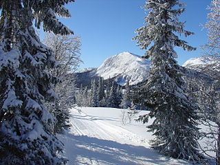
The Swiss National Park is located in the Western Rhaetian Alps, in eastern Switzerland. It lies within the canton of Graubünden, between Zernez, S-chanf, Scuol, and the Fuorn Pass in the Engadin valley on the border with Italy. Founded in 1914, the Swiss National Park is the oldest national park in the alps and in Central Europe.

Blåfjella–Skjækerfjella National Park lies in Trøndelag county, Norway. It is the third largest national park on the Norwegian mainland and one of the largest remaining true wilderness areas. It is located in the municipalities of Verdal, Snåsa, Grong, Lierne, and Steinkjer. The terrain is characterized by mountain plains, lakes, forested valleys, marshes, and a few mountain peaks. The Sami people have lived in and used the area for several centuries. There are many Sami cultural monuments here, such as settlements, gathering places, burial sites, and sacred places.
Eggedal is a valley and parish in Buskerud county, Norway. It consisting of the northwestern half of the municipality of Sigdal.

Riserva naturale orientata Saline di Trapani e Paceco is an Italian nature reserve in the Province of Trapani between the municipalities of Trapani and Paceco on the west coast of Sicily. It was founded in 1995 and in the framework of the Ramsar Convention entrusted to WWF Italy. Its area of 987 hectares consists of two zones. Besides Mediterranean flora and fauna, there is a saline work museum in an old salt mill.

Belle Isle Marsh Reservation in East Boston, Suffolk County, Massachusetts is an urban nature preserve and public recreation area containing mostly coastal wetlands. The 350-acre (1.4 km2) Reservation includes the largest remaining salt marsh in the Boston area. The marsh also borders the towns of Revere and Winthrop.

Burton Mere Wetlands is a nature reserve on the Dee Estuary straddling the border between Cheshire, England and Flintshire, Wales. It is run by the Royal Society for the Protection of Birds (RSPB) and incorporates the older Inner Marsh Farm reserve. It lies near the village of Burton, about 3 kilometres (1.9 mi) south of Neston. It has all been developed by the RSPB and includes a large area of mixed wetland habitats, bluebell woodlands, and arable fields all managed to attract wildlife.

Reggello is a comune (municipality) in the Metropolitan City of Florence in the Italian region of Tuscany, located about 35 kilometres southeast of Florence, between the north-western side of Pratomagno and the Upper Valdarno.
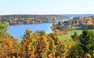
Orlången is a lake in central Huddinge Municipality, just south of Stockholm, Sweden.

Bear's Den is a 6-acre (24,000 m2) nature reserve in New Salem, Massachusetts. The reservation is close to the Quabbin Reservoir and is owned by the Trustees of Reservations.
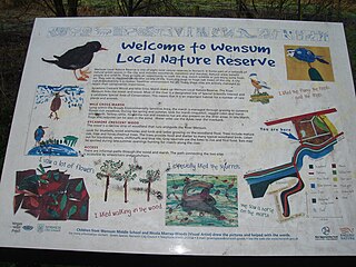
Wensum Local Nature Reserve or Wensum Valley is a Local Nature Reserve in Norwich in the English county of Norfolk. The reserve consists of two sites; Mile Cross Marsh52.6419°N 1.2657°E and Sycamore Crescent Wood which are linked by the Riverside Path a public footpath via the Sycamore Crescent footbridge
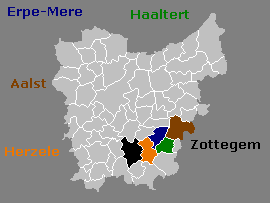
The Molenbeek-Ter Erpenbeek or in popular language Molenbeek is a brook in the Denderstreek region of Belgium. The stream has a length of approximately 25 kilometers. The source of the Molenbeek is in Godveerdegem and the delta is located at Hofstade. This brook is not to be confused with a 22-km water body called Molenbeek, which also flows through Erpe-Mere. The 22-km Molenbeek is part of the Drie Molenbeken drainage basin.
Rotes Luch is a reclaimed fen area, known locally as a luch, and extends to a width of about 1 kilometre (0.62 mi) over a length of approximately 10 kilometres (6.2 mi) from southwest to northeast. It is located in the southwestern corner of the nature reserve Märkische Schweiz of Brandenburg, Germany.

Adelaide Local Nature Reserve is in North West London, in the area of Chalk Farm, Primrose Hill, Belsize Park and Swiss Cottage. It is managed by a local volunteer group, the Adelaide Nature Reserve Association, which works with the council to improve the site for wildlife and local community use and enjoyment. The site is a Local Nature Reserve and Site of Borough Importance for Nature Conservation, Grade 1.

Sapperton Valley is a 3.7-hectare (9.1-acre) nature reserve near Chalford in the Stroud district of Gloucestershire, England. The site is managed by the Gloucestershire Wildlife Trust under leasing arrangements with the Bathurst Estate, in place since 1964.

The Marismas de Isla Cristina are located at the mouth of the river Carreras in the province of Huelva, Andalusia, in southern Spain. Created in 1989, the natural park has a surface area of 21.45 square kilometres (8.28 sq mi), shared between the municipalities of Ayamonte and Isla Cristina.

Gernon Bushes is a 32 hectare nature reserve north-east of Epping in Essex. It is managed by the Essex Wildlife Trust. It is part of the Epping Forest Site of Special Scientific Interest and Nature Conservation Review site.

Church Farm Marshes is a 56 hectare nature reserve in Thorington in Suffolk. It is managed by the Suffolk Wildlife Trust.
Cholsey Marsh is a 19-hectare (47-acre) nature reserve near Cholsey in Oxfordshire, England. It is managed by the Berkshire, Buckinghamshire and Oxfordshire Wildlife Trust.

Hook with Warsash is a 251.6-hectare (622-acre) Local Nature Reserve west of Fareham in Hampshire. It is owned by Hampshire County Council and managed by Hampshire Countryside Service. It is part of Solent and Southampton Water Ramsar site and Special Protection Area, of Solent Maritime Special Area of Conservation, and of Lee-on-The Solent to Itchen Estuary Site of Special Scientific Interest.


