
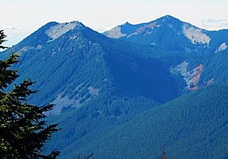
Mount Catherine is a mountain peak in the Cascade Range in Washington state located near Snoqualmie Pass and Keechelus Lake. It is accessible via Forest Road 9070 except in winter. The Nordic Pass snowshoe trail starts near the Summit East ski area, and ends at this popular destination at a low point on the west ridge of Mount Catherine. Winter ascents of Mount Catherine are frequently done by continuing up the ridge to the summit.
Bandera Mountain is a mountain located near Snoqualmie Pass, Washington in the Alpine Lakes Wilderness. The mountain is accessible by the Mason Lake Trail, which is located off I-90 at Exit 45 on Forest Road 9031.
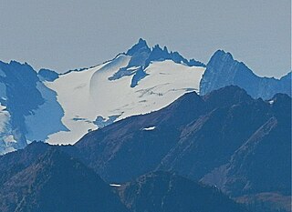
Spire Point is in Mount Baker-Snoqualmie and Wenatchee National Forests in the U.S. state of Washington. On the northwest slope of Spire Point lies Spire Glacier while Dana Glacier is to the east. Ascending Spire Point is a technical climb.

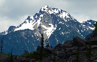
Sinister Peak is in Mount Baker-Snoqualmie and Wenatchee National Forests in the U.S. state of Washington. It is situated in Glacier Peak Wilderness and the North Cascades. Not quite 1 mi (1.6 km) east of Dome Peak, Sinister Peak is along a high ridge connecting the two peaks. The Chickamin Glacier is on the north slopes of Sinister Peak while the Garden Glacier is just southeast. Though some of the routes to the summit are technical, it can be reached by a moderate scramble.

Mount Dickerman, or Dickerman Mountain, is a mountain in Mount Baker-Snoqualmie National Forest in Washington state. It is located northwest of Barlow Pass along the Mountain Loop Highway. A strenuous four mile trail leads from this highway to the summit with views which includes Glacier Peak, Monte Cristo Peak, and Sloan Peak.

Mount Teneriffe is a mountain located in King County of Washington state. The mountain is 1,459 meters high and is located at the western edge of the Cascade Range on land managed by Mount Baker-Snoqualmie National Forest. Its nearest higher peak is Green Mountain, 1.18 miles (1.90 km) to the northeast. The mountain takes its name from the island of Tenerife in Spain.

Kendall Peak is a mountain located on the county line separating King County and Kittitas County of Washington state. It is within the Alpine Lakes Wilderness on the crest of the Cascade Range. Kendall Peak is situated two miles northeast of Snoqualmie Pass on land managed by Mount Baker-Snoqualmie National Forest. Precipitation runoff on the east side of the mountain drains into Silver Creek and makes its way to the Columbia River via Yakima River, whereas the west side of the mountain drains into the South Fork Snoqualmie River via Commonwealth Creek. The Pacific Crest Trail traverses its west flank and an exposed section of the trail called Kendall Katwalk has seen tragic deaths over the years, most recently September 5, 2018. The nearest higher peak is Red Mountain, 0.9 miles (1.4 km) to the north-northwest.
Lundin Peak is a summit located in King County of Washington state. It is part of the Cascade Range and is within the Alpine Lakes Wilderness. Lundin Peak is situated three miles north of Snoqualmie Pass on land managed by Mount Baker-Snoqualmie National Forest. Lundin Peak is a high point on a ridge located midway between Snoqualmie Mountain and Red Mountain. Precipitation runoff from the mountain drains into tributaries of the Snoqualmie River. Originally called Snoqualmie Little Sister, the peak's toponym was changed in 1931 to honor district forest ranger John Lundin.
Sheep Mountain is a 6,166-foot-elevation (1,879-meter) summit near the western edge of the North Cascades, in Snohomish County of Washington state. It is located one mile east of Barlow Pass along the Mountain Loop Highway near the Monte Cristo area. It is situated on land administered by the Mount Baker-Snoqualmie National Forest. Back in the old mining days of the late 1800s, the long sub-range stretching from Cadet Peak to Sheep Mountain was known as Pride of the Mountains Range. Precipitation runoff from the mountain drains into tributaries of the Sauk River.
Bryant Peak is a 5,801-foot (1,768-metre) summit located in King County of Washington state. It's part of the Cascade Range and is within the Alpine Lakes Wilderness. Bryant Peak is located northwest of Snoqualmie Pass and the Alpental ski area, on land managed by Mount Baker-Snoqualmie National Forest. Bryant Peak is located south of Snow Lake which is a popular hiking destination. The nearest higher neighbor is Chair Peak, 0.65 miles (1.05 km) to the northwest. Originally called Hemlock Peak, Bryant Peak was renamed in 1925 to honor Sidney V. Bryant of The Mountaineers who made the first ascent of Kaleetan Peak in 1914. Precipitation runoff from the mountain drains into tributaries of the Snoqualmie River.

The Tooth is the descriptive name for a 5,606-foot-elevation (1,709-meter) fin-like, andesite pillar located in King County of Washington state. It is part of the Cascade Range and is within the Alpine Lakes Wilderness. The Tooth is located northwest of Snoqualmie Pass and the Alpental ski area on land managed by Mount Baker-Snoqualmie National Forest. The nearest higher peak is Bryant Peak, 0.44 miles (0.71 km) to the northwest. Originally called Denny Horn and Denny Tooth, The Tooth became the officially recognized name in 1918, with Denny referring to its position on the high ridge between Denny Mountain and Chair Peak. The Tooth is a popular rock-climbing destination, even in winter. The easiest route is class 4 scrambling, but solid rock provides technical routes, with the South Face considered a classic 5.4 climb that was first done in 1928 by Anderson and Wunderling.

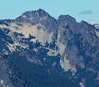
Summit Chief Mountain is a 7,467-foot (2,276-meter) mountain summit located on the county line separating King County and Kittitas County in Washington state. It is entirely within the Alpine Lakes Wilderness, on land managed by Mount Baker-Snoqualmie National Forest. Summit Chief Mountain is situated on the crest of the Cascade Range, nine miles northeast of Snoqualmie Pass. Precipitation runoff from the west side of the mountain drains into tributaries of the Snoqualmie River, whereas the east side drains into tributaries of the Yakima River. The nearest higher peak is Chimney Rock, 1.29 miles (2.08 km) to the southwest.

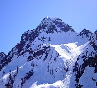
Four Brothers is a 6,485-foot-elevation (1,977-meter) mountain summit located in Kittitas County of Washington state.

Mount Hermann is a 6,240+ ft Skagit Range summit located northwest of Mount Shuksan and northeast of Mount Baker, in the North Cascades of Washington state. It is situated in the Mount Baker Wilderness, on land managed by Mount Baker-Snoqualmie National Forest. Mount Hermann is located immediately west of the Mt. Baker Ski Area, at the end of the Mount Baker Highway. Precipitation runoff from the mountain drains into tributaries of the Nooksack River. This peak is named for Binger Hermann (1843–1926), head of the United States General Land Office. This geographic feature has also had variant names "Mount Herman", and "Herman Peak". The present toponym and spelling was officially adopted in 1988 by the U.S. Board on Geographic Names.

Cowboy Mountain is a 5,853-foot-elevation mountain summit located in northeast King County of Washington state. It is situated at Stevens Pass, on land managed by Mount Baker-Snoqualmie National Forest. This mountain is best known for ski runs on its north slopes which are part of the Stevens Pass Ski Area. Cowboy Mountain is part of the Chiwaukum Mountains, which are a subset of the Cascade Range. Its nearest higher neighbor is Big Chief Mountain, 1.9 mi (3.1 km) to the northeast, and the Pacific Crest Trail passes through the saddle between these two mountains. Precipitation runoff from the peak drains into headwaters of the Tye River, which in turn is a tributary of the Skykomish River. The longest railroad tunnel in the United States, the Cascade Tunnel, was bored directly under Cowboy Mountain, as a response to deadly avalanches that threatened trains of the Great Northern Railway. The deadliest avalanche in the history of the United States, the 1910 Wellington avalanche, occurred approximately two miles west of Cowboy Mountain.

Jove Peak is a 6,007 ft (1,830 m) mountain summit located 5 mi (8.0 km) north of Stevens Pass on the common border of Snohomish County with Chelan County in Washington state. This peak is situated 12 mi (19 km) west of Lake Wenatchee, in the Henry M. Jackson Wilderness, on land managed by Mount Baker-Snoqualmie National Forest and Okanogan-Wenatchee National Forest. Jove Peak was named by Albert Hale Sylvester for Jove in association with the mythology-theme of nearby Minotaur and Theseus Lakes which are near Labyrinth Mountain, 2.5 mi (4.0 km) to the northeast. Precipitation runoff from the peak drains west into headwaters of Rapid River, or east into Rainy Creek which is a tributary of the Little Wenatchee River.

Castle Mountain is a 6,680-foot (2,036 m) mountain summit located in Pierce County of Washington state. It is set on the boundary of Norse Peak Wilderness, on land managed by Mount Baker-Snoqualmie National Forest. It is situated three miles (4.8 km) north of Crystal Mountain ski area, and one mile west of the crest of the Cascade Range. Precipitation runoff from Castle Mountain drains into tributaries of the White River. The Pacific Crest Trail traverses the east slope of Castle's Southeast Peak.
Bessemer Mountain is a 5,166-foot-elevation (1,575-meter) mountain summit located in King County of Washington state. It is situated at the western edge of the Cascade Range, on land managed by Mount Baker-Snoqualmie National Forest. Bessemer Mountain is more notable for its large, steep rise above local terrain than for its absolute elevation. Topographic relief is significant as the south aspect rises over 4,200 feet above Middle Fork Snoqualmie River in two miles. Precipitation runoff from this mountain drains into tributaries of the Snoqualmie River.

Abiel Peak is a 5,365 ft (1,640 m) mountain summit located in eastern King County of Washington state. It is set 1,000 feet west of the crest of the Cascade Range, on land managed by Mount Baker-Snoqualmie National Forest. Abiel Peak is situated six miles south-southwest of Snoqualmie Pass, and neighbors include Silver Peak, three-quarters mile to the north-northeast, Tinkham Peak three-quarters mile to the east, and Humpback Mountain two miles to the northwest. Precipitation runoff from the south side of the mountain drains into headwaters of Tinkham Creek which is a tributary of the North Fork Cedar River, whereas the north side of the mountain drains into Annette Lake, thence the South Fork Snoqualmie River via Humpback Creek. Topographic relief is significant as the north aspect rises 1,860 feet above Annette Lake in one-half mile.

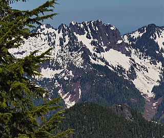
Tinkham Peak is a double summit mountain located on the common boundary of King County and Kittitas County in Washington state.


