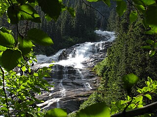
The Snoqualmie River is a 45-mile (72 km) long river in King County and Snohomish County in the U.S. state of Washington. The river's three main tributaries are the North, Middle, and South Forks, which drain the west side of the Cascade Mountains near the town of North Bend and join near the town of Snoqualmie just above the Snoqualmie Falls. After the falls the river flows north through rich farmland and the towns of Fall City, Carnation, and Duvall before meeting the Skykomish River to form the Snohomish River near Monroe. The Snohomish River empties into Puget Sound at Everett. Other tributaries of the Snoqualmie River include the Taylor River and the Pratt River, both of which enter the Middle Fork, the Tolt River, which joins at Carnation, and the Raging River at Fall City.

Taughannock Falls State Park is a 750-acre (3.0 km2) state park located in the Town of Ulysses in Tompkins County, New York in the United States. The park is northwest of Ithaca near Trumansburg.
Fall Creek Falls State Resort Park is a state park in Van Buren and Bledsoe counties, in the U.S. state of Tennessee. The over 26,000-acre (110 km2) park is centered on the upper Cane Creek Gorge, an area known for its unique geological formations and scenic waterfalls. The park's namesake is the 256-foot (78 m) Fall Creek Falls, the highest free-fall waterfall east of the Mississippi River.

Prospect State Scenic Viewpoint, is a state park south of the community of Prospect on Oregon Route 62 in Jackson County, in the U.S. state of Oregon. It was formerly known as Mill Creek Falls Scenic Area, a private hiking area that was developed by Willamette Industries along the Rogue River. Both Mill Creek Falls and Pearsony Falls are contained within the area, with Barr Creek Falls close by.

Scott's Gulf is a canyon situated along the Caney Fork in White County, Tennessee, in the southeastern United States. The canyon stretches for approximately 18 miles (29 km) as the Caney Fork drops from the top of the Cumberland Plateau down to the eastern Highland Rim. This remote section of the river is home to a wilderness area consisting of a largely undisturbed deciduous forest, numerous waterfalls, caves and other geological formations, and Class IV and Class V whitewater rapids.

The Middle Fork Feather River is a major river in Plumas and Butte Counties in the U.S. state of California. Nearly 100 miles (160 km) long, it drains about 1,062 square miles (2,750 km2) of the rugged northern Sierra Nevada range.
Blum Basin Falls is a waterfall in Whatcom County, in the U.S. state of Washington. It is located in North Cascades National Park on the headwaters of Blum Creek, a tributary of the Baker River. Fed by two small retreating glaciers and several snowfields on the southern side of Mount Blum, the waterfall is formed by the largest meltwater stream that feeds the mainstem of Blum Creek. The falls tumble 1,680 feet (510 m) down a high glacial headwall several miles within the national park in two distinct stages; the first is a series of slides over rounded rock, above the tree line, and the second is a series of near-vertical plunges to the forested valley below. Although most of the falls is clearly visible, parts of it are obscured by tall pines that grow at its base. There is no trail leading to the waterfall.

Depot Creek, also known as Brown Creek and Kokanee Creek, is a large creek in south-central British Columbia, Canada and Whatcom County, Washington, United States. It is in the Pacific Ocean drainage basin, and is located in the North Cascades. There is a waterfall along its course, Depot Creek Falls.

The Miller River is a river in King County, Washington. Named for 1890s prospector John Miller, it is a tributary of the Skykomish River, which it joins near the community of Miller River. The Miller River is about 3.5 miles (5.6 km) long from the confluence of its main tributaries, the East Fork and West Fork. Miller River Campground is located just downriver from the confluence.

Sulphide Creek Falls is a tall, moderately large volume waterfall within North Cascades National Park in Washington state. The falls drop from Sulphide Lake on the southeast side of Mount Shuksan down a narrow flume-like canyon to a broad basin below. Because of the narrow, twisting shape of the canyon the waterfall is exceptionally difficult to see from ground-level perspectives. The total vertical drop of the waterfall is in the range of 2,100 feet (640 m) to 2,200 feet (670 m) feet, but it has not yet been accurately measured. Foot access to the bottom of the waterfall involves 2.5 miles (4.0 km) of off-trail travel in extremely brushy terrain and several potentially dangerous fords of a large stream.

Eagle Creek is a tributary of the Columbia River in Multnomah and Hood River counties in the U.S. state of Oregon. It cuts through a narrow canyon in its 3,200 feet (980 m) descent to the Columbia River Gorge and is known for its concentration of 13 waterfalls in about 5 miles (8.0 km) distance. Eight major falls are on Eagle Creek and the East Fork Eagle Creek itself, while five are on its tributaries.
There are multiple waterfalls in the basin of the North Fork Cascade River, a river in the North Cascades of Washington that drains to the Cascade River. Many of these are taller than the more famous waterfalls in North America, but do not receive much attention due to their remoteness.
Whinnimic Falls is a waterfall in the headwaters of Lemah Creek in the Alpine Lakes Wilderness Area. It is set in a narrow valley below Lemah Mountain. The falls are one of two in the valley, the other being the smaller Upper Lemah Valley Falls. Whinnimic Falls plunges about 350 feet (110 m) off a vertical cliff, onto a valley floor dotted with ponds and grassy meadows. The stream heads in two tarns and the remains of a small glacier.
The valley of the West Fork Foss River contains a fair amount of waterfalls. The river heads in a series of large lakes: Big Heart Lake, Angeline Lake, and Otter Lake- which form spectacular waterfalls as they plunge down to Delta Lake. On the valley walls downstream of Delta Lake, are found even more waterfalls.

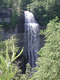
Salt Creek Falls is a cascade and plunge waterfall on Salt Creek, a tributary of the Middle Fork Willamette River, that plunges into a gaping canyon near Willamette Pass in the Willamette National Forest, near Oakridge, Oregon. The waterfall is notable for its main drop of 286 feet (87 m) which makes it the third highest plunge waterfall in Oregon after Multnomah Falls and Watson Falls the second highest, which was re-measured in 2009 and found to be 293 feet rather than an earlier measurement of 272 feet passing Salt Creek Falls. The pool at the bottom of the waterfall is 20 metres (66 ft) deep.

McWay Creek is a 2.5-mile-long (4.0 km) coastal stream in Monterey County in the U.S. state of California. It flows steeply west and south from McWay Canyon, high in California's Central Coast Range, and spills into the Pacific Ocean at Waterfall Cove after flowing over scenic McWay Falls. Most of the creek and its watershed are contained within Julia Pfeiffer Burns State Park, 12 miles (19 km) south of Pfeiffer Big Sur State Park. The creek is named after Christopher McWay from New York, a pioneer who homesteaded the property.
The Tye River is a river in the U.S. state of Washington. It rises near Stevens Pass in the Cascade Mountains and flows west, joining the Foss River to form the South Fork Skykomish River. Its waters eventually empty into Puget Sound near Everett via the Skykomish River and Snohomish River. U.S. Route 2 follows the river's entire length. A BNSF Railway line follows most of the river except near the pass where the tracks use the Cascade Tunnel. Powerlines run by the Bonneville Power Administration (BPA) follow the Tye River west of Tunnel Creek.
The South Fork Coquille River is the longest tributary of the Coquille River in coastal Oregon in the United States. From its headwaters in the Southern Oregon Coast Range, the river flows northwest to join the North Fork Coquille River at Myrtle Point, forming the main stem Coquille. The South Fork is about 63 miles (101 km) long, and its watershed drains roughly 288 square miles (750 km2) of rural Coos County.

The East Fork Kaweah River is a 22.5-mile (36.2 km) tributary of the Kaweah River in Tulare County, California. The river begins below Farewell Gap at the head of the Mineral King Valley in Sequoia National Park. It flows north through mountain meadows then turns west through a steep canyon, where it forms a waterfall about 200 feet (61 m) high known alternately as "Mineral King Falls" or "Three-Falls-Below-The-Gate". It then receives its largest tributary, Horse Creek, from the left before leaving the national park and turning northwest. It joins the Kaweah River about 2 miles (3.2 km) upstream of Three Rivers.