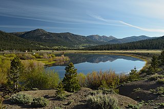
The Great Basin Desert is part of the Great Basin between the Sierra Nevada and the Wasatch Range. The desert is a geographical region that largely overlaps the Great Basin shrub steppe defined by the World Wildlife Fund, and the Central Basin and Range ecoregion defined by the U.S. Environmental Protection Agency and United States Geological Survey. It is a temperate desert with hot, dry summers and snowy winters. The desert spans large portions of Nevada and Utah, and extends into eastern California. The desert is one of the four biologically defined deserts in North America, in addition to the Mojave, Sonoran, and Chihuahuan Deserts.

Boundary Peak is a mountain in Esmeralda County, Nevada, United States. With a peak elevation of 13,147 feet (4,007 m), it is the highest natural point in the state of Nevada.

The Desert National Wildlife Refuge is a protected wildlife refuge, administered by the U.S. Fish and Wildlife Service, located north of Las Vegas, Nevada, in northwestern Clark and southwestern Lincoln counties, with much of its land area lying within the southeastern section of the Nevada Test and Training Range. The Desert NWR, created on May 20, 1936, is the largest wildlife refuge in the lower 48 states of the United States, encompassing 1.615 million acres (6,540 km2) of the Mojave Desert in the southern part of Nevada. The refuge was originally established at 2.25 million acres. In 1940 840,000 acres were transferred to the Department of Defense.

The Amargosa Range is a mountain range in Inyo County, California and Nye County, Nevada. The 110-mile (180 km) range runs along most of the eastern side of California's Death Valley, separating it from Nevada's Amargosa Desert. The U-shaped Amargosa River flows clockwise around the perimeter of the range, ending 282 feet (86 m) below sea level in the Badwater Basin.

The Virgin Mountains are a mountain range of the northeastern Mojave Desert, located in Clark County, southeastern Nevada and Mohave County, northwestern Arizona.

The Chemehuevi Mountains are found at the southeast border of San Bernardino County in southeastern California adjacent the Colorado River. Located south of Needles, California and northwest of the Whipple Mountains, the mountains lie in a north–south direction in general, and are approximately 15 miles (24 km) in length.
The Deep Creek Range, (often refereed to as the Deep Creek Mountains, are a mountain range in the Great Basin located in extreme western Tooele and Juab counties in Utah, United States. The range trends north–south, and is composed of granite in its central highest portion. The valley to the east is Snake Valley, and to the west is Deep Creek Valley. Nearby communities include Callao, Utah to the east and the community of Ibapah and the lands of the Confederated Tribes of the Goshute Reservation to the west.

The Snake Range is a mountain range in White Pine County, Nevada, United States. The south-central portion of the range is included within Great Basin National Park, with most of the remainder included within the Humboldt-Toiyabe National Forest. The range reaches a maximum elevation of 13,065 feet (3,982 m) at the summit of Wheeler Peak, the tallest independent mountain within Nevada and the second highest point within the state. The range also contains four of the five highest mountain peaks in Nevada, including all peaks greater than 12,000 feet (3,658 m) except for Boundary Peak.

Arc Dome is the highest mountain of the Toiyabe Range in northwestern Nye County, Nevada, United States. It is the thirteenth-highest mountain in the state. Arc Dome also ranks as the second-most topographically prominent peak in Nye County and the eighth-most prominent peak in the state. The peak is located about 53 miles (85 km) north of the community of Tonopah, within the Arc Dome Wilderness of the Humboldt-Toiyabe National Forest.
The Jackson Mountains are a north-northeast trending mountain range in southwestern Humboldt County, Nevada. The range is flanked on the west by the Black Rock Desert and the Black Rock Range beyond. To the north across the Quinn River and Nevada State Route 140 lie the Bilk Creek Mountains. To the northeast across Kings River Valley is the Double Mountains and to the east are the Sleeping Hills. To the southeast and south lie the Eugene and Kamma Mountains. The ghost town of Sulphur lies just southwest of the pass between the Jackson and Kamma ranges. Nevada State Route 49 and the Union Pacific railroad Feather River Route traverse this pass.

The Black Rock Range is a mountain range in northwestern Nevada. It is named for Black Rock Point, which is located at the southern end of the range. The Black Rock Range divides the Black Rock Desert into eastern and western arms. Pahute Peak, also known as Big Mountain, is the highest point in the range at 8,566 feet (2,611 m) above sea level.

The Calico Hills or Calico Mountains are a mountain range in northwestern Nevada. The range runs north to south along the western edge of the Black Rock Desert. This mountain range is located in western Humboldt County and the northwestern corner of Pershing County, approximately 30 miles north of the town of Gerlach, Nevada. The best access to the Calico Hills is located from the maintained Soldier Meadows Road that forms its eastern boundary.

The Eldorado Mountains, also called the El Dorado Mountains, are a north-south trending mountain range in southeast Nevada bordering west of the south-flowing Colorado River; the endorheic Eldorado Valley borders the range to the west, and the range is also on the western border of the Colorado River's Black Canyon of the Colorado, and El Dorado Canyon on the river. The range is 50 miles (80 km) southeast of Las Vegas, Nevada; and the Eldorado Mountains connect with the Highland and Newberry mountains.

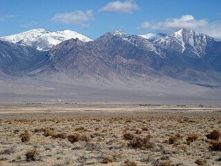
The landlocked U.S. state of Nevada has a varied geography and is almost entirely within the Basin and Range Province and is broken up by many north–south mountain ranges. Most of these ranges have endorheic valleys between them.

Arizona is a landlocked state situated in the southwestern region of the United States of America. It has a vast and diverse geography famous for its deep canyons, high- and low-elevation deserts, numerous natural rock formations, and volcanic mountain ranges. Arizona shares land borders with Utah to the north, the Mexican state of Sonora to the south, New Mexico to the east, and Nevada to the northwest, as well as water borders with California and the Mexican state of Baja California to the southwest along the Colorado River. Arizona is also one of the Four Corners states and is diagonally adjacent to Colorado.

The Worthington Mountains is a small 12 miles (19 km) long north-south trending mountain range in northwestern Lincoln County, Nevada. The range is bounded by the Sand Spring Valley to the west and Garden Valley to the east. The Quinn Canyon Range lies to the northwest, the Golden Gate Range lies to the east and the Timpahute Range lies to the south and southeast.

The Bare Mountain Range is a mountain range in southern Nye County, Nevada, in the United States. Bare Mountain and Wildcat Peak are the high points of the range.

The Mountain states form one of the nine geographic divisions of the United States that are officially recognized by the United States Census Bureau. It is a subregion of the Western United States.
Kumiva Peak is an 8,238-foot elevation (2,511 m) summit located in Pershing County, Nevada, United States.