
Kumaon or Kumaun is one of the two regions and administrative divisions of the Indian state of Uttarakhand, the other being Garhwal. It includes the districts of Almora, Bageshwar, Champawat, Nainital, Pithoragarh, and Udham Singh Nagar. It is bounded on the north by Tibet, on the east by Nepal, on the south by the state of Uttar Pradesh, and on the west by the Garhwal region. The people of Kumaon are known as Kumaonis and speak the Kumaoni language.

Mahakali was one of the fourteen zones located in the Far-Western Development Region of Nepal, covering an area of 6,205 km2 in the most western part of the country. It stretches along Nepal's far western border with India, marked by the Kali River or Mahakali River.
Baitadi District, historical name “Bairath” (बैराथ), a part of Sudurpashchim Pradesh, is one of the 77 districts of Nepal. It is a Hill district. Baitadi, with Dasharathchand as its headquarters, covers an area of 1,519 km2 (586 sq mi) and has a population of 250,898 according to the census (2011). The Baitadi district entails 56 village development councils (VDCs) and two municipality. Baitadi falls into the farthest western regional district of Nepal touching Jhulaghat, India, Nepal's neighboring country, to its border.

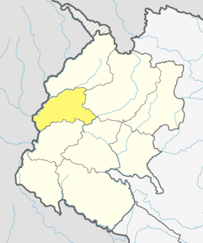
Darchula District (Nepali: दार्चुला जिल्ला Listen , a part of Sudurpashchim Pradesh, is one of the nine districts of province and one of seventy-seven districts of Nepal. The district, with Khalanga, Mahakali as its district headquarters, covers an area of 2,322 km2 and has a population of 133,274. Darchula Lies in the west-north corner of the country.

Doti District, part of Sudurpashchim Pradesh, is one of the 77 districts of Nepal. This district, with Silgadhi as its headquarters, covers an area of 2,025 square kilometres (782 sq mi) with a population of 207,066 in 2001 and increasing marginally to 211,746 in 2011.

Askot or Askote is a small Himalayan town in Pithoragarh district of Uttarakhand in India. It is the part of Kanalichhina development Block and Didihat Tehsil.

Doti, also known as Doti region, Dotigarh (डोटीगढ़) as used in the Jagar, in the Farwestern region of Nepal, is a region situated between River Kali bordering the Uttarakhand in the west and the Karnali river on the east. Doti was one of eight different princely states of the Katyuri Kingdom.

Baijnath is a small town on the banks of the Gomati river in the Bageshwar district in Kumaon division of Uttarakhand, India. The place is most noted for its ancient temples, which have been recognized as Monuments of National Importance by the Archaeological Survey of India in Uttarakhand. Baijnath has been selected as one of the four places to be connected by the 'Shiva Heritage Circuit' in Kumaon, under the Swadesh Darshan Scheme of the Government of India.
The Katyuri kings were a medieval ruling clan of present-day Uttarakhand, India. They ruled over the region now known as Kumaon from 700 to 1200 CE.
Barakot is a ward in Dasharathchanda municipality, in Baitadi District in Sudurpashchim Pradesh of western Nepal. Earlier it was a village development committee (VDC). At the time of the 1991 Nepal census it had a population of 2,389 and had 462 houses in the village.

The Far-Western Development Region was one of Nepal's five development regions. It was located at the western end of the country and had its headquarters in Dipayal.

Hunainath is a village development committee in Darchula District in the Mahakali Zone of western Nepal. At the time of the 1991 Nepal census it had a population of 1631.It is named after the Hunainath, a god in Nepal.
Huti is a village development committee (VDC) in Darchula District in the Mahakali Zone of western Nepal. At the time of the 1991 Nepal census it had a population of 2317 people living in 417 individual households. It is named after the village of Huti. The Brama Devta temple is located there at Huti-2 and is visited by many pilgrims.
Khalanga is a town and the district headquarters of the Darchula District. It is part of the Mahakali municipality in the Mahakali Zone of Far-western State, Nepal. The town is located near the Mahakali River which is on the border with Uttarakhand state, India. The town on the Indian side of the border also has the same name, but spelt Dharchula.
Uku is a village development committee in Darchula District in the Mahakali Zone of western Nepal right bank of Kali river. At the time of the 1991 Nepal census it had a population of 3931. It is a Historical place being an ancient kingdom of kings of Pal dynasty.
Latinath is a village development committee in Darchula District in the Mahakali Zone of western Nepal. At the time of the 1991 Nepal census it had a population of 3392 people living in 587 individual households. In this development region one of the famous temple of this district is located which is called "latainath" or "latinath".
Pipalchauri is a village development committee in Darchula District in the Mahakali Zone of western Nepal. At the time of the 1991 Nepal census it had a population of 1854 people living in 293 individual households.
Samant or Sawad were the feudal kings of the Doti region, which was formed after the disintegration of Katyuri kingdom of Uttarakhand and far western region of Nepal during the 13th century.
Kumaon Kingdom was an independent Himalayan kingdom in the eastern region of present-day Uttarakhand state of India established around 7th century and remained independent sovereign kingdom until 1791.

Sudurpashchim Pradesh is one of the seven provinces established by the new constitution of Nepal which was adopted on 20 September 2015. It borders the Tibet Autonomous Region of China to the north, Karnali Pradesh and Province No. 5 to the east, and the Indian states of Uttarakhand to the west and Uttar Pradesh to the south. Initially known as Province No. 7, the newly elected Provincial Assembly adopted Sudurpashchim Pradesh as the permanent name for the province in September 2018. As per a 28 September 2018 Assembly voting, the city of Godawari has been declared the capital of the Province. The province is coterminous with the former Far-Western Development Region, Nepal. The three major cities in terms of population and economy are Dhangadhi, Bhimdutta (Mahendranagar) and Tikapur.

