
Brigg (/'brɪg/) is a market town in North Lincolnshire, England, with a population of 5,076 in the 2001 UK census, the population increased to 5,626 at the 2011 census. The town lies at the junction of the River Ancholme and east–west transport routes across northern Lincolnshire. As a formerly important local centre, the town's full name of Glanford Brigg is reflected in the surrounding area and local government district of the same name. The town's urban area includes the neighbouring hamlet of Scawby Brook.

The West Branch Susquehanna River is one of the two principal branches, along with the North Branch, of the Susquehanna River in the Northeastern United States. The North Branch, which rises in upstate New York, is generally regarded as the extension of the main branch, with the shorter West Branch being its principal tributary.

Elena is a Bulgarian town in the central Stara Planina mountain in Veliko Tarnovo Province, located 42 km southeast of Veliko Tarnovo. It is the administrative centre of the homonymous Elena Municipality. The area is also a mountain resort, known for the typical local cuisine. As of December 2009, the town had a population of 5,665. It forms a terminal for the Gorna Oryahovitsa-Elena railway line.

Cromford is a village and civil parish in Derbyshire, England, in the valley of the River Derwent between Wirksworth and Matlock. It is 17 miles (27 km) north of Derby, 2 miles (3.2 km) south of Matlock and 1 mile (1.6 km) south of Matlock Bath. It is first mentioned in the 11th-century Domesday Book as Crumforde, a berewick of Wirksworth, and this remained the case throughout the Middle Ages. The population at the 2011 Census was 1,433. It is principally known for its historical connection with Richard Arkwright and the nearby Cromford Mill, which he built outside the village in 1771. Cromford is in the Derwent Valley Mills World Heritage Site.

Hurstpierpoint is a village in the Mid Sussex district, in the county of West Sussex, England, 4 miles (6.4 km) southwest of Burgess Hill, and 1.5 miles (2.4 km) west of Hassocks railway station. It sits in the civil parish of Hurstpierpoint and Sayers Common which has an area of 2029.88 ha and a population of 7,112.
Byala Cherkva is a town in Pavlikeni Municipality, Veliko Turnovo Province, Central-North Bulgaria. The settlement is located close to the town of Pavlikeni about 28 km away from the city of Veliko Tarnovo. Its name in Bulgarian means white church, a popular placename around the world, equivalent to Bela Crkva, Weisskirchen, Whitechurch, etc. As of December 2009, the town had a population of 2,612.

Byala is a small town and seaside resort in Eastern Bulgaria, located on the Bulgarian Black Sea Coast in Varna Province. It is the administrative centre of the homonymous Byala Municipality and lies in a semi-mountainous region in the easternmost branches of Stara Planina about 50 km south of the city of Varna and 70 km north of Burgas. As of June 2022, the town had a population of 2,205.

Treeton is a village and civil parish of the Metropolitan Borough of Rotherham in South Yorkshire, England. It is located about 4 miles (6 km) south of the town of Rotherham and 5 miles (8 km) east of Sheffield City Centre.

Hawes is a market town and civil parish in North Yorkshire, England, at the head of Wensleydale in the Yorkshire Dales, and historically in the North Riding of Yorkshire. The River Ure north of the town is a tourist attraction in the Yorkshire Dales National Park.

Overton is a large village and parish in Hampshire, England, west of Basingstoke and east of Andover and Whitchurch. The village contains the smaller hamlets of Southington, Northington, Ashe, Polhampton, and Quidhampton, the latter two lying to the north of the village. The River Test has its source 1 mile (1.6 km) to the east in Ashe.
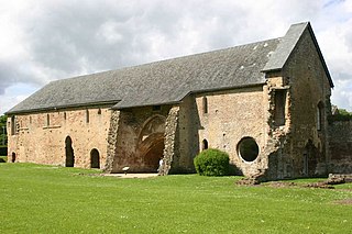
Washford is a village on the Washford River in the civil parish of Old Cleeve, Somerset, England. The village is next to Cleeve Abbey, one of the best-preserved medieval monasteries in England. It centred in a valley close to the Bristol Channel on the A39 road 7 miles (11 km) east of the resort town of Minehead and 2 miles (3 km) southwest of the port of Watchet.

Berney Arms Windmill is a tower mill located at Berney Arms alongside the River Yare at the south-western end of Breydon Water in the English county of Norfolk. The windmill is in an isolated spot in The Broads around 3.5 miles (5.6 km) north-east of the village of Reedham and 4 miles (6.4 km) south-west of Great Yarmouth. The mill has no road access but can be accessed by boat, by foot or from Berney Arms railway station. It is a scheduled monument under the care of English Heritage.

The Cambridgeshire Lodes are a series of man-made waterways, believed to be Roman in origin, located in the county of Cambridgeshire, England. Bottisham, Swaffham Bulbeck, Reach, Burwell, Wicken and Monks Lodes all connect to the River Cam, while Soham and Cottenham Lodes connect to the River Great Ouse. All have been navigable historically, but some are no longer officially navigable.

The Five Mile River is a 23.5-mile-long (37.8 km) river located in Connecticut's northeast corner which flows through the towns of Thompson, Putnam, and Killingly. The original Nipmuc name was Assawaga, meaning "place between" or "halfway place". The Assawaga received its English name from the fact that the first land laid out upon it was "supposed to be about five miles from" Woodstock, Connecticut. The Five Mile is a tributary of the Quinebaug River and is part of the Thames River watershed. Its source is Little Pond, close to the Massachusetts border. It empties into the Quinebaug River at Danielson, near the intersection of Connecticut Route 12 and U.S. Route 6.
Pazartsi is a village in Momchilgrad Municipality, Kardzhali Province, southern Bulgaria. Each September, a local fair known as Dag Bayrama takes place at the base of Stramni Rid Mountain. This event is a traditional gathering celebrated by the local community.
Blagun is a village in Krumovgrad Municipality, Kardzhali Province, southern Bulgaria.
Chal is a village in Krumovgrad Municipality, Kardzhali Province, southern Bulgaria.
Chernooki is a village of Krumovgrad Municipality, in Kardzhali Province, southern Bulgaria.
Dazhdovnik is a village in Krumovgrad Municipality, Kardzhali Province, southern Bulgaria.
Doborsko is a village in Krumovgrad Municipality, Kardzhali Province, southern Bulgaria.
