
Krumovgrad is a town in Kardzhali Province in the south of Bulgaria, located in the Eastern Rhodopes on the banks of the river Krumovitsa. According to 2011 census, the population is ethnic Bulgarians (48.97%), ethnic Turks (18.95%), and others including the Romani people. The town is named after the successful medieval Bulgarian ruler Krum, the name meaning 'city of Krum' in Bulgarian.
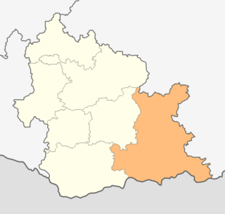
Krumovgrad Municipality is a municipality in Kardzhali Province, Bulgaria. The administrative centre is Krumovgrad.
Bagriltsi is a village in Krumovgrad Municipality, Kardzhali Province, southern Bulgaria. It is situated in the region Khaskovo in Bulgaria.
Baratsi is a village in Krumovgrad Municipality, Kardzhali Province, southern Bulgaria.
Egrek is a village in Krumovgrad Municipality, Kardzhali Province, southern Bulgaria.
Golyama Chinka is a village in Krumovgrad Municipality, Kardzhali Province, southern Bulgaria.
Golyam Devesil is a village in Krumovgrad Municipality, Kardzhali Province, southern Bulgaria.
Golyamo Kamenyane is a village in Krumovgrad Municipality, Kardzhali Province, southern Bulgaria.
Grivka is a village in Krumovgrad Municipality, Kardzhali Province, southern Bulgaria.
Kandilka is a village in Krumovgrad Municipality, Kardzhali Province, southern Bulgaria.
Lulichka is a village in Krumovgrad Municipality, Kardzhali Province, southern Bulgaria.
Metlika is a village in Krumovgrad Municipality, Kardzhali Province, southern Bulgaria.
Pashintsi is a village in Krumovgrad Municipality, Kardzhali Province, southern Bulgaria.
Pelin is a village in Krumovgrad Municipality, Kardzhali Province, southern Bulgaria.
Podrumche is a village in Krumovgrad Municipality, Kardzhali Province, southern Bulgaria.
Potocharka is a village in Krumovgrad Municipality, Kardzhali Province, southern Bulgaria.
Potochnitsa is a village in Krumovgrad Municipality, Kardzhali Province, southern Bulgaria. The village is a Turkish-origin settlement and is referred to as Ada or Adaköy in local Turkish.
Ralichevo is a village in Krumovgrad Municipality, Kardzhali Province, southern Bulgaria.
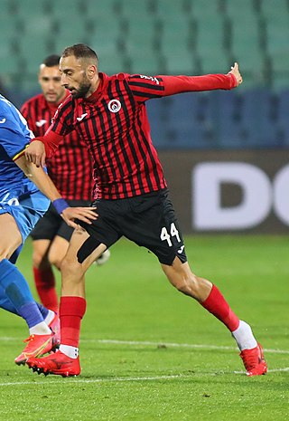
Bozhidar Katsarov is a Bulgarian professional footballer who plays as a midfielder for Krumovgrad.

Football Club Krumovgrad 1925 is a football club based in Krumovgrad, Bulgaria. which currently competes in the First League, the top level of Bulgarian football league system. The team plays its home matches at the local Krumovgrad Stadium, but for 2023–24 season they play at Sport Complex Nikola Shterev - Starika in Plovdiv.
