Devils Island (Nova Scotia)

Last updated

Devils Island
Island community
Lighthouse DGJ 7383 - Devils Island Lighthouse (6230998678).jpg
Lighthouse on Devils Island
Canada Nova Scotia location map 2.svg
Red pog.svg
Devils Island
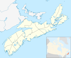
Location of Devils Island, Nova Scotia
Coordinates: 44°35′0″N63°27′32.59″W / 44.58333°N 63.4590528°W / 44.58333; -63.4590528
CountryCanada
Province Nova Scotia
Municipality Halifax Regional Municipality
District9
Founded1711
Area
(Island)
  Total.12 km2 (0.046 sq mi)
Elevation
4.6 m (15.1 ft)
Time zone UTC-4 (AST)
  Summer (DST) UTC-3 (ADT)
GNBC CodeCAJKW
Website http://www.devilsisland.ca/ [ dead link ]

Devils Island, Nova Scotia is located on the northeast entrance of Halifax Harbour off the coast of the community of Eastern Passage, part of the Halifax Regional Municipality. The name originated from an early French merchant named Deval or Devol. [1] The first permanent settlement on this 12-hectare (30-acre) island was established in 1830, and by 1850 there were three houses and a school. By 1901 the settlement had grown to 18 houses. A number of Devil's Island residents, notably Ben Henneberry, provided valuable folklore to pioneering Canadian folklorist Helen Creighton. Most of the residents were moved to the mainland during World War II. The last permanent resident, a Norwegian artist, moved off in 2000. The island is currently owned by Halifax entrepreneur Bill Mont. The Devil's Island Lighthouse, built in 1877, replacing an earlier tower built in 1852, is still standing but is not functional and is threatened.[ by what? ] The island was also the base for a rescue lifeboat until the 1950s which saved the crews of many vessels stranded on the shoals approaching Halifax Harbour.
Related Research Articles

<span class="mw-page-title-main">Louisbourg</span> Place in Nova Scotia, Canada

Louisbourg is an unincorporated community and former town in Cape Breton Regional Municipality, Nova Scotia.

<span class="mw-page-title-main">Liverpool, Nova Scotia</span> Community in Nova Scotia, Canada

Liverpool is a Canadian community and former town located along the Atlantic Ocean of the Province of Nova Scotia's South Shore. It is situated within the Region of Queens Municipality which is the local governmental unit that comprises all of Queens County, Nova Scotia.

<span class="mw-page-title-main">Canso, Nova Scotia</span> Community in Nova Scotia, Canada

Canso is a community in Guysborough County, on the north-eastern tip of mainland Nova Scotia, Canada, next to Chedabucto Bay. In January 2012, it ceased to be a separate town and as of July 2012 was amalgamated into the Municipality of the District of Guysborough.

<span class="mw-page-title-main">Halifax, Nova Scotia</span> Capital and most populous municipality of Nova Scotia, Canada

Halifax is the capital and largest municipality of the Canadian province of Nova Scotia, and the largest municipality in Atlantic Canada. Halifax is one of Canada's fastest growing municipalities, and as of 2022, it is estimated that the CMA population of Halifax was 480,582, with 348,634 people in its urban area. The regional municipality consists of four former municipalities that were amalgamated in 1996: Halifax, Dartmouth, Bedford, and Halifax County.

<span class="mw-page-title-main">Shelburne, Nova Scotia</span> Town in Nova Scotia, Canada

Shelburne is a town located in southwestern Nova Scotia, Canada.

<span class="mw-page-title-main">Halifax Harbour</span> Harbour in Nova Scotia, Canada

Halifax Harbour is a large natural harbour on the Atlantic coast of Nova Scotia, Canada, located in the Halifax Regional Municipality. Halifax largely owes its existence to the harbour, being one of the largest and deepest ice-free natural harbours in the world. Before Confederation it was one of the most important commercial ports on the Atlantic seaboard. In 1917, it was the site of the world's largest man-made accidental explosion, when the SS Mont-Blanc blew up in the Halifax Explosion of December 6.

<span class="mw-page-title-main">History of Halifax, Nova Scotia</span> Aspect of history

The community of Halifax, Nova Scotia was created on 1 April 1996, when the City of Dartmouth, the City of Halifax, the Town of Bedford, and the County of Halifax amalgamated and formed the Halifax Regional Municipality. The former City of Halifax was dissolved, and transformed into the Community of Halifax within the municipality.

<span class="mw-page-title-main">Georges Island (Nova Scotia)</span>

Georges Island is a glacial drumlin and the largest island entirely within the harbour limits of Halifax Harbour located in Nova Scotia's Halifax Regional Municipality. The Island is the location of Fort Charlotte - named after King George's wife Charlotte. Fort Charlotte was built during Father Le Loutre's War, a year after Citadel Hill. The island is now a National Historic Site of Canada. As of August 6, 2020, the island is open to the public on the weekends, from June until Thanksgiving weekend.

<span class="mw-page-title-main">McNabs Island</span> Island in Halifax Harbour in Nova Scotia, Canada

McNabs Island is the largest island in Halifax Harbour located in Halifax Regional Municipality, Nova Scotia, Canada. It played a major role in defending Halifax Harbour and is now a provincial park. The island was settled by Britons in the 1750s and later by Peter McNab, and McNab family members lived on the island until 1934.

<span class="mw-page-title-main">Sheet Harbour, Nova Scotia</span> Place in Nova Scotia, Canada

Sheet Harbour is a rural community in Nova Scotia, Canada. It is located in the eastern reaches of the Halifax Regional Municipality, approximately 117 km (73 mi) northeast of the central urban area of the municipality, concentrated on Downtown Halifax and Dartmouth. The community is located along the Marine Drive scenic route on Trunk 7 at its junctions with Route 224 and Route 374. Surrounding the branched harbour which its name is derived from, the community has a population of about 800 and its respective census tract, containing sizable amounts of land around the community, has a population of 3,478 as of the 2011 Census. Two rivers, West River and East River, flow through the community and into the Northwest and Northeast Arms of the harbour respectively. The coastline of the community is heavily eroded and the region in which the community is located has an abundance of lakes. The region has a humid continental climate, congruent with the majority of Nova Scotia, and the ocean significantly influences the temperature.

<span class="mw-page-title-main">Sambro, Nova Scotia</span> Community in Nova Scotia, Canada

Sambro is a rural fishing community on the Chebucto Peninsula in the Halifax Regional Municipality, in Nova Scotia, Canada.

Dartmouth founded in 1750, is a Metropolitan Area and former city in the Canadian province of Nova Scotia.

<span class="mw-page-title-main">Geography of Nova Scotia</span>

Nova Scotia is a province located in Eastern Canada fronting the Atlantic Ocean. One of the Maritime Provinces, Nova Scotia's geography is complex, despite its relatively small size in comparison to other Canadian provinces.

<span class="mw-page-title-main">Sambro Island Light</span> Lighthouse

Sambro Island Lighthouse is a landfall lighthouse located at the entrance to Halifax Harbour, Nova Scotia, on an island near the community of Sambro in the Halifax Regional Municipality. It is the oldest surviving lighthouse in North America and its construction is a National Historic Event.

Chebucto Head is a Canadian headland on Nova Scotia's Chebucto Peninsula located within the community of Duncan's Cove.

<span class="mw-page-title-main">Walton, Nova Scotia</span> Village in Nova Scotia, Canada

Walton is a village in the Canadian province of Nova Scotia, located in the Municipal District of East Hants, Nova Scotia. The community is named after John Nutting's son James Walton Nutting.

<span class="mw-page-title-main">Indian Harbour, Nova Scotia</span>

Indian Harbour is a small fishing community of the Halifax Regional Municipality in the Canadian province of Nova Scotia on the Chebucto Peninsula. It is located between the communities of Peggy's Cove and Hackett's Cove.

<span class="mw-page-title-main">Timeline of Halifax, Nova Scotia history</span>

This timeline of the history of the Halifax Regional Municipality documents all events that had happened in Halifax, Nova Scotia, Canada, including historical events in the former city of Dartmouth, the Town of Bedford and Halifax County. Events date back to the early 18th century and continue until the present in chronological order.

<span class="mw-page-title-main">Devils Island Light (Nova Scotia)</span> Lighthouse

The Devils Island Light is a Nova Scotia lighthouse located at the eastern shore entrance to Halifax Harbour on Devils Island, Nova Scotia. First lit in 1852, it was succeeded by a second lighthouse in 1877 which survives today. The lighthouse has influenced regional folklore and remains an important community landmark although it is currently neglected and threatened.

References

  1. Kinsman, Brian (April 1995). "McNabs History § Devils Island". Chebucto Community Net. Archived from the original on 28 Mar 2019. Retrieved 1 August 2023.