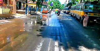
Santoshpur is a neighbourhood of Southern Kolkata in West Bengal, India. It is loosely bounded by Garfa to the north, the Eastern Metropolitan Bypass to the east, Jadavpur to the west and Baghajatin to the south.
Brahmapur is a neighbourhood of Kolkata in West Bengal, India. It is located in the southern fringes of the city and is flanked by Bansdroni to the north and west, Naktala to the east and Boral to the south.

Patuli (Baishnabghata Patuli Township) is a locality on the southern border of Kolkata city in West Bengal, India. It constitutes a major portion of Garia. Baishnaghata Patuli Township is a World Bank–funded project on the eastern fringes of EM Bypass, currently one of the most promising area of south Kolkata. The Township is divided into a number of designated Blocks, extending both side of the busy by pass connector.

Bansdroni is a locality of South Kolkata in West Bengal, India. It is a part of the Kolkata Municipal Corporation and the Kolkata Police jurisdiction area.

New Garia or Nabagaria is neighborhood of South Kolkata in Kolkata district in the Indian state of West Bengal. It is bounded by Chak Garia and Panchasayar to the north, Baishnabghata-Patuli and Briji to the west, Garia railway station and Kamalgazi to the south and Nayabad and Sreenagar to the east.
Tentulberia is a neighborhood of Rajpur Sonarpur, in the South 24 Parganas district, in West Bengal, India. It is accessible from the Garia Station Road, Rajpur Sonarpur. New Garia railway station and Garia railway station of Kolkata Suburban Railway serve the area.It is a part of area covered by Kolkata Metropolitan Development Authority (KMDA).

Naktala is a neighbourhood in South Kolkata in West Bengal, India. It is bounded by Ganguly Bagan to the north, Bansdroni to the west, Garia Crossing to the south and Baishnabghata Patuli to the east.

Chak Garia is a neighbourhood located in the eastern part of Garia, in West Bengal, India. It is bounded by Jadavpur to the north, New Garia to the south, Baishnabghata-Patuli Township to the west and Mukundapur, Nayabad to the east. It is primarily famous for the highrises namely, Hiland Park and Bengal Ambuja Upohar.
Sonarpur is a community development block that forms an administrative division in the Baruipur subdivision of the South 24 Parganas district in the Indian state of West Bengal.

Haltu is a neighbourhood of Southern Kolkata in West Bengal, India. This is mainly a residential area surrounded with Kasba, Jadavpur, Nandi Bagan, Kalikapur, Dhakuria and Selimpur.

Baghajatin is a locality of South Kolkata in the Indian state of West Bengal. It has been named in honour of Jatindranath Mukherjee whose nom de guerre was Bagha (Tiger) Jatin. It is located in the southern part of the city and is surrounded by Jadavpur and Santoshpur in the north, Chak Garia and Panchasayar in the east, Baishnabghata Patuli Township in the south and Bijoygarh and Regent Estate in the west. The locality is referred to as the middle-class and currently growing very well-off, upper-middle-class people's locality in South Kolkata. Though it is surrounded by its rich and famous areas, over the it still remains primarily a nice upper-middle-class neighbourhood. Apart from its critical location in south Calcutta, it is also a place inhabited by prominent people with strong social and cultural background. The two most important landmarks that signify this locality are Baghajatin railway station, Baghajatin bus terminal and EM Bypass which are the lifeline of this locality and its USP.

Netaji Nagar is a locality and part of South Kolkata and comes under the Jadavpur parliamentary area. It is a part of Tollygunge area. It is named after the famous freedom fighter Netaji Subhash Chandra Bose and a statue of Bose is placed on the road which is connected to Netaji Subhash Chandra Bose Road.
Champahati is a census town in and a gram panchayat within the jurisdiction of the Baruipur police station in the Baruipur CD block in the Baruipur subdivision of the South 24 Parganas district in the Indian state of West Bengal. It is a part of Kolkata Urban Agglomeration.
Ajoy Nagar is a southern neighbourhood of Kolkata, India. Ajoy Nagar is surrounded by Santoshpur, Kalikapur, Mukundapur and Garia.
Panchasayar is a neighbourhood of East Kolkata in the Indian state of West Bengal.
Survey Park is a neighbourhood within the Santoshpur area of East Kolkata in Kolkata in the Indian state of West Bengal.
Bijoygarh is a neighbourhood located of the southern part of Kolkata, in West Bengal, India. The neighbourhood shares its boundary with Jadavpur, Baghajatin, Bikramgarh, Regent Estate and Ranikuthi,

Dum Dum Park is a locality in South Dumdum of North 24 Parganas district in the Indian state of West Bengal. It is a part of area covered by Kolkata Metropolitan Development Authority (KMDA). Dum Dum Park is a planned area with straight and wide roads, multiple water tanks have become a coveted neighbourhood in Greater Kolkata.
In recent years, the multiple high budget theme Durga Puja of Kolkata draw several visitors to the area during the Durga Puja.
South Barasat is a village and a gram panchayat within the jurisdiction of the Jaynagar Majilpur police station in the Jaynagar I CD block in the Baruipur subdivision of the South 24 Parganas district in the Indian state of West Bengal.


