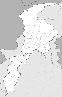
Nasirabad is a district in the centre-west of Balochistan, Pakistan. Nasirabad's headquarters are at Dera Murad Jamali.

Jampur, is a city and tehsil headquarters of Jampur Tehsil in Rajanpur District, Punjab Pakistan. It is located at 29°38'32" N, 70°35'45"E south of Dera Ghazi Khan, in the centre of Pakistan. It comprises an area of about 8–10 square kilometers and has a population of almost 120,000.The total area of the Jampur Tehsil is 2,322 square kilometers with a total population of 485,051 as per District Census Report (DCR) 1998.

Dera Ghazi Khan is a district in the Punjab province of Pakistan. Its capital is Dera Ghazi Khan city.
Bijar is a village and one of the 51 Union Councils of Khushab District in the Punjab Province of Pakistan. It is located on a very important junction from where the roads lead to all four directions.Mitha Tiwana is located on its east, Sheikhu is on west, Panja is on its south and Nawab de Kothi is on north side.
Golay Wali is a village that is one of the 35 Union Councils of Khushab District in the Punjab Province of Pakistan. It is located at 32°29'21″N 71°50'46″E.
Jabbi Shareef, is one of the 51 Union Councils of Khushab District in the Punjab Province of Pakistan is located at 12KM North of Mitha Tiwana Station at main Sargodha Mianwali Road. It is oldest city of the district and one of the oldest cities of Punjab. It belongs to Daman-e-Muhar region and it is largest city of Daman-e-Muhar. It has Awan as its major cast. Population of Jabbi Shareef is about 25,000 and is divided into three regions, Jabbi-Shumali, Jabbi-Janubi, Jabbi. It covers a vast land of 90 km2. It is located 37 km (23 mi) away from Khushab and 31 km (19 mi) away from Jauharabad. It is located at 32°23'60N 72°5'60E.
Nali Shumali, is a village and one of the 51 Union Councils of Khushab District in the Punjab Province of Pakistan. It is located at 32°29'17N 72°19'26E
Nari, is a village and one of the 51 Union Councils of Khushab District in the Punjab Province of Pakistan. It is located at 32°28'4N 72°24'32E

Wan Bhachran, is a town and union council, an administrative sub division, of Mianwali District in Punjab province of Pakistan. It is part of Mianwali Tehsil. The word 'Wan' means 'a well' in the Punjabi language whereas 'Bhachran' refers to the Bhachar clan that is prevalent in this part of the region.

Abbottabad Tehsil is an administrative subdivision (tehsil) of Abbottabad District in Khyber Pakhtunkhwa province of Pakistan.

Lasbela is a coastal district of Balochistan province of Pakistan. It became a separate district in Kalat Division on 30 June 1954. Uthal is the district headquarters. The district is divided into Five Tehsil and 22 union councils.
Doaba, is a town and union council of Mianwali District in the Punjab province of Pakistan. It is located in Piplan Tehsil at 32°20'1N 71°23'44E. Railway Station Bhumb named after main populated clan "Bhumb". In the West is River Indus and in the East is Main Thal Canal. It is the main historical town of the Tehsil Piplan and main occupation of the dweller is agriculture.The main towns of Doaba Union Council are Dhingana Mondanwala, Dhingana Bhumbanwala, Jaal Shumali/Junoobi,Thal Malkaan wala,Thal Bhachran wala, Olkhanwala & Chak No.2ML. Included in the Union Council is Chak no 2ML village, also known as Jamal Abad in honour of the late brigadier Jamal Dad Khan. Governmental general K Nazimul Deen came to this village in 1949. It is the village of military personnel who were gone after independence.
Mianwali Tehsil, is an administrative subdivision (tehsil) of Mianwali District in the Punjab province of Pakistan. The tehsil is subdivided into 2 Municipal commeties and 26 Union Councils
Bigwani Shumali is a town and union council of Dera Ismail Khan District in Khyber-Pakhtunkhwa province of Pakistan. It is located at 32°7'60N 71°1'0E and has an altitude of 169 metres.

Nari Shumali is a town and union council of Dera Ghazi Khan District in the Punjab province of Pakistan. The town is part of Taunsa Tehsil. It is located at 30°51'0N 70°40'0E and has an altitude of 136 metres.
Welpat Shumali is a town and union council of Bela Tehsil in the Lasbela District of Balochistan province, Pakistan.
Muzaffarpur Shumali, is a village of Mianwali District in the Punjab province of Pakistan. The village serves as a Union Council of Mianwali Tehsil. The Union Concil Muzafarpur Shumali is named in the honour of Khan Bahadar Malik Muzafar Khan Bhachar Bandial Ex MLA.The Inhabitants of this village are mostaly Zameendar consisting of the Bhachar clan.

Quaidabad Tehsil, is a tehsil located within Khushab District, Punjab, Pakistan.

Nawan Shehr Shumali is a union council and town of Abbottabad District in Khyber-Pakhtunkhwa province of Pakistan. According to the 2017 Census of Pakistan, the population is 6,798.
NA-178 (Muzaffargarh-III) was a constituency for the National Assembly of Pakistan.


