
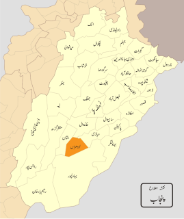
Dera Ghazi Khan is a district in the Punjab province of Pakistan. Its capital is Dera Ghazi Khan city.
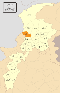
Lower Dir District is a district in Malakand Division of Khyber Pakhtunkhwa province in Pakistan. Timergara city is the district headquarters and largest city, while the second largest city is Chakdara.
{{Infobox settlement | official_name = | name = Lodhran District | native_name = ضِلع لودھراں | native_name_lang = | settlement_type = District | image_skyline = | imagesize = | image_alt = | image_caption = | image_map = Punjab Dist Lodharan.svg | mapsize = 200px | map_alt = | map_caption = Map of Punjab with Lodhran District highlighted | latd = |latm = |lats = |latNS = | longd = |longm = |longs = |longEW = | coordinates_type = | coordinates_display = | subdivision_type = Country | subdivision_name = Pakistan | subdivision_type1 = Province | subdivision_name1 = Punjab | founder = | seat_type = Headquarters | seat = Lodhran city | government_footnotes = | leader_party = | unit_pref = Metric | area_footnotes = | area_total_km2 = 1790 | population_footnotes = | population_as_of = 2017 | population_total = 1,700,620 | population_density_km2 = auto | timezone1 = PST | utc_offset1 = +5 | established_title = Established | established_date = | leader_title = Deputy Commissioner (DC) | leader_name = Saqib Ali Ateel | leader_title1 = District Police Officer (DPO) | leader_name1 = Aameer Taimour Khan | blank_name_sec1 = District Council | blank_info_sec1 = | blank1_name_sec1 = Number of Tehsils | blank1_info_sec1 = 3 | demographics1_title1 = Main language(s) | demographics1_info1 = Saraiki [[Punjabi] [Urdu]] | website = lodhran.gop.pk }}

Rokhri is a town and union council of Mianwali District, in the Punjab province of Pakistan. It is located at 32°39'25N 71°30'37E
Adhi Kot is a village and one of the 51 Union Councils of Khushab District in the Punjab Province of Pakistan. It is located at 32°6'13N 71°48'24E with an altitude of 177 metres.

Lawa is a Tehsil of Chakwal District in the Punjab province of Pakistan.

Isakhel is a town of Mianwali District in the Punjab province of Pakistan. The town is the headquarters of Isakhel Tehsil, an administrative subdivision of the district.
Trag is a village and Union Council of Mianwali District in the Punjab province of Pakistan. It is in Isakhel tehsil, and is one of the populated villages in the Mianwali District.
Dheri Zardad is a town and union council of Charsadda District in Khyber Pakhtunkhwa province of Pakistan. It is located on the bank of the Kabul River at 34°2'44N 71°50'9E and has an altitude of 258 metres. It was built by Zardad Khan Popalzay Durrani, who was the governor of the then Peshawar province under the Durrani Empire; he purchased the land and the village was built as a hunting place.
Khan Mahi is a town and union council in Charsadda District of Khyber-Pakhtunkhwa. It is located at 34°13'31N 71°52'27E and has an altitude of 309 metres . First Nazim of union council khanmahi was Dost Muhammad khan umaray and second and the last nazim was saifullah khan in Pervaiz Musharaf era.
Lar is a town and union council in Dera Ismail Khan District of Khyber-Pakhtunkhwa. It is located at 32°5'30N 71°4'15E and has an altitude of 184 metres.
Bigwani Shumali is a town and union council of Dera Ismail Khan District in Khyber-Pakhtunkhwa province of Pakistan. It is located at 32°7'60N 71°1'0E and has an altitude of 169 metres.
Bilot Sharif or Bilot is a town and union council of Dera Ismail Khan District in Khyber Pakhtunkhwa province of Pakistan. It is located at 32°15′20″N 71°9′41″E and has an altitude of 180 metres.
Kathgarh is a town and union council on Dera Ismail Khan District in the North-West Frontier Province of Pakistan. Its is built to the west shores of the river Beas. It is located at 32°9'2N 71°1'18E and has an altitude of 173 metres.
Kirri Khaisore is a town and union council of Dera Ismail Khan District in Khyber Pakhtunkhwa province of Pakistan. It is located at 32°19′48″N71°11′54″E and has an altitude of 189 metres.
Ratta Kulachi is a town and union council of Dera Ismail Khan District in Khyber Pakhtunkhwa province of Pakistan.
Usmanabad or Osmanabad is one of the neighbourhoods of Lyari Town in Karachi, Sindh, Pakistan.
Chak Fourteen MB is a village and one of the 51 Union Councils of Khushab District in the Punjab Province of Pakistan. It is located at 32°10'0N 72°52'20E.
Gar Munara is a village located on the bank of the Indus River, in Swabi, Khyber Pakhtunkhwa, Pakistan, near the town of Marghuz. Thousands of visitors across Pakistan visit Gar Munara every year, especially in summer to enjoy the Indus River. It has a population of around 5,000. Most of the people are government workers or public servants. Many of them go abroad for work. The village's only bank, HBL, is located in the center of the village. The main crops are wheat, corn, sugarcane, and tobacco. Resorts in Gar Munara include Rahat Khan Bangla and Ameer Sher Khan Bangla. Gar Munara village is surrounded by several other villages: Dhok to its east, Moosa Banda to its west, and Marghuz to its north, with the Indus River to its south. Cricket, kabadi and belorae are popular games in this village. The literacy rate is high in this area. There is one matriculation school for boys, and one for girls. There is also one primary school for boys and one for girls. A new college for girls was under construction and expected completion was mid-2015.
The people are loving and hospitality is at its peak with passage of time today in 2019 the people of Gar-munara are well educated and the streets and roads of village are well carpeted many streets are having street lights with solar-panels The population has increased with time to time people working abroad build their houses on big residential plots and are now living their lives happily Gar-munara had Fast spped internet mainly they communicate with their loves one living abroad through internet access to skype,whatsapp and using different other applications villagers are becoming modern and advance with the use of technology
Sethi Town is a neighborhood in Haji Camp, Peshawar, Pakistan located in the east of historic Peshawar city near "Haji Camp Bus Terminal" of Peshawar.


