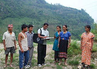
Dharmapuri | |
---|---|
Village | |
Location in Maharashtra, India [1] 19°18'44"N 76°44'32"E | |
Coordinates: 19°18′44″N76°44′32″E / 19.31222°N 76.74222°E Coordinates: 19°18′44″N76°44′32″E / 19.31222°N 76.74222°E | |
Country | |
State | Maharashtra |
District | Parbhani |
Government | |
• Type | Gram panchayat |
Population (2011) | |
• Total | 3,301 [2] |
Demonym(s) | Dharmapurikar |
Languages | |
• Official | Marathi |
Time zone | UTC+5:30 (IST) |
PIN | 431540 [3] |
Telephone code | 02452 |
ISO 3166 code | IN-MH |
Vehicle registration | MH-22 |
Dharmapuri is a village in Parbhani taluka of Parbhani district of Maharashtra state in India.
Parbhani is a city in Maharashtra state of India. It is the administrative headquarters of Parbhani District. Parbhani is the fourth largest city in Marathwada region of Maharashtra after Aurangabad, Nanded and Latur. Parbhani is around 200 kilometres (120 mi) away from regional headquarters of Aurangabad while it is 491 km (305 mi) away from the state capital Mumbai.
Parbhani district, is one of the eight districts in the Marathawada region of Maharashtra state of India. Parbhani city is the headquarters of this district. Parbhani district is well known for religious tourism of Jainism, Hinduism
Maharashtra is a state in the western peninsular region of India occupying a substantial portion of the Deccan Plateau. It is the second-most populous state and third-largest state by area in India. Spread over 307,713 km2 (118,809 sq mi), it is bordered by the Arabian Sea to the west, the Indian states of Karnataka and Goa to the south, Telangana to the southeast and Chhattisgarh to the east, Gujarat and Madhya Pradesh to the north, and the Indian union territory of Dadra and Nagar Haveli to the north west. It is also the world's second-most populous subnational entity.
According to the 2011 census of India, Dharmapuri had a population of 3301, of which 1854 were male and 1447 were female. The average sex ratio of the village was 780, which was lower than the Maharashtra state average of 929. The literacy rate was 75.53% compared to 82.3% for the state. Male literacy rate was 85% while female literacy rate was 62%. [4]
The 15th Indian Census was conducted in two phases, house listing and population enumeration. House listing phase began on 1 April 2010 and involved collection of information about all buildings. Information for National Population Register (NPR) was also collected in the first phase, which will be used to issue a 12-digit unique identification number to all registered Indian residents by Unique Identification Authority of India (UIDAI). The second population enumeration phase was conducted between 9 and 28 February 2011. Census has been conducted in India since 1872 and 2011 marks the first time biometric information was collected. According to the provisional reports released on 31 March 2011, the Indian population increased to 1.21 billion with a decadal growth of 17.70%. Adult literacy rate increased to 74.04% with a decadal growth of 9.21%. The motto of the census was 'Our Census, Our future'.
Following table shows distance of Dharmapuri from some of major cities.
City | Distance (km) |
---|---|
Parbhani | 6 |
Jintur | 40 |
Nanded | 72 |
Sailu | 50 |
Aurangabad | 183 |
Mumbai | 455 |
Zari is a major village in Parbhani taluka of Parbhani district of Maharashtra state in India.
Charthana is a major village in Jintur taluka of Parbhani district in Maharashtra state of India. It used to be known as Charukshetra Nagari in the name of king Charudatta. There are near about 360 temples of Mahadeva, some of which are under the ground. The Archaeological Survey of India (ASI) has acquired the remaining temples for conservation. Gokuleshwar mandir, Barav, Dwipmal, and Nartirtha are places of interest among many others.
Bhogaon is a major village in Jintur taluka of Parbhani district in Maharashtra state of India.
Sendra also known as Shendra is a village in Parbhani taluka of Parbhani district of Maharashtra state in India.
Dhar is a village in Parbhani taluka of Parbhani district of Maharashtra state in India.
Mirzapur is a village in Parbhani taluka of Parbhani district of Maharashtra state in India.
Takli Kumbhakarna also known as Takli is a village in Parbhani taluka of Parbhani district of Maharashtra state in India.
Nandkheda is a village in Parbhani taluka of Parbhani district of Maharashtra state in India.
Takli Bobade is a village in Parbhani taluka of Parbhani district of Maharashtra state in India.
Mandawa also known as Mandwa is a village in Parbhani taluka of Parbhani district of Maharashtra state in India.
Sultanpur is a small village in Parbhani taluka of Parbhani district of Maharashtra state in India.
Shahapur is a village in Parbhani taluka of Parbhani district of Maharashtra state in India.
Mangangaon is a village in Parbhani taluka of Parbhani district of Maharashtra state in India.
Jamb also known as Jam is a village in Parbhani taluka of Parbhani district of Maharashtra state in India.
Bramhangaon also known as Bramangaon is a village in Parbhani taluka of Parbhani district of Maharashtra state in India.
Raipur is a village in Parbhani taluka of Parbhani district of Maharashtra state in India.
Balsa also known as Balsa Khurd is a village in Parbhani taluka of Parbhani district of Maharashtra state in India.
Pathra also known as Pathara is a village in Parbhani taluka of Parbhani district of Maharashtra state in India.
Varpud also known as Warpud is a village in Parbhani taluka of Parbhani district of Maharashtra state in India.
Kaudgaon is a village in Parbhani taluka of Parbhani district of Maharashtra state in India.