
The Potomac River is a major river in the Mid-Atlantic region of the United States that flows from the Potomac Highlands in West Virginia to the Chesapeake Bay in Maryland. It is 405 miles (652 km) long, with a drainage area of 14,700 square miles (38,000 km2), and is the fourth-largest river along the East Coast of the United States and the 21st-largest in the United States. More than 5 million people live within its watershed.

The Chesapeake Bay is the largest estuary in the United States. The Bay is located in the Mid-Atlantic region and is primarily separated from the Atlantic Ocean by the Delmarva Peninsula, including parts of the Eastern Shore of Maryland, the Eastern Shore of Virginia, and the state of Delaware. The mouth of the Bay at its southern point is located between Cape Henry and Cape Charles. With its northern portion in Maryland and the southern part in Virginia, the Chesapeake Bay is a very important feature for the ecology and economy of those two states, as well as others surrounding within its watershed. More than 150 major rivers and streams flow into the Bay's 64,299-square-mile (166,534 km2) drainage basin, which covers parts of six states and all of Washington, D.C.

Poquoson, informally known as Bull Island, is an independent city in the Commonwealth of Virginia, United States. As of the 2020 census, the population was 12,460. The Bureau of Economic Analysis combines the city of Poquoson with surrounding York County for statistical purposes.

Lake Austin, formerly Lake McDonald, is a water reservoir on the Colorado River in Austin, Texas. The reservoir was formed in 1939 by the construction of Tom Miller Dam by the Lower Colorado River Authority. Lake Austin is one of the seven Highland Lakes created by the LCRA, and is used for flood control, electrical power generation, and recreation.

The James River is a river in Virginia that begins in the Appalachian Mountains and flows from the confluence of the Cowpasture and Jackson Rivers in Botetourt County 348 miles (560 km) to the Chesapeake Bay. The river length extends to 444 miles (715 km) if the Jackson River is included, the longer of its two headwaters. It is the longest river in Virginia. Jamestown and Williamsburg, Virginia's first colonial capitals, and Richmond, Virginia's current capital, lie on the James River.

The Susquehanna River is a major river located in the Mid-Atlantic region of the United States, overlapping between the lower Northeast. At 444 miles (715 km) long, it is the longest river on the East Coast of the United States. By watershed area, it is the 16th-largest river in the United States, and also the longest river in the early 21st-century continental United States without commercial boat traffic.

The Virginia Peninsula is located in southeast Virginia, bounded by the York River, James River, Hampton Roads and Chesapeake Bay. It is sometimes known as the Lower Peninsula to distinguish it from two other peninsulas to the north, the Middle Peninsula and the Northern Neck.

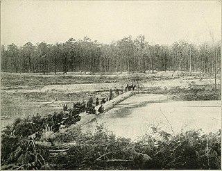
The Chickahominy is an 87-mile-long (140 km) river in eastern Virginia. The river, which serves as the eastern border of Charles City County, rises about 15 miles (24 km) northwest of Richmond and flows southeast and south to the James River. The river was named after the Chickahominy Indian tribe who lived near the river when the English colonists arrived in 1607. Chickahominy descendants live in Charles City County today.

The Tioga River is a tributary of the Chemung River, approximately 58 miles (93 km) long, in northern Pennsylvania and western New York in the United States. It drains a region of ridges in the northern Allegheny Plateau in the watershed of the Susquehanna River.
The Warwick River is a 14.4-mile-long (23.2 km) tidal estuary which empties into the James River a few miles from Hampton Roads at the southern end of Chesapeake Bay in southeast Virginia in the United States. Originating in York County near the northern side a few miles west of Yorktown, it flows south across the Virginia Peninsula and is almost entirely located in the independent city of Newport News.
The South River is a 10-mile-long (16 km) tributary of the Chesapeake Bay in Anne Arundel County, Maryland in the United States. It lies south of the Severn River, east of the Patuxent River, and north of the West River and Rhode River, and drains to the Chesapeake Bay.
Crooked Creek is a 26.3-mile-long (42.3 km) tributary of the Tioga River located entirely in Tioga County, Pennsylvania in the United States.

Pohick Creek is a 14.0-mile-long (22.5 km) tributary stream of the Potomac River in Fairfax County in the U.S. state of Virginia. It takes its name from the Pohick Native American tribe once prevalent in the area.

Little Hunting Creek is a 3.6-mile-long (5.8 km) primarily tidal tributary of the Potomac River located in Fairfax County, Virginia, not to be confused with Hunting Creek farther north. A stone-arch bridge, completed in 1931, carries traffic on the George Washington Memorial Parkway across the narrow mouth of the creek, located 96.6 miles (155.5 km) upriver from the mouth of the Potomac. The Washington family built its Mount Vernon plantation on the Potomac River along both banks of Little Hunting Creek during colonial times. The creek is bordered by residential communities in addition to the Mount Vernon property. It is a popular location for recreational fishing, and much of the wildlife characteristic of the tidal Potomac wetlands can be spotted there.

Chickahominy Reservoir is located near U.S. Highway 20 100 miles (160.9 km) east of Bend, Oregon, and 32 miles (51.5 km) west of Burns, Oregon, in the United States. It was built as an irrigation reservoir, but is now managed by Oregon Department of Fish and Wildlife as a recreational fishery. The reservoir is very long and is narrow at points, almost pinched at the center.
Chickahominy Wildlife Management Area is a 5,217-acre (21.11 km2) Wildlife Management Area (WMA) in Charles City County, Virginia. It is the only WMA located in the coastal plain of tidewater Virginia consisting primarily of forested uplands with a lesser amount of wetland habitat. The area's namesake is the Chickahominy River, a tidal river which forms its eastern boundary. Morris Creek flows through the property, forming its southern boundary; other smaller creeks and marshes are also present. The forests mainly consist of mixed hardwoods and pines. The preserve is nearly level, with elevations ranging from 25 to 50 feet above sea level.
Lanexa is an unincorporated community partially in New Kent County, and partially in James City County, Virginia, United States. The ZIP Code for Lanexa is 23089. Lanexa is located by the Chickahominy River and has many tourism sites for camping and outdoor activities. Diascund Creek runs immediately to the east of the center of Lanexa. A dam creates the Diascund Creek Reservoir on the north side of the community.
The Poquoson River is an 11.7-mile-long (18.8 km), mostly tidal river in the state of Virginia. The river is an estuarine inlet of the Chesapeake Bay, entering just south of the mouth of the York River.

Glenn Martin National Wildlife Refuge includes the northern half of Smith Island, which lies 11 miles (18 km) west of Crisfield, Maryland, and Watts Island, which is located between the eastern shore of Virginia and Tangier Island. Both islands are situated in the lower Chesapeake Bay.
