
Madagascar, officially the Republic of Madagascar, and previously known as the Malagasy Republic, is an island country in the Indian Ocean, approximately 400 kilometres off the coast of East Africa. At 592,800 square kilometres (228,900 sq mi) Madagascar is the world's second-largest island country. The nation comprises the island of Madagascar and numerous smaller peripheral islands. Following the prehistoric breakup of the supercontinent Gondwana, Madagascar split from the Indian subcontinent around 88 million years ago, allowing native plants and animals to evolve in relative isolation. Consequently, Madagascar is a biodiversity hotspot; over 90% of its wildlife is found nowhere else on Earth. The island's diverse ecosystems and unique wildlife are threatened by the encroachment of the rapidly growing human population and other environmental threats.
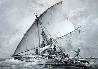
The history of Madagascar is distinguished clearly by the early isolation of the landmass from the ancient supercontinent containing Africa and India, and by the island's late colonization by human settlers arriving in outrigger canoes from the Sunda islands between 200 BC and 500 AD. These two factors facilitated the evolution and survival of thousands of endemic plant and animal species, some of which have gone extinct or are currently threatened with extinction due to the pressures of a growing human population. Over the past two thousand years the island has received waves of settlers of diverse origins including Austronesian, Bantu, Arab, South Asian, Chinese and European. The majority of the population of Madagascar today is a mixture of Austronesian, Bantu, North Indian, Arab and Somali settlers.

Antananarivo, also known by its colonial shorthand form Tana, is the capital and largest city of Madagascar. The administrative area of the city, known as Antananarivo-Renivohitra, is the capital of Analamanga region. The city sits at 1,280 m (4,199 ft) above sea level in the center of the island, the highest national capital by elevation among the island countries. It has been the country's largest population center since at least the 18th century. The presidency, National Assembly, Senate and Supreme Court are located there, as are 21 diplomatic missions and the headquarters of many national and international businesses and NGOs. It has more universities, nightclubs, art venues, and medical services than any city on the island. Several national and local sports teams, including the championship-winning national rugby team, the Makis are based here.
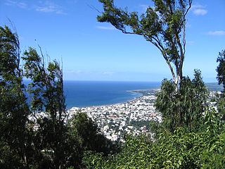
Réunion is an overseas department and region of the French Republic and an Indian Ocean island in East Africa, east of Madagascar and 175 km (109 mi) southwest of Mauritius. As of January 2020, it had a population of 859,959.

The Afrotropical realm is one of Earth's eight biogeographic realms. It includes Africa south of the Sahara Desert, the majority of the Arabian Peninsula, the island of Madagascar, southern Iran and extreme southwestern Pakistan, and the islands of the western Indian Ocean. It was formerly known as the Ethiopian Zone or Ethiopian Region.

The ecoregions of Madagascar, as defined by the World Wildlife Fund, include seven terrestrial, five freshwater, and two marine ecoregions. Madagascar's diverse natural habitats harbour a rich fauna and flora with high levels of endemism, but most ecoregions suffer from habitat loss.

Toamasina, meaning "like salt" or "salty", unofficially and in French Tamatave, is the capital of the Atsinanana region on the east coast of Madagascar on the Indian Ocean. The city is the chief seaport of the country, situated 215 km (134 mi) northeast of its capital and biggest city Antananarivo. According to the 2014 official estimate, Toamasina had a population of 300,813. The city is served by Toamasina Airport.
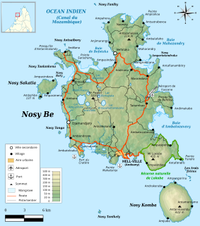
Nosy Be[ˌnusʲ ˈbe] is an island off the northwest coast of Madagascar. Nosy Be is Madagascar's largest and busiest tourist resort. It has an area of 320.02 square kilometres (123.56 sq mi), and its population was 109,465 according to the provisional results of the 2018 Census.
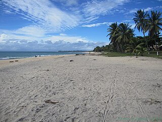
Sava is a region of northern Madagascar. Its capital is Sambava. Until 2009 Sava belonged to Antsiranana Province. The region is situated at the northern part of the east coast of Madagascar. It is bordered by Diana to the north, Sofia to the west, and Analanjirofo to the south. The population was 1,123,013 in 2018 and the total area is 25,518 km2 (9,853 sq mi). The region contains wild areas such as Marojejy National Park.
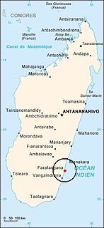
Farafangana is a city on the south-east coast of Madagascar and capital of the Atsimo-Atsinanana region.
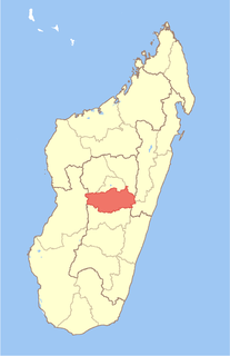
Vakinankaratra is a region in central Madagascar. The capital of the region is Antsirabe. Vakinankaratra covers an area of 16,599 kilometres, and had a population of 2,074,358 in 2018.
Articles related to Madagascar include:
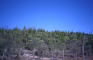
Androy is the most southerly region of Madagascar. It covers an area of 19,540 km2, and had a population of 903,376 inhabitants in 2018. The administrative capital is Ambovombe-Androy, and the chief administrator is Michael Andrianirina.

Vatovavy-Fitovinany is a region located in southeast Madagascar. Its capital is Manakara. It is inhabited by the Antemoro people.

Menabe is a region in western Madagascar, with its capital at Morondava. It covers an area of 46,121 square kilometres, and its population was 700,577 in 2018. The population mostly belongs to the Sakalava ethnic group. The region is named after the 18th-century Sakalava Kingdom of Menabe. The name "Menabe", in turn, means "big red", after the color of laterite rock that dominates the landscape.

Anosy is one of the 22 regions of Madagascar. It is located in the southeast of the country, on the eastern side of what was once the Toliara Province. The name Anosy means "island(s)" in Malagasy.

Districts are second-level administrative divisions of Madagascar below the regions. There are 114 districts in Madagascar. Districts are in their turn divided into communes; while some of the districts in urban areas and offshore islands each consist of only one commune, most of the districts are divided typically into 5–20 communes.
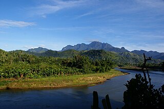
Marojejy National Park is a national park in the Sava Region of northeastern Madagascar. It covers 55,500 ha (214 sq mi) and is centered on the Marojejy Massif, a mountain chain that rises to an elevation of 2,132 m (6,995 ft). Access to the area around the massif was restricted to research scientists when the site was set aside as a strict nature reserve in 1952. In 1998, it was opened to the public when it was converted into a national park. It became part of the World Heritage Site known as the Rainforests of the Atsinanana in 2007. Despite its rugged terrain, poaching and selective logging are still persistent problems, particularly since the start of the 2009 political crisis in Madagascar. Mining, slash-and-burn agriculture, and wood collection also pose threats to the park and its wildlife.

Malagasy is an Austronesian language and the national language of Madagascar. Most people in Madagascar speak it as a first language, as do some people of Malagasy descent elsewhere.
The COVID-19 pandemic in Madagascar is part of the ongoing worldwide pandemic of Coronavirus disease 2019 (COVID-19) caused by severe acute respiratory syndrome coronavirus 2 (SARS-CoV-2). On 20 March 2020, the first case in Madagascar was confirmed in Antananarivo.


