Ditmas Park, Brooklyn

Last updated
Ditmas Park Historic District
Ditmas Av Rugby Rd house sunny jeh.jpg
Ditmas Avenue and Rugby Road
USA New York City location map.svg
Red pog.svg
USA New York location map.svg
Red pog.svg
Usa edcp location map.svg
Red pog.svg
LocationBounded by Marlborough Rd., Dorchester Rd., Ocean Ave., and Newkirk Ave., New York, New York
Coordinates 40°38′20″N73°57′40″W / 40.63889°N 73.96111°W / 40.63889; -73.96111
Area35 acres (14 ha)
Built1902
Architectural styleColonial, Queen Anne, Bungalow
NRHP reference No. 83001688 [1]
Added to NRHPSeptember 30, 1983

Ditmas Park is a historic district in the neighborhood of Flatbush in Brooklyn, New York City. The traditional boundaries of Ditmas Park, including Ditmas Park West, are Ocean Avenue and greater Flatbush to the east, Dorchester Road and the Prospect Park South neighborhood to the north, Coney Island Avenue and the Kensington neighborhood to the west, and Newkirk Avenue to the south. [2] The name Ditmas Park is often used as a shorthand for the several neighborhoods that comprise the larger area of Victorian Flatbush. [3]

Contents

Ditmas Park is patrolled by the New York City Police Department's 70th Precinct, [4] and is within Brooklyn Community District 14. The New York City Subway's B and Q trains serve Ditmas Park.

The neighborhood is located on land formerly owned by the Ditmas family. The area remained rural until the 1890s. At that time, Brooklyn was becoming more popular, due to the development of Prospect Park and the Brooklyn Bridge, along with improved transportation in New York City. Lewis H. Pounds was one of the early developers of the area now known as Ditmas Park Historic District. This eight-block national historic district consists of 2,000 to 2,500 largely residential buildings built between 1902 and 1914. Many of the buildings are large, free-standing, single-family homes with gables and front porches. Most of the building architects were local to the Flatbush or Brooklyn area, and they specialized in suburban buildings. Architectural styles of the area's buildings include Colonial Revival, Bungalow/Craftsman, Queen Anne, Tudor, Greek Revival, and Japanese Cottage. These styles are uncommon in Brooklyn, where brownstones and rowhouses are typical. The district also includes apartment buildings, a commercial district along Cortelyou Road, and one church, the brick Neo-Georgian Flatbush-Tompkins Congregational Church (1910) at which Conrad Tillard is since 2018 the Senior Minister. [5] [6] [7] [8] [3] [9] [10]

Community

Ditmas Park, Brooklyn
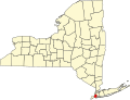
Location in New York City

Newkirk Avenue, Coney Island Avenue, Cortelyou Road, Foster Avenue, and Church Avenue are the neighborhood's commercial strips while many of their north–south streets are lined with historic Victorian style homes. Since much of Ditmas Park is residential, many locals go to nearby Park Slope to run errands and shop, although the neighborhood has seen increased commercialization due to its recent gentrification.

The Ditmas Park Historic District was listed on the National Register of Historic Places in 1983. [1] Throughout the 1980s and early 1990s, wealthy families purchased the large Victorian homes, but in the past few years, the neighborhood has experienced rapid gentrification, with an influx of young people and artists attracted to the large spaces for relatively cheap rents. An example of this is Cortelyou Road, a commercial street in the neighborhood. Cortelyou enjoys a number of delis, bars, coffee shops, restaurants, the Flatbush Food Co-op, and more upscale restaurants. Cortelyou is also home to many venues, which attracts many local musicians, as well as more well-known artists. [11]

In October 2009, Time Out New York named Ditmas Park one of the best neighborhoods in New York City for food. Similar articles praising Ditmas Park for its food have appeared in The New York Times and AM New York . [12] [13] [14]

The area is also frequently used for movie and TV filming due to its Victorian houses, which project a suburban feel.

Associations

The Ditmas Park Association, founded in 1908, hosts social events, publishes a newsletter and a home improvement directory, and works on numerous civic issues, often jointly with its sister neighborhoods and the Flatbush Development Corporation. The Flatbush Development Corporation hosts an annual Victorian Flatbush House Tour.

Other neighborhood associations also serve parts of the neighborhood, such as the Ditmas Park West Neighborhood Association (DPW), and Beverley Square West Neighborhood Association. DPW runs a Yahoo group for the neighborhood. Flatbush Artists is also based in the area and has an annual artwalk featuring artists who live in the area. [15]

Beginning in March 2012, the website Ditmas Park Corner documented important events and openings in the area, and served as a forum for discussions and inquiries about the neighborhood; [16] as of 2017 the site was incorporated into the Brooklyn-wide news site Bklyner . [17] For a brief period of time in the early 2010s, Ditmas Park Corner had competition from Ditmas Park Patch, one of a series of neighborhood news organizations run by AOL.

Library

The Brooklyn Public Library's Cortelyou branch is located at 1305 Cortelyou Road, near Argyle Road. The branch was first proposed in 1969, but did not open until 1983. [18]

Transportation

New York City Subway stops in or very near to Ditmas Park are Beverley Road ( Q train), Cortelyou Road ( Q train), Newkirk Plaza ( B and Q trains), and Avenue H ( Q train). MTA-operated express buses that run through Ditmas Park are the BM1 , BM2 , BM3 and BM4, and local buses are the B8 , B68 and B103. [19]

Notable residents

Related Research Articles

The BMT Brighton Line, also known as the Brighton Beach Line, is a rapid transit line in the B Division of the New York City Subway in Brooklyn, New York City, United States. Local service is provided at all times by the Q train, but is joined by the B express train on weekdays. The Q train runs the length of the entire line from Coney Island–Stillwell Avenue to the Manhattan Bridge south tracks. The B begins at Brighton Beach and runs via the bridge's north tracks.

<span class="mw-page-title-main">Flatlands, Brooklyn</span> Neighborhood of Brooklyn in New York City

Flatlands is a neighborhood in the southeast part of the borough of Brooklyn in New York City. The current neighborhood borders are roughly defined by the Bay Ridge Branch to the north, Avenue U to the south, Ralph Avenue to the east, and Flatbush Avenue to the southwest.

<span class="mw-page-title-main">Midwood, Brooklyn</span> Neighborhood of Brooklyn in New York City

Midwood is a neighborhood in the south-central part of the New York City borough of Brooklyn. It is bounded on the north by the Bay Ridge Branch tracks just above Avenue I and by the Brooklyn College campus of the City University of New York, and on the south by Avenue P and Kings Highway. The eastern border consists of parts of Nostrand Avenue, Flatbush Avenue, and Coney Island Avenue; parts of McDonald Avenue and Ocean Parkway mark the western boundary.

<span class="mw-page-title-main">Flatbush</span> Neighborhood of Brooklyn in New York City

Flatbush is a neighborhood in the New York City borough of Brooklyn. The neighborhood consists of several subsections in central Brooklyn and is generally bounded by Prospect Park to the north, East Flatbush to the east, Midwood to the south, and Kensington and Parkville to the west. The modern neighborhood includes or borders several institutions of note, including Brooklyn College.

<span class="mw-page-title-main">Kensington, Brooklyn</span> Neighborhood of Brooklyn in New York City

Kensington is a neighborhood in the central portion of the New York City borough of Brooklyn, located south of Prospect Park and Green-Wood Cemetery. It is bordered by Coney Island Avenue to the east; Fort Hamilton Parkway and Caton Avenue to the north; McDonald Avenue, Dahill Road or 36th Street to the west; and Ditmas Avenue or Foster Avenue to the south. Kensington and Parkville are bordered by the Prospect Park South and Ditmas Park subsections of Flatbush to the east; Windsor Terrace to the north; Borough Park to the west; and Midwood to the south.

<span class="mw-page-title-main">East Flatbush, Brooklyn</span> Neighborhood of Brooklyn in New York City

East Flatbush is a residential neighborhood in the New York City borough of Brooklyn. East Flatbush is bounded by Crown Heights and Empire Boulevard to the north; Brownsville and East 98th Street to the east; Flatlands, Canarsie and the Long Island Rail Road's Bay Ridge Branch to the south; and the neighborhood of Flatbush and New York Avenue to the west. East Flatbush is a predominantly African American neighborhood and has a population of 135,619 as of the 2010 United States census.

<span class="mw-page-title-main">Prospect Park South</span> United States historic place

Prospect Park South is a small neighborhood in Flatbush, Brooklyn, New York City, located south of Prospect Park. It is included within the Prospect Park South Historic District, which was designated by the New York City Landmarks Preservation Commission in 1979 and listed on the National Register of Historic Places in 1983. The historic district is bounded by Church Avenue to the north, the BMT Brighton Line of the New York City Subway to the east, Beverley Road to the south, and between Stratford Road and Coney Island Avenue to the west.

<span class="mw-page-title-main">Flatbush Avenue</span> Avenue in Brooklyn, New York

Flatbush Avenue is a major avenue in the New York City Borough of Brooklyn. It runs from the Manhattan Bridge south-southeastward to Jamaica Bay, where it joins the Marine Parkway–Gil Hodges Memorial Bridge, which connects Brooklyn to the Rockaway Peninsula in Queens. The north end was extended from Fulton Street to the Manhattan Bridge as "Flatbush Avenue Extension".

<span class="mw-page-title-main">Downtown Brooklyn</span> Central business district in New York City

Downtown Brooklyn is the third largest central business district in New York City, and is located in the northwestern section of the borough of Brooklyn. The neighborhood is known for its office and residential buildings, such as the Williamsburgh Savings Bank Tower and the MetroTech Center office complex.

Brooklyn Community Board 17 is a New York City community board that encompasses the Brooklyn neighborhoods of East Flatbush, Remsen Village, Farragut, Rugby, Erasmus and Ditmas Village. The District is delimited by East 32nd Street, Glenwood Road, Nostrand Avenue, Foster Avenue, and Bedford Avenue on the west, Clarkson Avenue, Utica Avenue, and East New York Avenue on the north, East 98th Street on the east, as well as by the Long Island Rail Road on the south.

<span class="mw-page-title-main">Prospect Park station (BMT lines)</span> New York City Subway station in Brooklyn

The Prospect Park station is an express station on the BMT Brighton Line of the New York City Subway. It is located in between Lincoln Road, Lefferts Avenue, Empire Boulevard, Ocean Avenue and Flatbush Avenue in Flatbush, Brooklyn, near the border of Crown Heights, Prospect Heights, Park Slope, and Prospect Lefferts Gardens. The station, which serves Prospect Park and Brooklyn Botanic Garden, is served by the Q train and Franklin Avenue Shuttle at all times and by the B train on weekdays.

<span class="mw-page-title-main">Newkirk Plaza station</span> New York City Subway station in Brooklyn

The Newkirk Plaza station is an express station on the BMT Brighton Line of the New York City Subway in Flatbush, Brooklyn. It is located on an open-cut at the center of the pedestrian-only Newkirk Plaza shopping mall, which is bounded by Newkirk Avenue on the north, Foster Avenue on the south, Marlborough Road to the west, and East 16th Street to the east. The station is served by the Q train at all times and by the B train on weekdays only.

<span class="mw-page-title-main">Beverley Road station</span> New York City Subway station in Brooklyn

The Beverley Road station is a local station on the BMT Brighton Line of the New York City Subway. It is located over a private right-of-way at Beverly Road between Marlborough Road/East 15th Street and East 16th Street in the neighborhood of Flatbush, Brooklyn. The station is served by the Q train at all times.

<span class="mw-page-title-main">Cortelyou Road station</span> New York City Subway station in Brooklyn

The Cortelyou Road station is a local station on the BMT Brighton Line of the New York City Subway, located at Cortelyou Road between Marlborough Road and East 16th Street in the neighborhood of Flatbush, Brooklyn. The station is served by the Q train at all times.

<span class="mw-page-title-main">Prospect Lefferts Gardens</span> Neighborhood of Brooklyn in New York City

Prospect Lefferts Gardens is a residential neighborhood in the Flatbush area of the New York City borough of Brooklyn. The community is bounded by Empire Boulevard to the north, Clarkson Avenue to the south, New York Avenue to the east, and Ocean Avenue/Prospect Park to the west. Prospect Lefferts Gardens was designated a New York City Landmark area in 1979 and called the Prospect Lefferts Gardens Historic District.

<span class="mw-page-title-main">Beverley Squares</span> Neighborhoods of Brooklyn in New York City

Beverley Square East and Beverley Square West, also spelled Beverly Square, are a pair of neighborhoods in the Flatbush section of the New York City borough of Brooklyn. Located southwest of Prospect Park within what is now called Victorian Flatbush, one of the largest concentrations of Victorian houses in the United States, they were developed in the 1900s primarily by Thomas Benton Ackerson, whose former home is in Beverley Square West.

<span class="mw-page-title-main">Victorian Flatbush</span> Neighborhood of Brooklyn in New York City

Victorian Flatbush is the western section of the Flatbush section of Brooklyn, New York, bordering Midwood, that is characterized by Victorian houses.

<span class="mw-page-title-main">West Midwood, Brooklyn</span> Neighborhood of Brooklyn in New York City

West Midwood is a planned community and historic enclave in the New York City borough of Brooklyn. West Midwood is located in central Brooklyn in the southern edge of the community of Victorian Flatbush, abutting the northern boundary of the community of Midwood. It is bordered by Foster Avenue to the north, the BMT Brighton subway line to the east, Avenue H to the south, and Coney Island Avenue to the west. West Midwood is located south of Prospect Park within what is sometimes referred to as Ditmas Park.

<span class="mw-page-title-main">Flatbush Malls</span> Traffic medians in Brooklyn, New York

The Flatbush Malls are a pair of tree-lined landscaped medians series along several roads in the Victorian Flatbush neighborhood of Brooklyn, New York City. An architecture critic has written that the malls "give the streets an uncommon spaciousness, if not grandeur". The first series was built in the northern part of the neighborhood along Albemarle Road, and extending one block north on Buckingham Road, in the Prospect Park South development of 1899, east of Coney Island Avenue and west of the BMT Brighton Line. This was modeled by the Scottish landscape architect John Aiken on Commonwealth Avenue Mall in Boston, with a design that originally included shrubbery but not trees, and in turn likely inspired the other neighborhood series.

References

  1. 1 2 "National Register Information System". National Register of Historic Places . National Park Service. March 13, 2009.
  2. Ditmas Park and Ditmas Park West Brooklyn Community Board 14, Retrieved March 6, 2022.
  3. 1 2 Inserra, Jonah (2018-03-06). "Ditmas Park Is Home to One of the Largest Collections of Victorian Homes in the Country". Untapped New York. Retrieved 2021-01-06.
  4. 70th Precinct, New York City Police Department, Accessed September 26, 2017. "This precinct is home to Midwood, Fiske Terrace, Ditmas Park, and Prospect Park South."
  5. Greene, Leonard (2022-10-28). "Rev. Calvin Butts, longtime leader of Harlem's Abyssinian Baptist Church, dead at 73". The New York Daily News.
  6. "Flatbush-Tompkins Congregational Church". CCCNY.
  7. Larry Gobrecht (August 1983). "National Register of Historic Places Registration:Ditmas Park Historic District". New York State Office of Parks, Recreation and Historic Preservation. Archived from the original on 2012-10-19. Retrieved 2011-03-12.See also: "Accompanying 23 photos". Archived from the original on 2015-09-24. Retrieved 2014-12-15.
  8. "Block by Block: Ditmas Park (Published 2016)". The New York Times. 2016-01-12. ISSN   0362-4331 . Retrieved 2021-01-06.
  9. Douglas Elliman (2018-07-10). "7 reasons to buy an apartment—or an entire Victorian house—in Ditmas Park, Brooklyn". Brick Underground. Retrieved 2021-01-06.
  10. "Ditmas Park Historic District Designation Report" (PDF). City of New York.
  11. Nat Baldwin | Concerts | Time Out New York
  12. Freedman, Lisa (2009-09-01). "Why I Love Ditmas Park". Time Out New York. Archived from the original on 2010-01-23. Retrieved 2010-01-22.
  13. Shannon, Jonathan (2009-10-25). "Your $30 Sunday". Time Out New York. Archived from the original on 2010-09-02. Retrieved 2010-01-22.
  14. Mooney, Jake (2009-11-13). "Moved for the Space; Stayed for the Food". The New York Times. Retrieved 2010-01-22.
  15. "Home". flatbushartists.org.
  16. "About". Ditmas Park Corner. ditmasparkcorner.com. Archived from the original on November 30, 2016.
  17. "About Us Archived 2018-02-25 at the Wayback Machine ". Bklyner. bklyner.com. Retrieved February 25, 2018.
  18. "Cortelyou Library". Brooklyn Public Library. August 19, 2011. Retrieved February 21, 2019.
  19. "Brooklyn Bus Map" (PDF). Metropolitan Transportation Authority. October 2020. Retrieved December 1, 2020.
  20. Salisbury, Vanita. "While Stuck in Traffic, the National's Aaron Dessner Fantasizes About Living in Rural New England", New York (magazine) , December 1, 2011. Accessed November 21, 2016. "Name: Aaron Dessner; Age: 35; Neighborhood: Ditmas Park"
  21. 1 2 https://www.spin.com/2023/08/sufjan-stevens-new-album/
  22. "Remembering Ric Menello". Ditmas Park Corner . 2013-03-02. Archived from the original on 2013-03-13. Retrieved 2013-03-17.
  23. Blumenfeld, Larry. "Brooklynite Writes Jazz With a Poet's Pen", The Wall Street Journal , May 17, 2011. Accessed September 26, 2017. "If you see saxophonist Roy Nathanson on the Q train, head down and pen out, he's working on a poem. 'I can only write poetry while riding the subway,' he said recently from the living room of his house in Brooklyn's Ditmas Park."
  24. Roalf, Peggy. "The Q&A: Tim O'Brien", AI-AP presents DART, December 29, 2014. Accessed November 21, 2016. "Originally from North Haven, Connecticut, I moved to Brooklyn and in with my then girlfriend/now wife, Scholastic Creative Director Elizabeth Parisi, in the early 90s when Brooklyn was still a city in transition. Park Slope was beginning to be gentrified and when we felt we were priced out in ’96, we bought a large Victorian home in another neighborhood in transition, Ditmas Park."
  25. Quenqua, Douglas (15 February 2013). "The Boy Wonder of BuzzFeed". The New York Times.
  26. Plitt, Amy. "Here's How Michelle Williams Will Transform Her Crumbling Brooklyn Mansion; The Oscar-nominated actress is planning some big changes to the Ditmas Park home", Curbed New York, March 16, 2016. Accessed November 21, 2016. "Last year, actress Michelle Williams put down roots in Ditmas Park, buying a sprawling eight-bedroom mansion at 1440 Albemarle Road for $2.5 million."