Freilassing, until 1923 Salzburghofen is a town of some 16,000 inhabitants in the southeastern corner of Bavaria, Germany. It belongs to the "Regierungsbezirk" Oberbayern and the "Landkreis" (County) of Berchtesgadener Land. Located very close to the German-Austrian border, Freilassing can be seen as the biggest satellite of Salzburg, the centre of which is eight kilometres away, on the other side of the border.
Erding is a town in Bavaria, Germany, and capital of the rural district of the same name. It had a population of 36,469 in 2019.

Puchheim is suburb to Munich in the district of Fürstenfeldbruck, in Bavaria, Germany. It has about 20,000 inhabitants.
Baar is a municipality in Aichach-Friedberg district, in Bavaria, southern Germany.

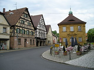
Pegnitz is a town in the Bayreuth district in Upper Franconia, Bavaria, Germany, with a population of approximately 15,000 inhabitants. It is also the source of the river Pegnitz. The city Bayreuth is about 27 km to the north.
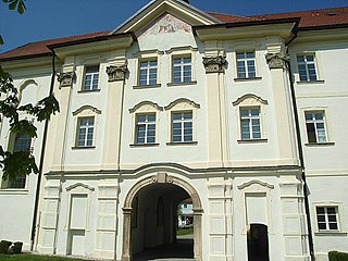
Aldersbach is a municipality in the district of Passau in Bavaria in Germany. The former Cistercian Aldersbach Abbey, of which the Baroque church remains, is located in the village. There is also a brewery with museum. Aldersbach has around 4,500 inhabitants.

Grünwald is a municipality in the district of Munich, in the state of Bavaria, Germany. It is located on the right bank of the Isar, 12 km southwest of Munich (centre). As of 31 December 2020 it had a population of 11,303.

Geisenhausen is a municipality with market town status in the district of Landshut, in Bavaria, Germany. It is situated 14 km southeast of Landshut in the valley of the Kleine Vils.

Münsing is a municipality in the district of Bad Tölz-Wolfratshausen in Bavaria in Germany.

Schönbrunn im Steigerwald is a community in the Upper Franconian district of Bamberg and a member of the administrative community (Verwaltungsgemeinschaft) of Burgebrach.

Wechingen is a municipality in the district of Donau-Ries in Bavaria in Germany.
Neunkirchen am Brand is a municipality in the district of Forchheim in Bavaria in Germany.

Riedbach is a municipality in the district of Haßberge in Bavaria in Germany. It is situated 20 km northeast of Schweinfurt and 8 km north of Haßfurt.

Steinbach is a municipality in the district of Kronach in Bavaria in Germany.

Igling is a municipality in the district of Landsberg in Bavaria in Germany.
Pfatter is a municipality in the district of Regensburg in Bavaria, Germany. It lies on the river Danube. The Danube village used to be a central place in the Gäuboden and had a central function in its region.

Neukirchen is a municipality in the district of Straubing-Bogen in Bavaria, Germany. It is located in the Donau-Wald region in the Bavarian Forest.
Tacherting is a municipality in the north of the district of Traunstein in Bavaria, Germany.

Hawangen is a municipality in the district of Unterallgäu in Bavaria, Germany, with about 1,254 inhabitants. Hawangen is situated 5 km (3 mi) east of Memmingen. The town has a municipal association with Ottobeuren.

Prem is a municipality in the Weilheim-Schongau district, in Bavaria, Germany.