Schonungen

Last updated
Schonungen
Mainberg.jpg
Mainberg Castle (left), river Main (right) and Schonungen in the background
DEU Schonungen COA.svg
Coat of arms
Location of Schonungen within Schweinfurt district
Schonungen in SW.svg
Germany adm location map.svg
Red pog.svg
Schonungen
Bavaria location map.svg
Red pog.svg
Schonungen
Coordinates: 50°03′N10°19′E / 50.050°N 10.317°E / 50.050; 10.317 Coordinates: 50°03′N10°19′E / 50.050°N 10.317°E / 50.050; 10.317
Country Germany
State Bavaria
Admin. region Unterfranken
District Schweinfurt
Subdivisions9 Ortsteile
Government
   Mayor (202026) Stefan Rottmann [1] (SPD)
Area
  Total81.03 km2 (31.29 sq mi)
Elevation
218 m (715 ft)
Population
 (2020-12-31) [2]
  Total7,663
  Density95/km2 (240/sq mi)
Time zone UTC+01:00 (CET)
  Summer (DST) UTC+02:00 (CEST)
Postal codes
97453
Dialling codes 09721, 09727, 09526
Vehicle registration SW
Website www.schonungen.de

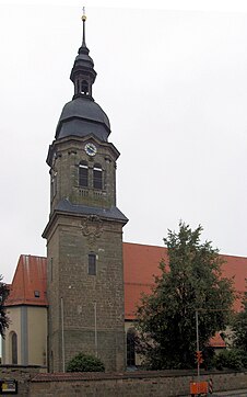
Schonungen is a municipality in the Schweinfurt district, Bavaria, Germany. The villages in this municipality are:

and some more

Related Research Articles

Ergolding Place in Bavaria, Germany

Ergolding is a municipality in the district of Landshut, in Bavaria, Germany. It is situated on the left bank of the Isar, 5 km northeast of Landshut.

Aurach, Germany Place in Bavaria, Germany

Aurach is a municipality in the district of Ansbach in Bavaria in Germany.

Bruckberg, Middle Franconia Place in Bavaria, Germany

Bruckberg is a municipality in the district of Ansbach in Bavaria in Germany.

Diebach Place in Bavaria, Germany

Diebach is a municipality in the district of Ansbach in Bavaria in Germany.

Dombühl Place in Bavaria, Germany

Dombühl is a municipality in the district of Ansbach in Bavaria in Germany.

Gerolfingen Place in Bavaria, Germany

Gerolfingen is a municipality in the district of Ansbach in Bavaria in Germany.

Langfurth Place in Bavaria, Germany

Langfurth is a municipality in the district of Ansbach in Bavaria in Germany.

Mönchsroth Place in Bavaria, Germany

Mönchsroth is a municipality in the district of Ansbach in Bavaria in Germany.

Ohrenbach Place in Bavaria, Germany

Ohrenbach is a municipality in the district of Ansbach in Bavaria in Germany.

Wettringen, Bavaria Place in Bavaria, Germany

Wettringen is a municipality in the district of Ansbach in Bavaria in Germany.

Heroldsbach Place in Bavaria, Germany

Heroldsbach is a municipality in the district of Forchheim in Bavaria in Germany.

Riedbach Place in Bavaria, Germany

Riedbach is a municipality in the district of Haßberge in Bavaria in Germany. It is situated 20 km northeast of Schweinfurt and 8 km north of Haßfurt.

Tiefenbach, Landshut Place in Bavaria, Germany

Tiefenbach is a municipality in the district of Landshut in Bavaria in Germany. The river Isar flows through the municipality.

Leuchtenberg Place in Bavaria, Germany

Leuchtenberg is a municipality in the district of Neustadt an der Waldnaab in Bavaria, Germany, essentially a suburb of nearby Weiden in der Oberpfalz, and a larger historical region in the Holy Roman Empire governed by the Landgraves of Leuchtenberg.

Beratzhausen Place in Bavaria, Germany

Beratzhausen is a market town and municipality in the district of Regensburg in Bavaria in Germany.

Schierling Place in Bavaria, Germany

Schierling is a municipality in the district of Regensburg in Bavaria in Germany.

Waldbrunn, Bavaria Place in Bavaria, Germany

Waldbrunn is a municipality in the district of Würzburg in Bavaria, Germany.

Moosbach, Bavaria Place in Bavaria, Germany

Moosbach is a municipality in the district of Neustadt an der Waldnaab in Bavaria, Germany.

Vachendorf Place in Bavaria, Germany

Vachendorf is a municipality in the district of Traunstein in Bavaria, Germany.

Holzkirchen, Lower Franconia Place in Bavaria, Germany

Holzkirchen is a municipality in the district of Würzburg in Bavaria, Germany.

References

  1. Liste der ersten Bürgermeister/Oberbürgermeister in kreisangehörigen Gemeinden, Bayerisches Landesamt für Statistik, 15 July 2021.
  2. "Tabellenblatt "Daten 2", Statistischer Bericht A1200C 202041 Einwohnerzahlen der Gemeinden, Kreise und Regierungsbezirke". Bayerisches Landesamt für Statistik und Datenverarbeitung (in German). June 2021.