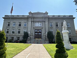
Dixie, Washington

Last updated

Dixie, Washington
CDP
Walla Walla County Washington Incorporated and Unincorporated areas Dixie Highlighted.svg
Location of Dixie, Washington
Coordinates: 46°08′26″N118°09′07″W / 46.14056°N 118.15194°W / 46.14056; -118.15194
CountryUnited States
State Washington
County Walla Walla
Area
  Total
0.5 sq mi (1.3 km2)
  Land0.5 sq mi (1.3 km2)
  Water0.0 sq mi (0.0 km2)
Elevation
[1]
1,562 ft (476 m)
Population
 (2020) [2]
  Total
225
  Density450/sq mi (170/km2)
Time zone UTC-8 (Pacific (PST))
  Summer (DST) UTC-7 (PDT)
ZIP code
99329
Area code 509
FIPS code 53-18055 [3]
GNIS feature ID2408673 [1]

Dixie is a census-designated place (CDP) in Walla Walla County, Washington, United States. The population was 197 at the 2010 census.

Contents

A post office called Dixie has been in operation since 1881. The community has one elementary school, which is administered by the Dixie School District, and feeds older students into Pioneer Middle School and Walla Walla High School [4] in Walla Walla Public Schools.

Dixie derives its name from the eponymous song. [5]

Geography

According to the United States Census Bureau, the CDP has a total area of 0.5 square miles (1.3 km2), all of it land.

Demographics

Historical population
CensusPop.Note
2000 220
2010 197−10.5%
2020 22514.2%

As of the census [3] of 2000, there were 220 people, 84 households, and 63 families residing in the CDP. The population density was 428.2 people per square mile (165.3 people/km2). There were 87 housing units at an average density of 169.3 units per square mile (65.4 units/km2). The racial makeup of the CDP was 90.45% White, 3.64% Native American, 4.55% from other races, and 1.36% from two or more races. Hispanic or Latino of any race were 5.91% of the population.

There were 84 households, out of which 26.2% had children under the age of 18 living with them, 67.9% were married couples living together, 4.8% had a female householder with no husband present, and 25.0% were non-families. 20.2% of all households were made up of individuals, and 6.0% had someone living alone who was 65 years of age or older. The average household size was 2.62 and the average family size was 3.00.

In the CDP, the age distribution of the population shows 22.7% under the age of 18, 6.8% from 18 to 24, 25.5% from 25 to 44, 31.4% from 45 to 64, and 13.6% who were 65 years of age or older. The median age was 42 years. For every 100 females, there were 107.5 males. For every 100 females age 18 and over, there were 104.8 males.

The median income for a household in the CDP was $33,125, and the median income for a family was $40,714. Males had a median income of $29,583 versus $19,000 for females. The per capita income for the CDP was $24,650. About 7.1% of families and 9.9% of the population were below the poverty line, including 28.6% of those under the age of eighteen and none of those 65 or over.

Related Research Articles

<span class="mw-page-title-main">Walla Walla County, Washington</span> County in Washington, United States

Walla Walla County is a county located in the southeast of the U.S. state of Washington. As of the 2020 census, its population was 62,584. The county seat and largest city is Walla Walla. The county was formed on April 25, 1854 and is named after the Walla Walla tribe of Native Americans.

<span class="mw-page-title-main">Garfield County, Washington</span> County in Washington, United States

Garfield County is a county located in the U.S. state of Washington. As of the 2020 census, the population was 2,286, making it the least populous county in Washington; with about 3.2 inhabitants per square mile (1.2/km2), it is also the least densely populated county in Washington. The county seat and only city is Pomeroy.

<span class="mw-page-title-main">Columbia County, Washington</span> County in Washington, United States

Columbia County is a county located in the U.S. state of Washington. As of the 2020 census, the population was 3,952, making it the second-least populous county in Washington. The county seat and largest city is Dayton. The county was created out of Walla Walla County on November 11, 1875, and is named after the Columbia River. Columbia County is included in the Walla Walla, WA Metropolitan Statistical Area.

<span class="mw-page-title-main">Indian Falls, California</span> Census-designated place in California, United States

Indian Falls is a census-designated place (CDP) in Plumas County, California, United States. The population was 10 at the 2020 census, down from 54 at the 2010 census.

<span class="mw-page-title-main">St. James, Maryland</span> CDP in Maryland, United States

St. James is a census-designated place (CDP) in Washington County, Maryland, United States. The population was 1,657 at the 2000 census. It is also the home of St. James School, Hagerstown, a small, Episcopalian, boarding school. St. James was formerly named "Lydia."
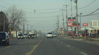
<span class="mw-page-title-main">South Monroe, Michigan</span> Census-designated place & unincorporated community in Michigan, United States

South Monroe is an unincorporated community and census-designated place (CDP) in Monroe County in the U.S. state of Michigan. The population was 6,468 at the 2020 census. The CDP is located within Monroe Charter Township.
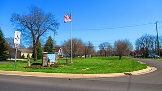
<span class="mw-page-title-main">Woodland Beach, Michigan</span> Census-designated place & unincorporated community in Michigan, United States

Woodland Beach is a census-designated place (CDP) and unincorporated community in Monroe County in the U.S. state of Michigan. The population was 1,899 at the 2020 census. The CDP is located within Frenchtown Charter Township.

<span class="mw-page-title-main">Washington Heights, New York</span> CDP in New York, United States

Washington Heights is a census-designated place (CDP) in Orange County, New York, United States. The population was 2,205 at the 2020 census.
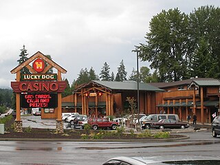
<span class="mw-page-title-main">Skokomish, Washington</span> CDP in Washington, United States

Skokomish is a census-designated place (CDP) in Mason County, Washington, United States. The population was 617 at the 2010 census. The town is the headquarters of the Skokomish Indian Tribe.

<span class="mw-page-title-main">Elk Plain, Washington</span> CDP in Washington, United States

Elk Plain is a census-designated place (CDP) in Pierce County, Washington, United States. The population was 14,534 at the 2020 census.

<span class="mw-page-title-main">Canyon Creek, Washington</span> CDP in Washington, United States

Canyon Creek is a census-designated place (CDP) in Snohomish County, Washington, United States. The population was 3,445 at the 2020 census, up from 3,200 at the 2010 census. Prior to the 2010 census, the CDP was known as Jordan Road-Canyon Creek.

<span class="mw-page-title-main">Lake Bosworth, Washington</span> CDP in Washington, United States

Lake Bosworth is a census-designated place (CDP) in Snohomish County, Washington, United States. The population was 868 at the 2020 census, up from 667 at the 2010 census.

<span class="mw-page-title-main">Lake Ketchum, Washington</span> CDP in Washington, United States

Lake Ketchum is a census-designated place (CDP) in Snohomish County, Washington, United States. The population was 1,268 at the 2020 census, up from 930 at the 2010 census.

<span class="mw-page-title-main">East Cathlamet, Washington</span> CDP in Washington, United States

East Cathlamet is a census-designated place (CDP) in Wahkiakum County, Washington, on the eastern border of the town of Cathlamet. The population was 578 as of the 2020 census. The East Cathlamet community is part of the Wahkiakum School District, a K-12 school district of about 430 students. The name "Kathlamet" (Cathlamet) comes from the Kathlamet tribe, which in their language, means "rocky shore."

<span class="mw-page-title-main">Burbank, Washington</span> CDP in Washington, United States

Burbank is a census-designated place (CDP) in Walla Walla County, Washington, United States, where the Snake River meets the Columbia. The population was 3,291 at the 2010 census. Named for Luther Burbank, the city is located just east of Pasco and Kennewick, across the Snake and Columbia Rivers, respectively. Burbank is part of the Tri-Cities, WA urban area, despite being located in the Walla Walla metropolitan area.

<span class="mw-page-title-main">College Place, Washington</span> City in Washington, United States

College Place is a city in Walla Walla County, Washington, United States. It neighbors the larger city of Walla Walla, and had a population of 9,902 at the 2020 census.

<span class="mw-page-title-main">Garrett, Washington</span> CDP in Washington, United States

Garrett is a census-designated place (CDP) in Walla Walla County, Washington, United States. The population was 1,419 at the 2010 census.

<span class="mw-page-title-main">Touchet, Washington</span> CDP in Washington, United States

Touchet is a census-designated place (CDP) in Walla Walla County, Washington, United States. The population was 421 at the 2010 census.

<span class="mw-page-title-main">Walla Walla East, Washington</span> CDP in Washington, United States

Walla Walla East is a census-designated place (CDP) in Walla Walla County, Washington, United States. The population was 1,672 at the 2010 census.

<span class="mw-page-title-main">Wallula, Washington</span> CDP in Washington, United States

Wallula is a census-designated place (CDP) in Walla Walla County, Washington, United States. The population was 179 at the 2010 census.

References

  1. 1 2 U.S. Geological Survey Geographic Names Information System: Dixie, Washington
  2. "Census Bureau profile: Dixie, Washington". United States Census Bureau. May 2023. Retrieved May 10, 2024.
  3. 1 2 "U.S. Census website". United States Census Bureau . Retrieved January 31, 2008.
  4. "Post Offices". Jim Forte Postal History. Archived from the original on March 6, 2016. Retrieved July 29, 2016.
  5. Meany, Edmond S. (1923). Origin of Washington geographic names. Seattle: University of Washington Press. p. 70.