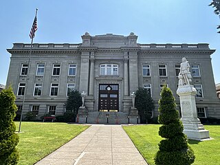
Walla Walla County is a county located in the southeast of the U.S. state of Washington. As of the 2020 census, its population was 62,584. The county seat and largest city is Walla Walla. The county was formed on April 25, 1854 and is named after the Walla Walla tribe of Native Americans.
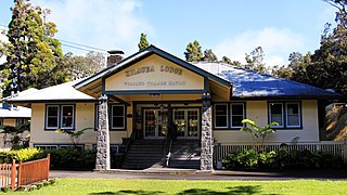
Volcano or Volcano Village is a census-designated place (CDP) in Hawaii County, Hawaii, United States located in the District of Puna with a small portion of the CDP in the District of Kaʻū. The population was 2,575 at the 2010 census, up from 2,231 at the 2000 census.

Lucernemines, usually written as Lucerne Mines, is a census-designated place (CDP) in Indiana County, Pennsylvania, United States. The population was 937 at the 2010 census.
West Pasco is a census-designated place (CDP) in Franklin County, Washington, United States. The population was 1,747 at the 2020 census, a significant decrease from 3,739 at the 2010 census.

Neilton is an unincorporated community and census-designated place (CDP) in Grays Harbor County, Washington, United States. The population was 299 at the 2020 census, down from 315 at the 2010 census.
Centerville is an unincorporated community and census-designated place (CDP) in Klickitat County, Washington, United States. Settled in 1877 by Albert J. Brown, the population was 94 at the 2020 census.

Roosevelt is an unincorporated community and census-designated place (CDP) in Klickitat County, Washington, United States. The population was 152 at the 2020 census. The Roosevelt Regional Landfill, one of the largest landfills in the United States, is located at Roosevelt.

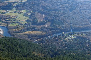
Greenwater is a census-designated place (CDP) in the northwest United States in Pierce County, Washington. Southeast of Seattle, the population was 67 at the 2010 census, down from 91 in 2000. At the 2020 census, the population was 95.

Clear Lake is a census-designated place (CDP) in Skagit County, Washington, United States. The population was 1,228 at the 2020 census. It is included in the Mount Vernon–Anacortes, Washington Metropolitan Statistical Area.
Rockport is a census-designated place (CDP) in Skagit County, Washington, United States. The population was 109 at the 2010 census. It is included in the Mount Vernon–Anacortes, Washington Metropolitan Statistical Area.

Startup is a census-designated place (CDP) in Snohomish County, Washington, United States. The population was 859 according to the 2020 census.

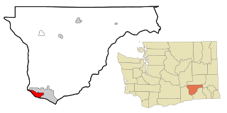
Burbank is a census-designated place (CDP) in Walla Walla County, Washington, United States, where the Snake River meets the Columbia. The population was 3,291 at the 2010 census. Named for Luther Burbank, the city is located just east of Pasco and Kennewick, across the Snake and Columbia Rivers, respectively. Burbank is part of the Tri-Cities, WA urban area, despite being located in the Walla Walla metropolitan area.

College Place is a city in Walla Walla County, Washington, United States. It neighbors the larger city of Walla Walla, and had a population of 9,902 at the 2020 census.

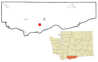
Dixie is a census-designated place (CDP) in Walla Walla County, Washington, United States. The population was 197 at the 2010 census.

Prescott is a city in central Walla Walla County, Washington. The population was 372 at the 2020 census.

Touchet is a census-designated place (CDP) in Walla Walla County, Washington, United States. The population was 421 at the 2010 census.

Walla Walla East is a census-designated place (CDP) in Walla Walla County, Washington, United States. The population was 1,672 at the 2010 census.

Wallula is a census-designated place (CDP) in Walla Walla County, Washington, United States. The population was 179 at the 2010 census.

Marietta-Alderwood is a census-designated place (CDP) in Whatcom County, Washington, United States. The population was 3,906 at the 2010 census. Parts of Marietta-Alderwood were annexed into Bellingham in 2019, while the rest remains an unincorporated area.

Guilford is a census-designated place (CDP) in the town of Guilford in Piscataquis County, Maine, United States. The population was 945 at the 2000 census.

