Dobrova pri Prihovi

Last updated
Dobrova pri Prihovi
Dobrova (until 1998)
Slovenia location map.svg
Red pog.svg
Dobrova pri Prihovi
Location in Slovenia
Coordinates: 46°21′49.26″N15°28′18.37″E / 46.3636833°N 15.4717694°E / 46.3636833; 15.4717694 Coordinates: 46°21′49.26″N15°28′18.37″E / 46.3636833°N 15.4717694°E / 46.3636833; 15.4717694
Country Flag of Slovenia.svg Slovenia
Traditional region Styria
Statistical region Drava
Municipality Oplotnica
Area
  Total 1.28 km2 (0.49 sq mi)
Elevation 316.3 m (1,037.7 ft)
Population (2015) [1]
  Total 48

Dobrova pri Prihovi (pronounced  [ˈdoːbɾɔʋa pɾi ˈpɾiːxɔʋi] ) is a small settlement in the Municipality of Oplotnica in eastern Slovenia. Traditionally the area was part of the Styria region. It is now included in the Drava Statistical Region. [2]

Oplotnica Town and Municipality in Slovenia

Oplotnica is a small town and municipality in eastern Slovenia. It lies on the Oplotniščica River, a left tributary of the Dravinja River, to the north of Slovenske Konjice. The area was part of the traditional region of Styria and formerly part of Austria-Hungary. The municipality is now included in the Drava Statistical Region.

Slovenia republic in Central Europe

Slovenia, officially the Republic of Slovenia, is a sovereign state located in southern Central Europe at a crossroads of important European cultural and trade routes. It is bordered by Italy to the west, Austria to the north, Hungary to the northeast, Croatia to the southeast, and the Adriatic Sea to the southwest. It covers 20,273 square kilometers (7,827 sq mi) and has a population of 2.07 million. One of the successor states of the former Yugoslavia, Slovenia is a parliamentary republic and a member of the United Nations, of the European Union, and of NATO. The capital and largest city is Ljubljana.

Drava Statistical Region Statistical region in 41

The Drava Statistical Region is a statistical region in Slovenia. The largest town in the region is Maribor. Its name comes from the Drava River and includes land on both banks along its course through Slovenia as well as the Pohorje mountains in the northeast of the region. The Drava is used for the production of hydroelectricity and the fertile land around it is used for agriculture. The share of job vacancies in all available jobs is among the highest in Slovenia and the region has a positive net migration rate but a very high natural decrease, which means an overall decrease in the population.

Contents

Name

The settlement was named Dobrova until 1998, when it was renamed Dobrova pri Prihovi (literally, 'Dobrova near Prihova') to differentiate it from other settlements with the same name. [1] The name Dobrova is shared with several other places in Slovenia and is derived from Common Slavic *dǫbrova 'place where there is a deciduous or oak forest', in turn derived from *dǫbъ 'deciduous tree, oak'. Like similar names (e.g., Dobrovce, Dobrovnik, Zadobrova ), it originally referred to the local vegetation. [3]

Proto-Slavic proto-language

Proto-Slavic is the unattested, reconstructed proto-language of all the Slavic languages. It represents Slavic speech approximately from the 5th to 9th centuries AD. As with most other proto-languages, no attested writings have been found; scholars have reconstructed the language by applying the comparative method to all the attested Slavic languages and by taking into account other Indo-European languages.

Dobrovce in Styria, Slovenia

Dobrovce is a village in the Municipality of Miklavž na Dravskem Polju in northeastern Slovenia. It lies on the right bank of the Drava River southeast of Maribor. The area is part of the traditional region of Styria. The municipality is now included in the Drava Statistical Region.

Dobrovnik Place in Prekmurje, Slovenia

Dobrovnik is a village in Slovenia and is the seat of the Municipality of Dobrovnik. It is located in the Prekmurje region. It has a significant Hungarian ethnic community.

Related Research Articles

Dobrova, Dobrova–Polhov Gradec Place in Upper Carniola, Slovenia

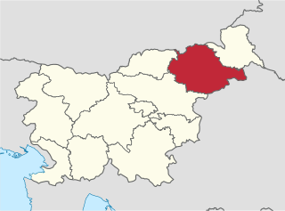
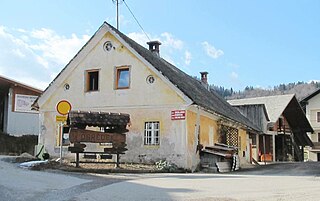
Dobrova is a clustered settlement northwest of Ljubljana in the Upper Carniola region of Slovenia. It is the administrative centre of the Municipality of Dobrova–Polhov Gradec. It lies on the road from Ljubljana to Polhov Gradec at the point where roads split off to Horjul to the southwest and to Šentvid, Ljubljana to the northeast. It extends along the flat area to the northeast up to the Gradaščica River and encompasses much of Dobrova Hill to the southwest. Bezenica Creek, Broad Creek, and Ječnik Creek, left tributaries of the Horjulščica River, flow through the hills west of the settlement. Dobrova includes the hamlets of Pod Kotom northwest of the main settlement and Graben southwest of the main settlement.

Brezje pri Dobrovi Place in Upper Carniola, Slovenia

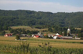
Brezje pri Dobrovi is an elongated village in the Municipality of Dobrova–Polhov Gradec in the Upper Carniola region of Slovenia on the road from Dobrova to Horjul. It lies on the somewhat elevated north side of the marshy valley of Horjulka Creek and it also includes the hamlet of Poljšno Brdo to the east of the main settlement. Ključ Hill rises above the settlement to the north, and Strmca Hill to the south.

Dolenja Vas pri Polhovem Gradcu Place in Upper Carniola, Slovenia

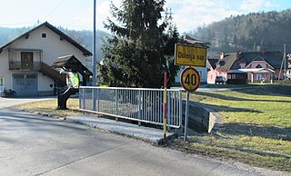
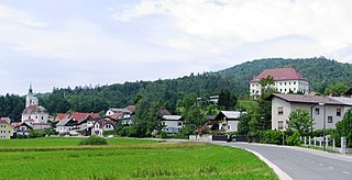
Dolenja Vas pri Polhovem Gradcu is a small village east of Polhov Gradec in the Municipality of Dobrova–Polhov Gradec in the Upper Carniola region of Slovenia.

Srednja Vas pri Polhovem Gradcu Place in Upper Carniola, Slovenia

Srednja Vas pri Polhovem Gradcu is a small settlement just east of Polhov Gradec in the Municipality of Dobrova–Polhov Gradec in the Upper Carniola region of Slovenia.

Log pri Polhovem Gradcu Place in Upper Carniola, Slovenia

Log pri Polhovem Gradcu is a small dispersed settlement east of Polhov Gradec in the Municipality of Dobrova–Polhov Gradec in the Upper Carniola region of Slovenia.

Osredek pri Dobrovi Place in Upper Carniola, Slovenia

Osredek pri Dobrovi is a village in the hills northwest of Dobrova in the Municipality of Dobrova–Polhov Gradec in the Upper Carniola region of Slovenia.

Podsmreka, Dobrova–Polhov Gradec Place in Upper Carniola, Slovenia

Podsmreka is a village south of Dobrova in the Municipality of Dobrova–Polhov Gradec in the Upper Carniola region of Slovenia.

Pristava pri Polhovem Gradcu Place in Upper Carniola, Slovenia

Pristava pri Polhovem Gradcu is a settlement next to Polhov Gradec in the Municipality of Dobrova–Polhov Gradec in the Upper Carniola region of Slovenia.

Rovt, Dobrova–Polhov Gradec Place in Upper Carniola, Slovenia

Rovt is a dispersed settlement in the hills west of Polhov Gradec in the Municipality of Dobrova–Polhov Gradec in the Upper Carniola region of Slovenia.

Smolnik, Dobrova–Polhov Gradec Place in Upper Carniola, Slovenia

Smolnik is a dispersed settlement in the hills northwest of Polhov Gradec in the Municipality of Dobrova–Polhov Gradec in the Upper Carniola region of Slovenia.

Dobrova pri Dravogradu in Carinthia, Slovenia

Dobrova pri Dravogradu is a village south of Dravograd in the Carinthia region in northern Slovenia.

Brezje pri Oplotnici in Styria, Slovenia

Brezje pri Oplotnici is a settlement in the Municipality of Oplotnica in eastern Slovenia. It lies in the hills between Oplotnica and Zreče. The area is part of the traditional region of Styria. The municipality is now included in the Drava Statistical Region.

Gorica pri Oplotnici in Styria, Slovenia

Gorica pri Oplotnici is a settlement on the western edge of Oplotnica in eastern Slovenia. The area is part of the traditional region of Styria. The entire Municipality of Oplotnica is included in the Drava Statistical Region.

Straža pri Oplotnici in Styria, Slovenia

Straža pri Oplotnici is a settlement in the Municipality of Oplotnica in eastern Slovenia. The area is part of the traditional region of Styria. The municipality is now included in the Drava Statistical Region.

Dobrnič Place in Lower Carniola, Slovenia

Dobrnič is a village in the Municipality of Trebnje in eastern Slovenia. It lies on the regional road from Trebnje to Žužemberk and is the largest settlement in the Dobrnič Basin. The area is part of the historical Lower Carniola region. The municipality is now included in the Southeast Slovenia Statistical Region.

Hrastje pri Mirni Peči in Lower Carniola, Slovenia

Hrastje pri Mirni Peči is a small settlement in the Municipality of Mirna Peč in southeastern Slovenia. The area is part of the traditional region of Lower Carniola and is now included in the Southeast Slovenia Statistical Region.

Hrastje pri Grosupljem in Lower Carniola, Slovenia

Hrastje pri Grosupljem is a settlement between Grosuplje and Šmarje-Sap in central Slovenia. The Slovenian A2 motorway runs across the settlement's territory. The area is part of the historical region of Lower Carniola. The Municipality of Grosuplje is now included in the Central Slovenia Statistical Region.

Spodnja Zadobrova Place in Upper Carniola, Slovenia

Spodnja Zadobrova is a formerly independent settlement in the eastern part of the capital Ljubljana in central Slovenia. It was part of the traditional region of Upper Carniola and is now included with the rest of the municipality in the Central Slovenia Statistical Region.

Zgornja Zadobrova Place in Upper Carniola, Slovenia

Zgornja Zadobrova is a formerly independent settlement in the eastern part of the capital Ljubljana in central Slovenia. It was part of the traditional region of Upper Carniola and is now included with the rest of the municipality in the Central Slovenia Statistical Region.

References

  1. 1 2 Statistical Office of the Republic of Slovenia: Dobrova pri Prihovi.
  2. Oplotnica municipal site
  3. Snoj, Marko. 2009. Etimološki slovar slovenskih zemljepisnih imen. Ljubljana: Modrijan and Založba ZRC, p. 114.