Zlogona Vas

Last updated
Zlogona Vas
Slovenia location map.svg
Red pog.svg
Zlogona Vas
Location in Slovenia
Coordinates: 46°23′55.03″N15°27′54.17″E / 46.3986194°N 15.4650472°E / 46.3986194; 15.4650472 Coordinates: 46°23′55.03″N15°27′54.17″E / 46.3986194°N 15.4650472°E / 46.3986194; 15.4650472
Country Flag of Slovenia.svg Slovenia
Traditional region Styria
Statistical region Drava
Municipality Oplotnica
Area
  Total 1.21 km2 (0.47 sq mi)
Elevation 577.4 m (1,894.4 ft)
Population (2002)
  Total 65
[1]

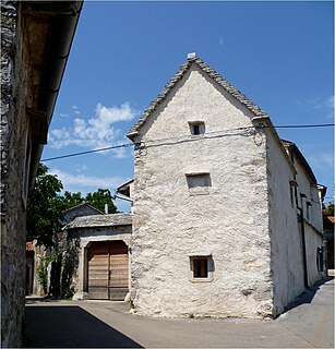
Zlogona Vas (pronounced  [ˈzloːɡɔna ˈʋaːs] ) is a village in the Municipality of Oplotnica in eastern Slovenia. It lies in the hills northeast of Čadram. The area is part of the traditional region of Styria. The municipality is now included in the Drava Statistical Region. [2]

Village Small clustered human settlement smaller than a town

A village is a clustered human settlement or community, larger than a hamlet but smaller than a town, with a population ranging from a few hundred to a few thousand. Though villages are often located in rural areas, the term urban village is also applied to certain urban neighborhoods. Villages are normally permanent, with fixed dwellings; however, transient villages can occur. Further, the dwellings of a village are fairly close to one another, not scattered broadly over the landscape, as a dispersed settlement.

Slovenia republic in Central Europe

Slovenia, officially the Republic of Slovenia, is a sovereign state located in southern Central Europe at a crossroads of important European cultural and trade routes. It is bordered by Italy to the west, Austria to the north, Hungary to the northeast, Croatia to the southeast, and the Adriatic Sea to the southwest. It covers 20,273 square kilometers (7,827 sq mi) and has a population of 2.07 million. One of the successor states of the former Yugoslavia, Slovenia is a parliamentary republic and a member of the United Nations, of the European Union, and of NATO. The capital and largest city is Ljubljana.

Čadram in Styria, Slovenia

Čadram is a settlement in the municipality of Oplotnica in eastern Slovenia. It lies immediately east of Oplotnica itself. The area is part of the traditional region of Styria. The municipality is now included in the Drava Statistical Region.

Two small roadside chapels in the settlement date to 1867 and the early 20th century. [3]

Chapel Religious place of fellowship attached to a larger institution

The term chapel usually refers to a Christian place of prayer and worship that is attached to a larger, often nonreligious institution or that is considered an extension of a primary religious institution. It may be part of a larger structure or complex, such as a college, hospital, palace, prison, funeral home, church, synagogue or mosque, located on board a military or commercial ship, or it may be an entirely free-standing building, sometimes with its own grounds. Chapel has also referred to independent or nonconformist places of worship in Great Britain—outside the established church.

Related Research Articles

Oplotnica Town and Municipality in Slovenia

Oplotnica is a small town and municipality in eastern Slovenia. It lies on the Oplotniščica River, a left tributary of the Dravinja River, to the north of Slovenske Konjice. The area was part of the traditional region of Styria and formerly part of Austria-Hungary. The municipality is now included in the Drava Statistical Region.

Birčna Vas Place in Lower Carniola, Slovenia

Birčna Vas is a settlement in the Municipality of Novo Mesto in southeastern Slovenia. It lies on the railway line from Ljubljana to Metlika. It was traditionally part of Lower Carniola and is now included in the Southeast Slovenia Statistical Region.

Dolenja Vas, Novo Mesto Place in Lower Carniola, Slovenia

Dolenja Vas is a settlement on the right bank of the Krka River in the Municipality of Novo Mesto in southeastern Slovenia. The entire municipality is part of the traditional region of Lower Carniola and is now included in the Southeast Slovenia Statistical Region.

Herinja Vas Place in Lower Carniola, Slovenia

Herinja Vas is a settlement in the hills north of Otočec in the Municipality of Novo Mesto in southeastern Slovenia. The area is part of the traditional region of Lower Carniola and is now included in the Southeast Slovenia Statistical Region.

Krajna Vas Place in Slovenian Littoral, Slovenia

Krajna Vas is a village in the Municipality of Sežana in the Littoral region of Slovenia, close to the border with Italy.

Dolenja Vas, Zagorje ob Savi in Upper Carniola, Slovenia

Dolenja Vas is a settlement in the Municipality of Zagorje ob Savi in central Slovenia. It extends from the western outskirts of Zagorje ob Savi to the left bank of the Sava River. The area is part of the traditional region of Upper Carniola. It is now included with the rest of the municipality in the Central Sava Statistical Region.

Gorenja Vas, Zagorje ob Savi in Lower Carniola, Slovenia

Gorenja Vas is a dispersed settlement north of Podkum in the Municipality of Zagorje ob Savi in central Slovenia. The area is part of the traditional region of Lower Carniola. It is now included with the rest of the municipality in the Central Sava Statistical Region.

Višnja Vas in Styria, Slovenia

Višnja Vas is a settlement on the Hudinja River in the Municipality of Vojnik in eastern Slovenia. The area was traditionally part of the Styria region. It is now included with the rest of the municipality in the Savinja Statistical Region.

Kovača Vas, Slovenska Bistrica in Styria, Slovenia

Kovača Vas is a settlement in the hills just north of Slovenska Bistrica in northeastern Slovenia. The area is part of the traditional region of Styria. It is now included with the rest of the Municipality of Slovenska Bistrica in the Drava Statistical Region.

Zgornja Nova Vas in Styria, Slovenia

Zgornja Nova Vas is a small village in the Pohorje Hills north of Slovenska Bistrica in northeastern Slovenia. The area is part of the traditional region of Styria. It is now included with the rest of the municipality in the Drava Statistical Region.

Dobriška Vas in Styria, Slovenia

Dobriška Vas is a small village south of Oplotnica in eastern Slovenia. The area is part of the traditional region of Styria. The Municipality of Oplotnica is now included in the Drava Statistical Region.

Kovaški Vrh in Styria, Slovenia

Kovaški Vrh is a dispersed settlement in the Municipality of Oplotnica in eastern Slovenia. It lies in the hills northwest of Oplotnica. The area is part of the traditional region of Styria and is now included in the Drava Statistical Region.

Okoška Gora in Styria, Slovenia

Okoška Gora is a settlement in the Municipality of Oplotnica in eastern Slovenia. It lies on the southern slopes of the Pohorje range east of Oplotnica. Traditionally the area was part of Styria and is now included in the Drava Statistical Region.

Zgornje Grušovje in Styria, Slovenia

Zgornje Grušovje is a settlement south of Prihova in the Municipality of Oplotnica in eastern Slovenia. The area is part of the traditional region of Styria and is included in the Drava Statistical Region.

Zlogona Gora in Styria, Slovenia

Zlogona Gora is a settlement in the Municipality of Oplotnica in eastern Slovenia. It lies on the southern slopes of the Pohorje range northeast of Oplotnica. Traditionally the area was part Styria. The municipality is now included in the Drava Statistical Region.

Konjiška Vas in Styria, Slovenia

Konjiška Vas is a settlement in the Municipality of Slovenske Konjice in eastern Slovenia. It lies at the foot of the eastern end of the Mount Konjice hills southeast of Slovenske Konjice. The area is part of the traditional region of Styria. The municipality is now included in the Savinja Statistical Region.

Zibiška Vas in Styria, Slovenia

Zibiška Vas is a small village in the Municipality of Šmarje pri Jelšah in eastern Slovenia. It lies on Zibika Creek west of Pristava pri Mestinju. The area was traditionally part of Styria. The municipality is now included in the Savinja Statistical Region.

Planinska Vas, Šentjur in Styria, Slovenia

Planinska Vas is a small village in the Municipality of Šentjur in eastern Slovenia. It lies in the Sava Hills east of Planina pri Sevnici. The area is part of the historical Styria region. The municipality is now included in the Savinja Statistical Region.

Kriška Vas Place in Lower Carniola, Slovenia

Kriška Vas is a village south of Višnja Gora in the Municipality of Ivančna Gorica in central Slovenia. The area is part of the historical region of Lower Carniola. The municipality is now included in the Central Slovenia Statistical Region.

Krška Vas, Ivančna Gorica in Lower Carniola, Slovenia

Krška Vas is a settlement just east of Krka, near the source of the Krka River, in the Municipality of Ivančna Gorica in central Slovenia. The area is part of the historical region of Lower Carniola. The municipality is now included in the Central Slovenia Statistical Region.

References